Related Research Articles
The Darling Scarp, also referred to as the Darling Range or Darling Ranges, is a low escarpment running north–south to the east of the Swan Coastal Plain and Perth, Western Australia. The escarpment extends generally north of Bindoon, to the south of Pemberton. The adjacent Darling Plateau goes easterly to include Mount Bakewell near York and Mount Saddleback near Boddington. It was named after the Governor of New South Wales, Lieutenant-General Ralph Darling.

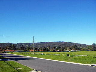
Kalamunda is a town and eastern suburb of Perth, Western Australia, located in the Darling Scarp at the eastern limits of the Perth metropolitan area.

Augusta is a town on the south-west coast of Western Australia, where the Blackwood River emerges into Flinders Bay. It is the nearest town to Cape Leeuwin, on the furthest southwest corner of the Australian continent. In the 2001 census it had a population of 1,091; by 2016 the population of the town was 1,109.

Waroona is a town located in the Peel region of Western Australia along the South Western Highway, between Pinjarra and Harvey. The town is the seat of the Shire of Waroona. At the 2016 census, Waroona had a population of 2,934.

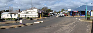
Dwellingup is a town in Western Australia located in a timber and fruitgrowing area in the Darling Range east-south-east of Pinjarra. At the 2011 census, Dwellingup had a population of 383.

South Western Highway is a highway in the South West region of Western Australia connecting Perth's southeast with Walpole. It is a part of the Highway 1 network for most of its length. It is about 406 kilometres (252 mi) long.

Onslow is a coastal town in the Pilbara region of Western Australia, 1,386 kilometres (861 mi) north of Perth. It has a population of 848 people and is located within the Shire of Ashburton local government area.
Nannup is a town in the South West region of Western Australia, approximately 280 kilometres (174 mi) south of Perth on the Blackwood River at the crossroads of Vasse Highway and Brockman Highway; the highways link Nannup to most of the lower South West's regional centres. At the 2011 census, Nannup had a population of 587.
Karridale is a small township in the south-west of Western Australia. It is located just north of Augusta and south of Margaret River between Caves Road and Bussell Highway. A newer township was built a short distance north east of the original Old Karridale following fires that destroyed the town in 1961. At the 2006 census, Karridale had a population of 285.

The Murray River is a river in the southwest of Western Australia. It played a significant part in the expansion of settlement in the area south of Perth after the arrival of British settlers at the Swan River Colony in 1829.
Gleneagle or Glen Eagle is a locality in Western Australia. The locality is south east of the state capital, Perth, close to Jarrahdale on the Albany Highway.
Kudardup is a locality in the South West region of Western Australia. The locality is in the Shire of Augusta-Margaret River and on the Bussell Highway, 312 kilometres (194 mi) south of the state capital, Perth.

A bushfire season occurred predominantly from June 2009 to May 2010. Increased attention has been given to this season as authorities and government attempt to preempt any future loss of life after the Black Saturday bushfires during the previous season, 2008–09. Long range weather observations predict very hot, dry and windy weather conditions during the summer months, leading to a high risk of bushfire occurrence.

The 2010 Western Australian storms were a series of storms that travelled over southwestern Western Australia on 21 and 22 March 2010. One of the more intense storm cells passed directly over the capital city of Perth between 3:30pm and 5:00pm on Monday 22 March 2010. It is the costliest natural disaster in Western Australian history, with the damage bill estimated at $1.08 billion.

During the summer of 2010–11, a relative lack of bushfires occurred along Eastern Australia due to a very strong La Niña effect, which instead contributed to severe flooding, in particular the 2010–11 Queensland floods and the 2011 Victorian floods. As a result of these weather patterns, most major fire events took place in Western Australia and South Australia. Some later significant fire activity occurred in Gippsland in eastern Victoria, an area which largely missed the rainfall that lead to the flooding in other parts of the state.
Perth, the capital city of the state of Western Australia, has a Mediterranean climate, with hot, dry summers and cool, wet winters. February is the hottest month of the year, with an average high of 31.6 °C (88.9 °F), and July is the coldest month of the year, with an average low of 7.9 °C (46.2 °F). 77% of rain in Perth falls between May and September. Perth has an average of 8.8 hours of sunshine per day, which equates to around 3,200 hours of annual sunshine, and 138.7 clear days annually, making it the sunniest capital city in Australia.

The most destructive bushfire season in terms of property loss since the 2008–09 Australian bushfire season, occurred in the summer of 2015–16, with the loss of 408 houses and at least 500 non-residential buildings as a result of wild fires between 1 June 2015 and 31 May 2016. The season also suffered the most human fatalities since the 2008–09 Australian bushfire season; 6 died in Western Australia, 2 in South Australia and 1 in New South Wales. 8 deaths were as a direct result of fire, and a volunteer firefighter died due to unrelated health complications while on duty.

The bushfire season of the summer of 2017–18, was expected to have above normal bushfire risks with an elevated fire risk for the most of eastern and south Australian coastal areas. Australia had experienced its warmest winter on record and the ninth driest winter on record leaving dry fuel loads across much of southern Australia. Expected warmer weather over the summer period would also increase the risk. Bushfires were also expected to occur earlier, before the end of winter, as a result of the warm and dry winter. Both Queensland and north-eastern New South Wales experienced the wettest October since 1975 leading to a downgrade in bushfire risk.
The 2016 Waroona-Yarloop bushfire started in the east in the forests of the Darling Scarp before reaching the Swan Coastal Plain and continued westwards until it reached the Indian Ocean. It started as a lightning strike that caused two fires in the Lane Poole Reserve state forest near Dwellingup, Western Australia on 5 January 2016 and then burnt close to Waroona and then through the historical town of Yarloop, destroying it, before continuing southwards towards the outskirts of the town of Harvey and westwards to Preston Beach. Around 70,000 ha of land was burnt, two people died and at least 166 buildings were destroyed in Yarloop alone with only ninety buildings surviving. In total 181 buildings and structures were lost with the total cost of fighting the fire and the cost of the damage and the loss resulting estimated at $155 million.
References
- 1 2 "Dwellingup and South-Western, WA: Bushfire". EMA Disasters database. 13 September 2006. Archived from the original on 7 October 2007. Retrieved 7 July 2008.
- ↑ Perth rainfall for 1961
- ↑ Bunbury rainfall for 1961
- 1 2 The Age , 3 March 1961; p. 6