2021 Beechina bushfire

Last updated
2021 Beechina bushfire
LocationShire of Mundaring
Coordinates 31°49′48″S116°19′33″E / 31.83000°S 116.32583°E / -31.83000; 116.32583 (approximate ignition point)
Statistics
Date(s)26 December – 27 December
Burned area167 ha
Buildings destroyedOne house; six outbuildings
DeathsNone
Map
Australia Perth location map.svg
Red pog.svg
Ignition point
Location of ignition point in relation to Perth

The 2021 Beechina bushfire was a bushfire that began on 26 December 2021 in Beechina, 46 kilometres (29 miles) east-north-east of the Perth central business district, in the Shire of Mundaring, Western Australia. The bushfire began less than five kilometres from the 2021 Wooroloo bushfire, and coincided with a COVID-19 outbreak and associated public health measures in the Perth metropolitan region. [1] [2] One house was destroyed as a result of the fire, along with six outbuildings and a number of vehicles.

Contents

Background

In the preceding months, Perth and environs had recorded high levels of rainfall, leading to increased amounts of vegetation growth. In December 2021, especially towards the latter part of the month, high temperatures (in excess of 40 °C at certain points) and low rainfall led to dangerous conditions, conducive to large bushfires. [3] Low dew points, low humidity and low soil moisture levels have recently made firefighting more difficult overnight – ordinarily, fires would reduce in size and ferocity overnight, however recently, this has not been the case due to the aforementioned factors. [4]

Total fire bans were declared for a wide-ranging area on 26 December and the days before, including the area where the fire began.

Timeline

26 December

The fire began near the intersection of Old Northam Road and Government Road in Beechina, [5] and was first reported at 3.41 pm. Weather conditions were harsh, with temperatures peaking at 43.5 °C during the day and wind gusts of up to 37 km/h recorded. [3] By 6.07pm, the Department of Fire and Emergency Services (DFES) had issued an emergency warning to those in Wooroloo, Chidlow and Gidgegannup. [6] Those in the emergency warning and watch and act zones were urged to evacuate – an area of approximately 2,479 hectares (6,130 acres). An evacuation centre was set up at the Mundaring Arena in Mundaring. [7] By 7.17pm, in excess of 155 hectares (380 acres) had been burned, stretching in a westerly direction from the starting point of the fire. The fire was moving fast in that direction. [8] 150 firefighters and aerial support were sent to the fire. The Shire of Mundaring Animal Pound was open and available to take domestic animals for residents who were evacuating the area, whilst the State Equestrian Centre was opened to accommodate animals from fire-affected areas. [9]

The Bureau of Meteorology (BOM) forecast strong wind gusts of up to 60 kilometres per hour overnight, as well as temperatures of more than 28 °C. The Australian Broadcasting Corporation (ABC) reported that several structures had been burned. [9]

By 9.06pm, DFES reported that more than 250 firefighters were attending the fire, as well as State Emergency Service (SES) and local government personnel. At this point, the bushfire was still moving fast in a westerly direction. DFES advised that residents of Warrigal Estate in Chidlow whom had not already evacuated that it was now too late to leave. The emergency warning zone encompassed the area bounded by Government Road, Old Northam Road, Lilydale Road and Needham Road, including Warrigal Estate in Wooroloo, Chidow and Gidgegannup. The watch and act zone encompassed the area bounded by Lilydale Road, Thomas Street, Elliott Road, Rosedale Road and Brompton Heights in Chidlow. The advice zone encompassed the area between Rosedale Road and Stoneville Road in Mount Helena, Stoneville, Gidgegannup and Chidlow. [10] Aircraft in attendance included one heavy waterbomber and two medium waterbombers, which were dumping water and fire retardant in fire-affected areas. [11] Two new DFES airtankers had also been deployed to the site. [12]

By 11.20pm, DFES advised that 164.5 hectares (406 acres) had been burned.

27 December

Overnight, the bushfire had been contained. [13] The emergency warning update at 7.07am from DFES noted that the bushfire was stationary, and 100 firefighters were attending. The emergency warning zone had been decreased in size to 760 hectares (1,900 acres), at this point encompassing the area bounded by Government Road, Old Northam Road, Forge Farm Riding School, Liberton Road and Jason Street, including Warrigal Estate. The Warrigal Estate was reportedly under threat by fire at the present moment, as noted in the 7.07am emergency warning update. [10] The watch and act zone encompassed the area aforementioned, as well as the balance of the former emergency warning zone. The advice zone remained mostly unchanged. [10] In addition to the 100 firefighters reported by DFES to be attending, SES, WA Police, St John Ambulance, the Department of Biodiversity, Conservation and Attractions and the Shire of Mundaring were in attendance. [10]

Wind gusts of up to 50 km/h were forecast for the morning by BOM, with high temperatures of 40 °C continuing.

By 8.02am, the emergency warning update from DFES advised that the bushfire was now contained and controlled, whilst the Warrigal Estate was still under threat by embers. [14] [15] Firefighters were reportedly patrolling the area and mopping up. Road closures at this point included Liberton Road between Stone Street and Needham Road, Needham Road between Liberton Road and Government Road, Lilydale Road between Breeze Road and Stone Street. Government Road between Needham Road and Old Northam Road had re-opened with significant amounts of water on the road. [10]

DFES Incident Controller Adrian Hamill spoke to ABC Radio Perth, informing listeners that 167 hectares (410 acres) had now been burned, as well as one house, near to where the fire started, and several sheds. The Warrigal Estate was still under threat, however all houses in the estate appeared to have been saved. [16]

By 11.12am, DFES issues an update to the emergency warning, which read that residences in Warrigal Estate, Forge Drive and Anvil Way may be under threat by embers. [17] 120 firefighters were reported to be in attendance at this point. The watch and act zone and advice zones remained mostly unchanged. [10]

By 11.45am, DFES issued another update to the emergency warning. A community meeting at the Wooroloo Hall was scheduled for 1.00pm, [7] and a number of roads were re-opened, including Needham Road and Lilydale Road, in addition to Government Road, which was re-opened by 8.02 am. Liberton Road remained closed.

There were few changes with regards to the bushfire after 11.45am and before 2.00 pm. At 2.00pm, DFES downgraded the alert level from emergency to watch and act as the bushfire was contained and controlled. The Mundaring Arena evacuation centre had been closed. Firefighters were reported to be on the scene and monitoring the situation. Embers were still threatening homes, so residents were asked to remain vigilant.

News outlets reported that one house and six outbuildings (such as sheds) and a number of vehicles, including cars and trucks, had been burned. [18] [19] The destroyed house was owned by Monique Leahy, and has been owned by the same family for almost 40 years. [20] [21]

By 7.12pm, DFES had again downgraded the alert level for the former watch and act area from watch and act to advice, whilst the balance of the former warning area was downgraded to all clear. All roads had been re-opened at this point. The Water Corporation advised that some properties in Wooroloo, Gidgegannup and Chidlow were without water. Power had been restored to approximately 120 homes in the area earlier in the day by Western Power. [14]

Cause of the fire

The WA Police arson squad was reported to have visited the area on the night of 26 December and "determined an area of origin of about 100m area," DFES incident controller Adrian Hamil said, "but they do think it was suspicious." A police spokesperson also said that the arson squad was investigation, but that it was normal procedure and too early to confirm the cause of the fire. [22]

WA Police Commissioner Chris Dawson said that the bushfire appeared to have three separate ignition points, and the cause was being treated as suspicious. [20] [21] [23] [19] [5]

A man was arrested on 15 January 2022, and appeared in Perth Magistrate's Court on 16 January 2022, charged with various arson offences. Police alleged that he lit up to a further eight fires in the surrounding area. [24]

Related Research Articles

<span class="mw-page-title-main">Railway Reserves Heritage Trail</span> Trail in Shire of Mundaring, Western Australia

The Railway Reserves Heritage Trail – also on some maps as Rail Reserve Heritage Trail or Rail Reserves Historical Trail, and frequently referred to locally as the Bridle Trail or Bridle Track – is within the Shire of Mundaring in Western Australia.

<span class="mw-page-title-main">Department of Fire and Emergency Services</span>

The Department of Fire and Emergency Services (DFES) is a government department that is responsible for fire and emergency services in Western Australia. The department came into being in 2012 as a result of the Perth Hills Bush Fire review.DFES is responsible for the management, training and funding of career and volunteer Services including:

<span class="mw-page-title-main">Chidlow, Western Australia</span> Suburb of Perth, Western Australia

Chidlow is a small community in the Shire of Mundaring approximately 45 kilometres east of Perth, Western Australia.

Wooroloo is a town on the outer fringe of the Perth metropolitan region, located off Great Eastern Highway in the eastern part of the Shire of Mundaring. At the 2021 census, Wooroloo had a population of 2,613.

<span class="mw-page-title-main">Electoral district of Swan Hills</span> State electoral district in Perth, Western Australia

Swan Hills is an electoral district of the Legislative Assembly in the Australian state of Western Australia.

<span class="mw-page-title-main">Perth Hills</span> Place in Western Australia

Perth Hills is a term used primarily for marketing purposes to identify the part of the Darling Scarp and hinterland east of the scarp that lies within the Shire of Mundaring, City of Swan, and the City of Kalamunda and as part of the constituent bodies belonging to the Eastern Metropolitan Regional Council of Perth, Western Australia.

<span class="mw-page-title-main">Shire of Mundaring</span> Local government area in Perth, Western Australia

The Shire of Mundaring is a local government area in eastern metropolitan Perth, the capital of Western Australia. The Shire covers an area of 645 square kilometres (249 sq mi) and had a population of approximately 38,000 as at the 2016 Census.

<span class="mw-page-title-main">Toodyay Road</span> Road in Western Australia

Toodyay Road is a mostly 2-lane undivided single carriageway in Western Australia, running from the north-eastern Perth suburb of Middle Swan, through Gidgegannup and Bailup, to the Wheatbelt town of Toodyay. It is signposted as State Route 50.

<span class="mw-page-title-main">2009–10 Australian bushfire season</span>

A bushfire season occurred predominantly from June 2009 to May 2010. Increased attention has been given to this season as authorities and government attempt to preempt any future loss of life after the Black Saturday bushfires during the previous season, 2008–09. Long range weather observations predict very hot, dry and windy weather conditions during the summer months, leading to a high risk of bushfire occurrence.

<span class="mw-page-title-main">2010–11 Australian bushfire season</span>

During the summer of 2010–11, a relative lack of bushfires occurred along Eastern Australia due to a very strong La Niña effect, which instead contributed to severe flooding, in particular the 2010–11 Queensland floods and the 2011 Victorian floods. As a result of these weather patterns, most major fire events took place in Western Australia and South Australia. Some later significant fire activity occurred in Gippsland in eastern Victoria, an area which largely missed the rainfall that lead to the flooding in other parts of the state.

The Kep Track is a bicycle, walking and horse track in the Darling Range and further east in Western Australia.

<span class="mw-page-title-main">2015–16 Australian bushfire season</span>

The most destructive bushfire season in terms of property loss since the 2008–09 Australian bushfire season, occurred in the summer of 2015–16, with the loss of 408 houses and at least 500 non-residential buildings as a result of wild fires between 1 June 2015 and 31 May 2016. The season also suffered the most human fatalities since the 2008–09 Australian bushfire season; 6 died in Western Australia, 2 in South Australia and 1 in New South Wales. 8 deaths were as a direct result of fire, and a volunteer firefighter died due to unrelated health complications while on duty.

<span class="mw-page-title-main">2015 Esperance bushfires</span>

The 2015 Esperance bushfires were a series of catastrophic bushfires that burned from 15 to 26 November and affected the Goldfields-Esperance region in the Australian state of Western Australia. During the fires, the Shire of Esperance experienced two significant fires and a complex of fires; 128,000 hectares were burnt by the Cascades fire, 18,000 hectares were burnt by the Merivale fire, and 164,000 hectares were burnt by the Cape Arid complex of fires. On 17 November, during the major run of the Cascades fire, four civilian fatalities occurred in vehicles traveling on Griggs Road in Scaddan. As of 2020, the Cascades fire was equally the worst bushfire in Western Australia in terms of human fatalities along with the Willow Springs/Nannup fire of January 1958.

The 2014 Perth Hills bushfire, sometimes referred to as the Parkerville fire, was a bushfire that burned from 12 January to 1 February and affected the Mundaring municipality of the Perth Hills in the Australian state of Western Australia. During a major run of the fire on the afternoon and evening of 12 January, fifty-seven houses and numerous non-residential buildings were completely destroyed, and a further six houses were damaged in the suburbs of Mount Helena, Stoneville, and Parkerville. Approximately 386 hectares of uncleared land and pasture—the majority on private property—were burned during the 21-day duration of the fire. None of the residential subdivisions impacted had been formally declared as being within a bushfire prone area.

<span class="mw-page-title-main">2017–18 Australian bushfire season</span>

The bushfire season of the summer of 2017–18, was expected to have above normal bushfire risks with an elevated fire risk for the most of eastern and south Australian coastal areas. Australia had experienced its warmest winter on record and the ninth driest winter on record leaving dry fuel loads across much of southern Australia. Expected warmer weather over the summer period would also increase the risk. Bushfires were also expected to occur earlier, before the end of winter, as a result of the warm and dry winter. Both Queensland and north-eastern New South Wales experienced the wettest October since 1975 leading to a downgrade in bushfire risk.

Following the devastating 2019–20 bushfires in Australia, authorities were urged to prepare early for the 2020–21 Australian bushfire season. The bushfire outlook for July to September 2020 was predicting a normal fire potential in Queensland with a good grass growth in many areas giving an increased risk of grass fires, an above normal season in the Kimberley region of Western Australia as a result of good rains from tropical cyclones, a normal but earlier season in the Northern Territory, an above normal season on the south coast of New South Wales and normal seasons elsewhere.

<span class="mw-page-title-main">2021 Wooroloo bushfire</span> Bushfires in Perth Hills, Western Australia February 2021

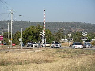
The 2021 Wooroloo bushfire was a fast moving bushfire that started on 1 February in Wooroloo, 45 kilometres (28 mi) north-east of the Perth central business district, in the Shire of Mundaring, Western Australia. By 2 February, the bushfire emergency had spread to Shires of Chittering and Northam, and the City of Swan. It had destroyed at least 86 houses and 2 fire trucks. By 6 February, the bushfire had travelled 26 km (16 mi) from its source. The fire coincided with a five day lockdown of the Perth metropolitan region that started at 6pm on 31 January, due to a case of COVID-19 outside of hotel quarantine. In July 2021, WA Police charged a man with a breach of duty and carrying out an activity that could cause a fire, alleging that he used an angle grinder that caused sparks.

<span class="mw-page-title-main">Wooroloo Regional Park</span> Conservation area in Western Australia

Wooroloo Regional Park, formerly Chidlow Regional Park, is a conservation park near Chidlow in the Perth Hills, 40 kilometres north-east of Perth, Western Australia, located within the Shire of Mundaring.

The 2016 Waroona-Yarloop bushfire started in the east in the forests of the Darling Scarp before reaching the Swan Coastal Plain and continued westwards until it reached the Indian Ocean. It started as a lightning strike that caused two fires in the Lane Poole Reserve state forest near Dwellingup, Western Australia on 5 January 2016 and then burnt close to Waroona and then through the historical town of Yarloop, destroying it, before continuing southwards towards the outskirts of the town of Harvey and westwards to Preston Beach. Around 70,000 ha of land was burnt, two people died and at least 166 buildings were destroyed in Yarloop alone with only ninety buildings surviving. In total 181 buildings and structures were lost with the total cost of fighting the fire and the cost of the damage and the loss resulting estimated at $155 million.

The 2021–22 Australian bushfire season was the season of summer bushfires in Australia. The outlook for the season was below average in parts of Eastern Australia thanks to a La Niña, with elevated fire danger in Western Australia. Higher than normal winter rainfall has resulted in above average to average stream flows and soil moisture levels through much of eastern Australia. The outlook to the end of spring was also for above average falls over much of the country apart for Western Australia. The Australian Capital Territory, Victoria and southern New South Wales are expected to have a below normal fire potential as a result of vegetation still recovering from the 2020–21 Australian bushfire season. Areas of south eastern Queensland, northern New South Wales and northern Western Australia expect an above normal fire potential caused by crop and grass growth in these areas.

References

  1. "COVID-19 update 23 December 2021". ww2.health.wa.gov.au. Retrieved 2021-12-27.
  2. "There's still much to learn about Perth's COVID outbreak. Here's what we do know". ABC News. 2021-12-24. Retrieved 2021-12-27.
  3. 1 2 "Perth, Western Australia December 2021 Daily Weather Observations" (PDF). Bureau of Meteorology. Archived (PDF) from the original on 2021-12-26.
  4. "'Catastrophic conditions' are leaving firefighters with less reprieve at night to tackle out-of-control blazes". ABC News. 2021-12-23. Retrieved 2021-12-28.
  5. 1 2 Hales, Holly; Murray, Duncan; Druce, Alexander (2021-12-27). "'You'll get caught': Warning to firebugs". NT News. Retrieved 2021-12-28.
  6. "Emergency warnings issued for two WA fires". Northern Beaches Review. 2021-12-26. Retrieved 2021-12-28.
  7. 1 2 "Emergency warning remains in effect as firefighters battle Perth hills bushfire". The Age. 2021-12-26. Retrieved 2021-12-28.
  8. "Firefighters facing 'at least 12 hours' at Wooroloo blaze". The West Australian. 2021-12-26. Retrieved 2021-12-28.
  9. 1 2 "Lives under threat as fire destroys structures in Wooroloo east of Perth". ABC News. 2021-12-26. Retrieved 2021-12-26.
  10. 1 2 3 4 5 6 "Emergency WA – Warnings & Incidents". www.emergency.wa.gov.au. Archived from the original on 2016-12-29. Retrieved 2021-12-26.
  11. "Home and sheds burnt to the ground as fire rages". The West Australian. 2021-12-26. Retrieved 2021-12-28.
  12. "HILLS FIRE EMERGENCY: 'Leaving now would be deadly'". PerthNow. 2021-12-26. Retrieved 2021-12-26.
  13. Bunch, Aaron (2021-12-27). "Two WA bushfires contained, risk remains". Mandurah Mail. Retrieved 2021-12-28.
  14. 1 2 "Two WA bushfires contained, but risk remains from burning embers". SBS News. Retrieved 2021-12-28.
  15. Press, Australian Associated (2021-12-27). "Bushfire emergency warnings issued for Perth hills and WA's south-west". the Guardian. Retrieved 2021-12-28.
  16. "Fire in Perth's east under control after destroying at least one house and several sheds". ABC News. 2021-12-26. Retrieved 2021-12-27.
  17. "Emergency warning remains in effect as firefighters battle Perth hills bushfire". WAtoday. 2021-12-26. Retrieved 2021-12-28.
  18. "First images emerge of trail of destruction left by bushfire east of Perth". ABC News. 2021-12-26. Retrieved 2021-12-27.
  19. 1 2 "Bushfires destroy homes and leave firefighters on alert in WA". www.9news.com.au. 27 December 2021. Retrieved 2021-12-28.
  20. 1 2 "'So much heartache': Family reels after bushfire near Perth razes home of almost 40 years". ABC News. 2021-12-27. Retrieved 2021-12-27.
  21. 1 2 "Police believe Boxing Day bushfires in WA deliberately lit by arsonist". 7NEWS. 2021-12-27. Retrieved 2021-12-28.
  22. "Arson probe amid fears Hills bushfire deliberately lit". PerthNow. 2021-12-27. Retrieved 2021-12-27.
  23. Hales, Holly; Murray, Duncan; Druce, Alexander (2021-12-26). "A major bushfire that destroyed property on Boxing Day is suspected to have been deliberately lit". The Australian. Retrieved 2021-12-28.
  24. "PICTURED: Volunteer FIREY charged with starting blaze". PerthNow. 2022-01-17. Retrieved 2022-01-31.