
The Black Friday bushfires of 13 January 1939, in Victoria, Australia, were part of the devastating 1938–1939 bushfire season in Australia, which saw bushfires burning for the whole summer, and ash falling as far away as New Zealand. It was calculated that three-quarters of the State of Victoria was directly or indirectly affected by the disaster, while other Australian states and the Australian Capital Territory were also badly hit by fires and extreme heat. This was the third-deadliest bushfire event in Australian history, only behind the 1983 Ash Wednesday bushfires and the 2009 Black Saturday bushfires.
The town of Crafers is in the Adelaide Hills to the south-east of Adelaide, South Australia, considered to be an outer suburb of Adelaide.

The Ash Wednesday bushfires, known in South Australia as Ash Wednesday II, were a series of bushfires that occurred in south-eastern Australia in 1983 on 16 February, the Christian holy day Ash Wednesday. Within twelve hours, more than 180 fires fanned by hot winds of up to 110 km/h (68 mph) caused widespread destruction across the states of Victoria and South Australia. Years of severe drought and extreme weather combined to create one of Australia's worst fire days in a century. The fires were the deadliest in Australian history until the Black Saturday bushfires in 2009.

Mount Lofty is the highest point in the southern Mount Lofty Ranges. It is located about 15 km (9.3 mi) east of the Adelaide city centre, within the Cleland National Park in the Adelaide Hills area of South Australia.

Marble Hill was the Vice-Regal summer residence for the Governor of South Australia for seventy-five years, from 1880 to 1955. It is also the name of a ward of the Adelaide Hills Council, and a suburb, both named after the residence and in which the residence is located. It is about 20 kilometres (12 mi) east of Adelaide between the towns of Ashton and Cherryville, and has expansive views of the Adelaide Hills to the North and East, and the Adelaide Plains to the West.

Macclesfield is a small town on the upper reaches of the River Angas in the Adelaide Hills region of South Australia. In the 2016 census, Macclesfield had a population of 832 while the 2016 Census showed an increase to 958.

Totness Recreation Park is a protected area in the Australian state of South Australia located within the localities of Mount Barker and Totness in the central Mount Lofty Ranges. Covering 41 hectares of land, the park is divided by the South Eastern Freeway and features a large dam. It was declared as a reserve in 1970 and re-designated as a recreation park in 1972. The park has no visitor facilities except for access tracks. It is the only park in the district, managed by the Department of Environment and Water, that is solely designated for recreation.

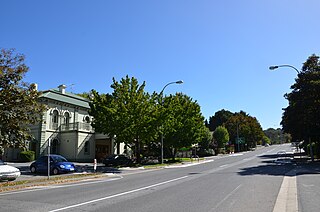
Mount Torrens is a small town in the eastern Adelaide Hills region of South Australia, 46 kilometres east-north-east of the state capital, Adelaide and 8 kilometres east of Lobethal. It is on Onkaparinga Valley Road (B34) between the towns of Charleston and Birdwood. It is the eastern end of the Amy Gillett Bikeway, which follows the former railway alignment from Oakbank. Mount Torrens is within the jurisdiction of the Adelaide Hills Council and the Mid Murray Council.

The Mount Lofty Fire Tower sits on top of Mount Lofty in the Adelaide Hills just to the east of the city of Adelaide, South Australia. The 34m high tower has a commanding view over a huge area of the rural areas surrounding Adelaide, and on a clear day the view can extend to as far as Kangaroo Island to the southwest, Monarto to the east, the Fleurieu Peninsula to the south, and the grassy plains beyond Two Wells to the north. The tower is used to spot fires in the Adelaide Hills and surrounds on days of very high or extreme fire danger during summer. The spotting crew determine the location of a smoke sighting by taking a bearing and then calculating distance using topographic maps. Details of the sighting are then passed to the 'Adelaide Fire' Communications Centre who despatch the nearest fire brigade.

The 2006–07 bushfire season was one of the most extensive bushfire seasons in Australia's history. Victoria experienced the longest continuously burning bushfire complex in Australia's history, with fires in the Victorian Alps and Gippsland burning over 1 million hectares of land over the course of 69 days. See Bushfires in Australia for an explanation of regional seasons.

Bushfires in Australia are a widespread and regular occurrence that have contributed significantly to shaping the nature of the continent over millions of years. Eastern Australia is one of the most fire-prone regions of the world, and its predominant eucalyptus forests have evolved to thrive on the phenomenon of bushfire. However, the fires can cause significant property damage and loss of both human and animal life. Bushfires have killed approximately 800 people in Australia since 1851, and billions of animals.

The Black Saturday bushfires were a series of bushfires that either ignited or were already burning across the Australian state of Victoria on and around Saturday, 7 February 2009, and were one of Australia's all-time worst bushfire disasters. The fires occurred during extreme bushfire weather conditions and resulted in Australia's highest-ever loss of human life from a bushfire, with 173 fatalities. Many people were left homeless and family-less as a result.
William David Hair McCall was an Australian Anglican bishop.

The Clare Valley is a valley located in South Australia about 100 kilometres north of Adelaide in the Clare and Gilbert Valleys council area. It is the river valley formed by the Hutt River but is also strongly associated with the roughly parallel Hill River. The valley is traversed by the Horrocks Highway and the towns in the valley along that route from south to north are Auburn, Leasingham, Watervale, Penwortham, Sevenhill and Clare. The geographical feature has given rise to the Clare Valley wine region designation, a notable winegrowing region of Australia.

The 2015 Sampson Flat fires were a series of bushfires in the Australian state of South Australia, the area affected was predominantly the northern Adelaide Hills and the outer Adelaide metropolitan area. The fire began on 2 January 2015 during a day of extreme heat and lasted until 9 January 2015; and burnt more than 20,000 hectares.
Prospect Hill is a small town in the southern Adelaide Hills of South Australia, Its major industries are forestry in Kuitpo Forest and dairy farming. There are also mountain bike trails in the area.
The 2020–21 Australian bushfire season was the season of summer bushfires in Australia. Following the devastating 2019–20 bushfires in Australia, authorities were urged to prepare early for the 2020–21 Australian bushfire season. The bushfire outlook for July to September 2020 was predicting a normal fire potential in Queensland with a good grass growth in many areas giving an increased risk of grass fires, an above normal season in the Kimberley region of Western Australia as a result of good rains from tropical cyclones, a normal but earlier season in the Northern Territory, an above normal season on the south coast of New South Wales and normal seasons elsewhere.
St Michael's House was an Australian educational institution in Crafers outside Adelaide, under the auspices of the Society of the Sacred Mission, established in 1947 and which was destroyed by fire in the Ash Wednesday bushfires in 1983 shortly after its closure. It trained candidates for ordination in the Anglican Church of Australia.
Paechtown is a historic locality in the Adelaide Hills of South Australia. It is now on the southern side of the South Eastern Freeway almost opposite Hahndorf.
