Related Research Articles

The 426 BC Malian Gulf tsunami devastated the coasts of the Malian and Euboean Gulfs, Greece, in the summer of 426 BC. Thucydides inquired into its causes, and concluded that the tsunami must have been caused by an earthquake, He was thus historically the first known to correctly interpret the cause of a tsunami as a preceding geological event. Herodotus, in contrast, had attributed the Potidaea tsunami to the divine wrath of Poseidon.
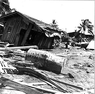
The 1976 Moro Gulf earthquake and tsunami took place on August 17 at 00:11 local time near the islands of Mindanao and Sulu, in the Philippines. Its magnitude was calculated as being as high as 8.0 on the moment magnitude scale.
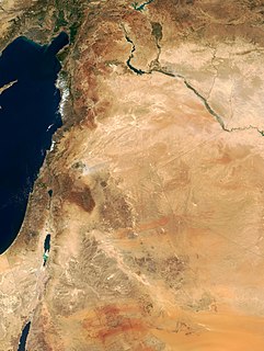
The 1202 Syria earthquake struck at about dawn on 20 May 1202 with an epicenter in southwestern Syria. Up to 1,100,000 deaths have been associated with this earthquake, although other estimates are much smaller. It was felt over a very wide area, from Sicily to Mesopotamia and Anatolia to upper Egypt, mostly affecting the Ayyubid Sultanate and the Kingdom of Jerusalem. The cities of Tyre, Acre and Nablus were heavily damaged. A magnitude of Ms = 7.6 has been estimated with damage up to XI on the Mercalli intensity scale.
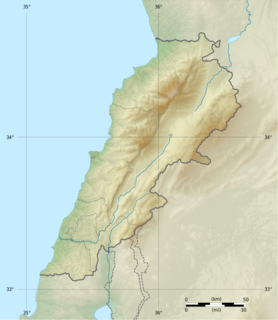
The Near East earthquakes of 1759 were a series of devastating earthquakes that shook a large portion of the Levant in October and November of that year. This geographical crossroads in the Eastern Mediterranean includes portions of Syria, Lebanon, Turkey, and Israel. The ruins of Baalbek, a settlement in the Beqaa Valley of Lebanon east of the Litani River, were badly damaged. These events, along with the earlier 1202 Syria earthquake, are likely the strongest historical earthquakes in the region.
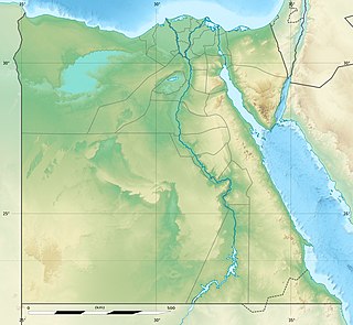
The 1995 Gulf of Aqaba earthquake occurred on November 22 at 06:15 local time and registered 7.3 on the Mw scale. The epicenter was located in the central segment of the Gulf of Aqaba, the narrow body of water that separates Egypt's Sinai Peninsula from the western border of Saudi Arabia. At least 8 people were killed and 30 were injured in the meizoseismal area.
The 551 Beirut earthquake occurred on 9 July with an estimated magnitude of about 7.5 on the moment magnitude scale and a maximum felt intensity of X (Extreme) on the Mercalli intensity scale. It triggered a devastating tsunami which affected the coastal towns of Byzantine Phoenicia, causing great destruction and sinking many ships. Overall large numbers of people were reported killed, with one estimate of 30,000 by Antoninus of Piacenza for Beirut alone.
Seismic risk in Malta is considered to be low with little historic damage noted and no known victims. The archipelago is however in a potentially significant seismic zone and the risk to the population is probably undervalued.
The 1886 Peloponnese earthquake occurred at 23:27 local time on 27 August. It had an estimated magnitude between 6.8 and 7.3 on the moment magnitude scale and a maximum felt intensity of X (Extreme) on the Mercalli intensity scale. It caused extensive damage in Messenia, with the towns of Filiatra and Marathos both severely affected. Between 326 and 600 people were killed. It was felt over a wide area from the Khedivate of Egypt to Malta and possibly as far away as Bern and Marseille.
The 991 Damascus earthquake took place in the city of Damascus on 5 April, 991.
The 957 Caspian Sea earthquake took place in the Caspian Sea and its vicinity in 957.
The 881 Acre earthquake took place in the vicinity of Acre in 881. Alexandria was reportedly affected by the same earthquake.
The 859 Syrian coasts earthquake took place in the coasts of the region of Syria in the year 859 or 860 CE. There are various estimated dates for the earthquake, ranging from 8 April 859 to 27 March, 860.
The 803 Mopsuestia earthquake took place in the vicinity of Mopsuestia and the Gulf of Alexandretta (İskenderun) in 802 or 803 CE.
The 740 Constantinople earthquake took place on 26 October, 740, in the vicinity of Constantinople and the Sea of Marmara.
The 554 Anatolia earthquake took place on August 15, in the southwest coasts of Anatolia. It affected the Güllük Gulf, and the island of Kos.
The 542 Sea of Marmara earthquake took place in the winter of 542 in the vicinity of the Sea of Marmara. It also affected the coasts of Thrace, and the Edremit Gulf.
The 684 Hakuho earthquake took place in Japan in 684. The earthquake was described in the history book Nihon Shoki. The earthquake took place on 29 November, 684, in year 13 of the reign of Emperor Tenmu. It caused the under-sea inundation of approximately 10 km2 (3.9 sq mi) of rice fields.

The 1766 Istanbul earthquake was a strong earthquake with epicenter in the eastern part of the Sea of Marmara, in the Çınarcık Basin which occurred in the early hours of Thursday morning, 22 May 1766. The earthquake had an estimated magnitude of 7.1 on the surface wave magnitude scale, and caused effects in a vast area extending from Izmit to Tekirdağ. In this area, the earthquake was followed by a tsunami which caused significant damage. The earthquake of 1766 was the last major earthquake to rock Istanbul because of a rupture of the North Anatolian Fault in the Marmara region.