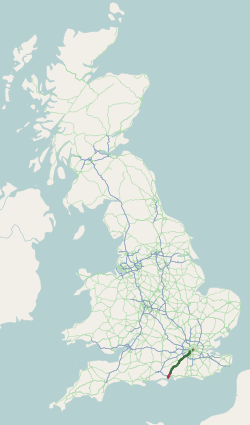
The Dartford-Thurrock River Crossing, commonly known as the Dartford Crossing and until 1991 the Dartford Tunnel, is a major road crossing of the River Thames in England, carrying the A282 road between Dartford in Kent in the south and Thurrock in Essex in the north.

Chessington is an area in the Royal Borough of Kingston upon Thames within Greater London. Historically part of Surrey, today it is the largest salient of Greater London into that county. At the 2011 census it had a population of 18,973. The Bonesgate Stream, a tributary of the Hogsmill River, runs through it. The popular theme park resort Chessington World of Adventures, which incorporates Chessington Zoo, is located in the south-west of the area.
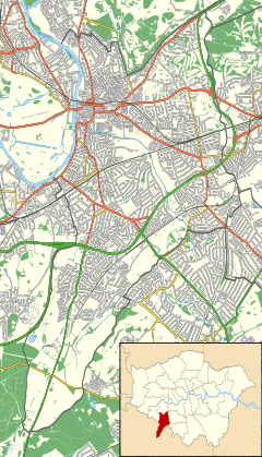
Tolworth is a suburban area in the Surbiton district, Royal Borough of Kingston upon Thames, Greater London. It is 11 miles (17.7 km) southwest of Charing Cross. Neighbouring places include Long Ditton, New Malden, Kingston, Surbiton, Berrylands, Hinchley Wood, Chessington, Ewell and Worcester Park. Surbiton is the nearest, about a mile to the northwest. Tolworth is divided in two by the A3 Kingston Bypass and is situated slightly north of the Greater London-Surrey border.
The A3, known as the Portsmouth Road or London Road in sections, is a major road connecting the City of London and Portsmouth passing close to Kingston upon Thames, Guildford, Haslemere and Petersfield. For much of its 67-mile (108 km) length, it is classified as a trunk road and therefore managed by National Highways. Almost all of the road has been built to dual carriageway standards or wider. Apart from bypass sections in London, the road travels in a southwest direction and, after Liss, south-southwest.

The M1 motorway connects London to Leeds, where it joins the A1(M) near Aberford, to connect to Newcastle. It was the first inter-urban motorway to be completed in the UK; the first motorway in the country was the Preston Bypass, which later became part of the M6.

The M4, originally the London-South Wales Motorway, is a motorway in the United Kingdom running from west London to southwest Wales. The English section to the Severn Bridge was constructed between 1961 and 1971; the Welsh element was largely complete by 1980, though a non-motorway section around Briton Ferry bridge remained until 1993. On the opening of the Second Severn Crossing in 1996, the M4 was rerouted over it.
The A2 is a major road in south-east England, connecting London with the English Channel port of Dover in Kent. This route has always been of importance as a connection between London and sea trade routes to Continental Europe. It was originally known as the Dover Road. The M2 motorway has replaced part of the A2 as the strategic route.

The A12 is a major road in Eastern England. It runs north-east/south-west between London and the coastal town of Lowestoft in the north-eastern corner of Suffolk, following a similar route to the Great Eastern Main Line until Ipswich. A section of the road between Lowestoft and Great Yarmouth became part of the A47 in 2017. Between the junctions with the M25 and the A14, the A12 forms part of the unsigned Euroroute E30. Unlike most A roads, this section of the A12, together with the A14 and the A55, has junction numbers as if it were a motorway.

The A48 is a trunk road in Great Britain running from the A40 at Highnam, 3 miles (4.8 km) west of Gloucester, England, to the A40 at Carmarthen, Wales. Before the Severn Bridge opened on 8 September 1966, it was a major route between England and South Wales. For most of its route, it runs almost parallel to the M4 motorway. During times of high winds at the Severn Bridge, the A48 is used as part of the diversion route and is still marked as a Holiday Route.

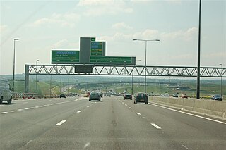
In civil engineering, grade separation is a method of aligning a junction of two or more surface transport axes at different heights (grades) so that they will not disrupt the traffic flow on other transit routes when they cross each other. The composition of such transport axes does not have to be uniform; it can consist of a mixture of roads, footpaths, railways, canals, or airport runways. Bridges, tunnels, or a combination of both can be built at a junction to achieve the needed grade separation.

The Hogsmill River in Surrey and Greater London, England is a small chalk stream tributary of the River Thames. It rises in Ewell and flows into the Thames at Kingston upon Thames on the lowest non-tidal reach, that above Teddington Lock.

The A421 is an important road for east/west journeys across south central England. Together with the A428, the A43 and A34, it forms the route from Cambridge through Milton Keynes to Oxford. The section between the A1 and the A5 is a national primary route.

The A165 is a road that links Scarborough and Kingston upon Hull, both in Yorkshire, England. The road is designated as a Primary Route from its junction with the A64 in Scarborough to its southern terminus in Hull.

The A1079 is a major road in Northern England. It links the cities of York and Kingston upon Hull, both in Yorkshire. The road is noted for its past safety issues, and regularly features in the Road Safety Foundations reports on Britain's most dangerous roads. Campaigners have been calling for the entire route to be made into a dual carriageway.

The A240 is a partially primary status A road in Surrey and Greater London that connects the A217 with the A3 and continues beyond through Surbiton to Kingston upon Thames. The road is 8.5 miles (13.7 km) long and is dualled as the Ewell bypass and thereafter to Tolworth Broadway. In conjunction with the A3 it provides an alternative to the congested A24 corridor through Morden and Merton.
The A243 road in England is a partially primary status A-road that runs from Leatherhead in Surrey to Surbiton in the Royal Borough of Kingston Upon Thames, Greater London. It is primary for most of its length, from Leatherhead to Hook Junction with the A3 before running as a non-primary A-road through Surbiton to its terminus at the A307. Although comparatively short it is a busy road connecting a number of other A roads with the M25 motorway.

The A309 is a mostly primary status A-road that runs in two sections, a short section in Twickenham and Teddington as a non-primary status A-road, as well as the much longer primary A- Road section that runs from Hampton Court to Hook.

Southborough High School, commonly known as Southborough, is a boys secondary School with a mixed sixth form. Founded in 1962, it has academy status and is in Surbiton, Greater London. It was rated a grade 2 school (Good) in 2017 by Ofsted.
Canadian speed limits are set by different levels of government, depending on the jurisdiction under which the road falls, resulting in differences from province to province. The limits have been posted in kilometres per hour (km/h) since September 1, 1977. Before then, when Canada used Imperial units, speed limits were in miles per hour (mph).

A traffic bottleneck is a localized disruption of vehicular traffic on a street, road, or highway. As opposed to a traffic jam, a bottleneck is a result of a specific physical condition, often the design of the road, badly timed traffic lights, or sharp curves. They can also be caused by temporary situations, such as vehicular accidents.