Achnahannet, Strathspey

Last updated

Achnahannet
Achnahannet - geograph.org.uk - 661156.jpg
Badenoch and Strathspey UK location map.svg
Red pog.svg
Achnahannet
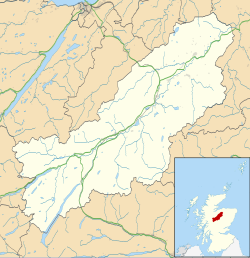
Location within the Badenoch and Strathspey area
OS grid reference NH977272
Council area
Country Scotland
Sovereign state United Kingdom
Postcode district PH26 3
Police Scotland
Fire Scottish
Ambulance Scottish
UK Parliament
Scottish Parliament
List of places
UK
Scotland
57°19′26″N3°42′01″W / 57.32397°N 3.70035°W / 57.32397; -3.70035

Achnahannet (Scottish Gaelic : Achadh na h-Annaid) [1] is a hamlet located northwest of Dulnain Bridge, and three and a half miles west-south-west of Grantown-on-Spey, [2] in the historical county of Morayshire, now in the Highland Council area, Scotland. Historically it belonged to the parish of Cromdale. [3]

Contents

The name, recorded as Auchnahannatt in 1589, means 'field of the mother church', from the Gaelic words achadh 'field' na h- 'of the' and annaid 'mother church, early church. [4] [3] An old chapel and a well named Tobar an Domhnaich is located nearby. [3]
Geography

Achnahannet Burn flows in the area; it is a tributary of the River Dulnain. [5] The land westward from Achnahannet to Lynmore contains a belt of morainic sands and gravels between the River Dulnain terraces. [6]

Notable people

Related Research Articles

<span class="mw-page-title-main">Highland (council area)</span> Council area of Scotland

Highland is a council area in the Scottish Highlands and is the largest local government area in the United Kingdom. It was the 7th most populous council area in Scotland at the 2011 census. It has land borders with the council areas of Aberdeenshire, Argyll and Bute, Moray and Perth and Kinross. The wider upland area of the Scottish Highlands after which the council area is named extends beyond the Highland council area into all the neighbouring council areas plus Angus and Stirling.

<span class="mw-page-title-main">Inverness</span> City in the Highlands of Scotland

Inverness is a city in the Scottish Highlands, having been granted city status in 2000. It is the administrative centre for The Highland Council and is regarded as the capital of the Highlands.

<span class="mw-page-title-main">Lochaber</span> Ward management area of the Highland Council

Lochaber is a name applied to a part of the Scottish Highlands. Historically, it was a provincial lordship consisting of the parishes of Kilmallie and Kilmonivaig. Lochaber once extended from the Northern shore of Loch Leven, a district called Nether Lochaber, to beyond Spean Bridge and Roybridge, which area is known as Brae Lochaber or Braigh Loch Abar in Gaelic. For local government purposes, the name was used for one of the landward districts of Inverness-shire from 1930 to 1975, and then for one of the districts of the Highland region from 1975 to 1996. Since 1996 the Highland Council has had a Lochaber area committee.

<span class="mw-page-title-main">Grantown-on-Spey</span> Town in Highland, Scotland

Grantown-on-Spey is a town in the Highland Council Area, historically within the county of Moray. It is located on a low plateau at Freuchie beside the river Spey at the northern edge of the Cairngorm mountains, about 20 miles (32 km) south-east of Inverness.

<span class="mw-page-title-main">River Spey</span> River in Scotland

The River Spey is a river in the northeast of Scotland. At 98 mi (158 km) it is the eighth longest river in the United Kingdom and the second longest and fastest-flowing river in Scotland. (The Tay is the longest with the Clyde third in Scotland. It is an important location for the traditions of salmon fishing and whisky production in Scotland.

<span class="mw-page-title-main">Achnashellach</span> Human settlement in Scotland

Achnashellach is an area in Wester Ross in the Highlands of Scotland, and within the Highland council area. It is at the eastern end of Loch Dùghaill, and on the A890 road. It has a railway station on the Kyle of Lochalsh Line.

Achnaha is a remote village in Ardnamurchan, Lochaber, in the Scottish council area of Highland.

<span class="mw-page-title-main">Achnamara</span>

Achnamara is a village in the Scottish council area of Argyll and Bute. Its location is approximately 56°1' N 5°34' W. Achnamara means 'field by the sea'. The name is formed from the Gaelic words achadh 'field', the definite article an, and muir 'sea'.

<span class="mw-page-title-main">Carrbridge</span> Village in Badenoch and Strathspey, Scotland

Carrbridge is a village in Badenoch and Strathspey in the Scottish Highlands. It lies off the A9 on the A938, west of Skye of Curr and southeast of Tomatin, near Bogroy. It has the oldest stone bridge in the Highlands and the nearby ancient pine forest contains the Landmark Forest Adventure Park.

<span class="mw-page-title-main">Achintraid</span> Human settlement in Scotland

Achintraid is a small one-time crofting township, situated at the north-eastern end of the sea loch Loch Kishorn, in Strathcarron, Ross-shire, Scottish Highlands and is in the Scottish council area of Highland.

<span class="mw-page-title-main">Scotshouse</span> Village in County Monaghan, Ireland

Scotshouse is a small agricultural village in the parish of Currin in County Monaghan, Ireland. It is roughly three miles east of where the counties of Cavan, Fermanagh and Monaghan meet. Scotshouse is about 7 kilometres (4 mi) from Clones, 18 km (11 mi) from Cavan town and 27 km (17 mi) away from Monaghan town.

<span class="mw-page-title-main">Auchlyne</span> Human settlement in Scotland

Auchlyne is a small hamlet in Stirling, Scotland. It is located approximately five miles west of Killin on Loch Tay, off the main A85 road that runs from Perth to Oban.

<span class="mw-page-title-main">Auchinloch</span> Village in North Lanarkshire, Scotland

Auchinloch is a village in Scotland, situated within the North Lanarkshire local authority area but very close to the boundary with East Dunbartonshire and sharing the G66 postcode of the town of Kirkintilloch and the adjoining village of Lenzie, located a short distance to the north. Other nearby settlements in North Lanarkshire are Stepps to the south and Chryston to the south-east, each approximately 1.3 miles (2.1 km) away across farmland and on the opposite side of the M80 motorway; the Glasgow City council area boundary and the suburb of Robroyston is about the same distance to the west. In previous years Auchinloch was in the Parish of Cadder and, from 1975 until 1996, the district of Strathkelvin within Strathclyde Region.

<span class="mw-page-title-main">Tarskavaig</span> Human settlement in Scotland

Tarskavaig is a crofting village on the west coast of Sleat on the Isle of Skye in Scotland. It sits in a glen which meets Tarskavaig Bay and lies opposite the Isles of Eigg, Rum and Canna. It is often said that Tarskavaig has the best view of the Cuillin in Skye.

<span class="mw-page-title-main">Dulnain Bridge</span> Human settlement in Scotland

Dulnain Bridge is a village in Strathspey, next to the meeting of the River Dulnain and the River Spey, three miles south-west of Grantown-on-Spey, in the Scottish Highlands and the Highland council area.

<span class="mw-page-title-main">Auchnagatt</span> Human settlement in Scotland

Auchnagatt is a village and rural area in Buchan, Aberdeenshire, Scotland, situated on the Ebrie Burn and on the A948 road between Ellon and New Deer.

<span class="mw-page-title-main">Achentoul</span> Human settlement in Scotland

Achentoul is a hamlet in the Kinbrace area of Sutherland, in the Scottish council area of Highland. Consisting of a few farmhouses and barns, Achentoul lies around 1.5 miles (2.4 km) north of Kinbrace along the A897 road and south of Loch An Ruathair. Although the Achentoul Forest is located in this area, the landscape is said to be dominated by moist Atlantic heather moor.

<span class="mw-page-title-main">Achnahanat</span> Human settlement in Scotland

Achnahanat is a crofting settlement on the south side of the Kyle of Sutherland in Scotland. It is about 4 miles west of Invershin in Sutherland, within the Scottish council area of Highland.

<span class="mw-page-title-main">Inverness-shire</span> Historic county in Scotland

Inverness-shire or the County of Inverness, is a historic county in Scotland. It is named after Inverness, its largest settlement, which was also the county town. Covering much of the Highlands and some of the Hebrides, it is Scotland's largest county by land area. It is generally rural and sparsely populated, containing only three towns which held burgh status, being Inverness, Fort William and Kingussie. The county is crossed by the Great Glen, which contains Loch Ness and separates the Grampian Mountains to the south-east from the Northwest Highlands. The county also includes Ben Nevis, the highest mountain in both Scotland and the United Kingdom.

<span class="mw-page-title-main">Melness</span> Human settlement in Scotland

Melness is a locality comprising a group of small remote crofting townships, lying to the west of Tongue Bay opposite Coldbackie, in the north coast of Sutherland, Scottish Highlands. It is in the Scottish council area of Highland. The individual hamlets are:

References

  1. Microsoft; Nokia. "Achnahannet" (Map). Bing Maps . Microsoft. Retrieved 26 February 2017.
  2. Groome, Francis Hindes (1895). Ordnance gazetteer of Scotland: a survey of Scottish topography, statistical, biographical, and historical. W. Mackenzie. Retrieved 20 February 2011.
  3. 1 2 3 Watson, William John (1973). The history of the Celtic place-names of Scotland. Irish University Press.
  4. Grant, Alison (2010). Macleod, Iseabail (ed.). The Pocket Guide to Scottish Place-Names. Glasgow: Richard Drew Ltd. p. 24. ISBN   978-1-899471-00-3. OCLC   759569647.
  5. Reid, William (1900). Grantown and the adjacent country: a guide to Strathspey. Angus Stuart.
  6. Annual report. Macaulay Institute for Soil Research. 1965.
  7. Aberd bookeen-angus herd. 1965.