Lynmore | |
---|---|
Coordinates: 38°08′37″S176°17′01″E / 38.143571°S 176.283608°E | |
Country | New Zealand |
City | Rotorua |
Local authority | Rotorua Lakes Council |
Electoral ward | Te Ipu Wai Auraki General Ward |
Area | |
• Land | 220 ha (540 acres) |
Population (June 2023) [2] | |
• Total | 3,510 |
(Lake Rotorua) | Ōwhata | |
Ngāpuna | Lynmore | |
Whakarewarewa |
Lynmore is a suburb of Rotorua in the Bay of Plenty Region of New Zealand's North Island.
In April 2018, Lynmore had the highest house prices in Rotorua. [3]
The local Apumoana Marae and Apumoana o te Ao Kohatu meeting house is a meeting place for the Tūhourangi hapū of Hurunga Te Rangi, Ngāti Kahupoko, Ngāti Taeotu and Ngāti Tumatawera. [4] [5]
Lynmore covers 2.20 km2 (0.85 sq mi) [1] and had an estimated population of 3,510 as of June 2023, [2] with a population density of 1,595 people per km2.
Year | Pop. | ±% p.a. |
---|---|---|
2006 | 3,129 | — |
2013 | 3,255 | +0.57% |
2018 | 3,288 | +0.20% |
Source: [6] |
Before the 2023 census, the suburb had a smaller boundary, covering 1.97 km2 (0.76 sq mi). [1] Using that boundary, Lynmore had a population of 3,288 at the 2018 New Zealand census, an increase of 33 people (1.0%) since the 2013 census, and an increase of 159 people (5.1%) since the 2006 census. There were 1,179 households, comprising 1,596 males and 1,692 females, giving a sex ratio of 0.94 males per female. The median age was 41.7 years (compared with 37.4 years nationally), with 693 people (21.1%) aged under 15 years, 492 (15.0%) aged 15 to 29, 1,590 (48.4%) aged 30 to 64, and 513 (15.6%) aged 65 or older.
Ethnicities were 81.0% European/Pākehā, 16.8% Māori, 2.7% Pacific peoples, 11.9% Asian, and 2.1% other ethnicities. People may identify with more than one ethnicity.
The percentage of people born overseas was 24.5, compared with 27.1% nationally.
Although some people chose not to answer the census's question about religious affiliation, 54.4% had no religion, 34.7% were Christian, 0.4% had Māori religious beliefs, 1.4% were Hindu, 0.6% were Muslim, 0.4% were Buddhist and 2.3% had other religions.
Of those at least 15 years old, 816 (31.4%) people had a bachelor's or higher degree, and 273 (10.5%) people had no formal qualifications. The median income was $41,400, compared with $31,800 nationally. 669 people (25.8%) earned over $70,000 compared to 17.2% nationally. The employment status of those at least 15 was that 1,410 (54.3%) people were employed full-time, 426 (16.4%) were part-time, and 75 (2.9%) were unemployed. [6]
Lynmore Primary School is a co-educational state primary school, [7] [8] with a roll of 569 as of February 2024. [9]
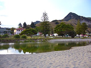
Tokomaru Bay is a small beachside community on the remote East Coast of New Zealand's North Island. It is 91 km north of Gisborne, on State Highway 35, and close to Mount Hikurangi. The district was originally known as Toka-a-Namu, which refers to the abundance of sandflies. Over the years the name was altered to Tokomaru Bay.
Murupara is a town in the Whakatāne District and Bay of Plenty Region of New Zealand's North Island. The town is in an isolated part of the region between the Kaingaroa Forest and Te Urewera protected area, on the banks of the Rangitaiki River, 65 kilometres southeast of Rotorua. Indigenous Māori also make up over 90% of the population.
Ngongotahā is a small settlement on the western shores of Lake Rotorua in the North Island of New Zealand. It is located 10 km (6.2 mi) northwest of the Rotorua central business district, and is considered as a suburb of Rotorua. It is part of the Rotorua functional urban area as defined by Statistics New Zealand. Ngongotahā has a population of 5,230 as of June 2023.
Tolaga Bay is both a bay and small town on the East Coast of New Zealand's North Island located 45 kilometres northeast of Gisborne and 30 kilometres south of Tokomaru Bay.
Putāruru is a small town in the South Waikato District and the Waikato region of New Zealand's North Island. It lies on the western side of the Mamaku Ranges and in the upper basin of the Waihou River. It is on the Oraka Stream 65 kilometres south-east of Hamilton. State Highway 1 and the Kinleith Branch railway run through the town.
Te Poi is a small village in rural Waikato, New Zealand, established in 1912 at the base of the Kaimai Range. Te Poi is part of a thriving farming area, particularly for dairying, thoroughbred horse breeding and cropping.
Maketu is a small town on the Western Bay of Plenty coast in New Zealand.
Te Teko is a small inland town along the banks of the Rangitaiki River in the Bay of Plenty region of New Zealand's North Island.
Reporoa is a rural community in Rotorua Lakes within the Waikato region of New Zealand's North Island.
Nukuhau is a suburb of Taupō in the Waikato Region of New Zealand's North Island.
Frasertown is a small settlement in the northern Hawke's Bay Region of New Zealand's eastern North Island.
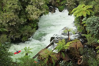
Okere Falls is a small town located 21 km from Rotorua on SH 33 between Rotorua and Tauranga on the North Island of New Zealand. The town is situated on the shore of the Okere Inlet of Lake Rotoiti, from which the Kaituna River flows north towards the Bay of Plenty.
Ohinemutu or Ōhinemutu is a suburb in Rotorua, New Zealand. It includes a living Māori village and the original settlement of Rotorua.
Pyes Pa is a suburb of Tauranga, New Zealand.
Rotoiti is a settlement on the shore of Lake Rotoiti, in Rotorua Lakes within the Bay of Plenty Region of New Zealand's North Island.
Mourea is a settlement in Rotorua Lakes within the Bay of Plenty Region of New Zealand's North Island.
Ngapuna is a suburb in eastern Rotorua in the Bay of Plenty Region of New Zealand's North Island.
Ōwhata is a semi-rural suburb of Rotorua in the Bay of Plenty region of New Zealand's North Island.
Mangakakahi is a suburb of Rotorua in the Bay of Plenty Region of New Zealand's North Island.
Utuhina is a suburb of Rotorua in the Bay of Plenty Region of New Zealand's North Island.