Mourea

Last updated

Mourea
Locality
St Mary's Church, Mourea, Rotorua.JPG
St Mary's Church, Mourea
Mourea
Coordinates: 38°02′46″S176°19′49″E / 38.045997°S 176.330150°E / -38.045997; 176.330150
CountryNew Zealand
Region Bay of Plenty
Territorial authority Rotorua Lakes District
WardTe Ipu Wai Auraki General Ward
CommunityRotorua Lakes Community
Electorates
Government
  Territorial authority Rotorua Lakes Council
  Regional council Bay of Plenty Regional Council
Area
[1]
  Total6.53 km2 (2.52 sq mi)
Population
 (June 2023) [2]
  Total430
  Density66/km2 (170/sq mi)

Mourea is a settlement in Rotorua Lakes within the Bay of Plenty Region of New Zealand's North Island.

Contents

It is located on a thin strip of land between Lake Rotorua and Lake Rotoiti, on State Highway 33.

Demographics

Mourea is described by Statistics New Zealand as a rural settlement, and covers 6.53 km2 (2.52 sq mi) [1] and had an estimated population of 430 as of June 2023, [2] with a population density of 66 people per km2. Mourea is part of the larger Rotoiti-Rotoehu statistical area. [3]

Historical population
YearPop.±% p.a.
2006375    
2013339−1.43%
2018399+3.31%
Source: [4]

Mourea had a population of 399 at the 2018 New Zealand census, an increase of 60 people (17.7%) since the 2013 census, and an increase of 24 people (6.4%) since the 2006 census. There were 126 households, comprising 198 males and 204 females, giving a sex ratio of 0.97 males per female, with 78 people (19.5%) aged under 15 years, 72 (18.0%) aged 15 to 29, 177 (44.4%) aged 30 to 64, and 72 (18.0%) aged 65 or older.

Ethnicities were 47.4% European/Pākehā, 68.4% Māori, 3.0% Pacific peoples, and 4.5% Asian. People may identify with more than one ethnicity.

Although some people chose not to answer the census's question about religious affiliation, 44.4% had no religion, 34.6% were Christian, 3.8% had Māori religious beliefs, 2.3% were Hindu and 6.0% had other religions.

Of those at least 15 years old, 60 (18.7%) people had a bachelor's or higher degree, and 57 (17.8%) people had no formal qualifications. 36 people (11.2%) earned over $70,000 compared to 17.2% nationally. The employment status of those at least 15 was that 150 (46.7%) people were employed full-time, 51 (15.9%) were part-time, and 24 (7.5%) were unemployed. [4]

Marae

Mourea has three marae:

Related Research Articles

<span class="mw-page-title-main">Tokomaru Bay</span> Town in the North Island of New Zealand

Tokomaru Bay is a small beachside community on the remote East Coast of New Zealand's North Island. It is 91 km north of Gisborne, on State Highway 35, and close to Mount Hikurangi. The district was originally known as Toka-a-Namu, which refers to the abundance of sandflies. Over the years the name was altered to Tokomaru Bay.

Ngongotahā is a small settlement on the western shores of Lake Rotorua in the North Island of New Zealand. It is located 10 km (6.2 mi) northwest of the Rotorua central business district, and is considered as a suburb of Rotorua. It is part of the Rotorua functional urban area as defined by Statistics New Zealand. Ngongotahā has a population of 5,230 as of June 2023.

<span class="mw-page-title-main">Tolaga Bay</span> Town in Gisborne District, New Zealand

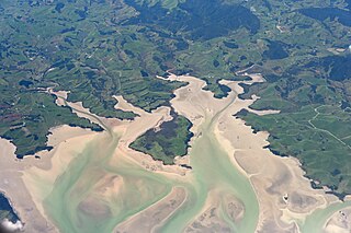
Tolaga Bay is both a bay and small town on the East Coast of New Zealand's North Island located 45 kilometres northeast of Gisborne and 30 kilometres south of Tokomaru Bay.

<span class="mw-page-title-main">Kawhia Harbour</span> Harbour and settlement in Waikato, New Zealand

Kawhia Harbour is one of three large natural inlets in the Tasman Sea coast of the Waikato region of New Zealand's North Island. It is located to the south of Raglan Harbour, Ruapuke and Aotea Harbour, 40 kilometres southwest of Hamilton. Kawhia is part of the Ōtorohanga District and is in the King Country. It has a high-tide area of 68 km2 (26 sq mi) and a low-tide area of 18 km2 (6.9 sq mi). Te Motu Island is located in the harbour.

<span class="mw-page-title-main">Maketu</span> Town in the Bay of Plenty, New Zealand

Maketu is a small town on the Western Bay of Plenty coast in New Zealand.

<span class="mw-page-title-main">Arapuni</span> Settlement in Waikato, New Zealand

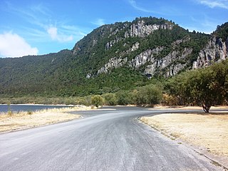
Arapuni is a rural town centre on the Waikato river in the South Waikato District of New Zealand. The town sits next to the Arapuni Dam, a hydroelectric dam at Lake Arapuni commissioned in 1929. The Arapuni Power Station consists of eight turbines which give a total output of 196 MW, the largest of the power stations on the Waikato river. The Arapuni hydro station is owned and operated by Mercury Energy.

Te Teko is a small inland town along the banks of the Rangitaiki River in the Bay of Plenty region of New Zealand's North Island.

<span class="mw-page-title-main">Kuratau</span> Settlement in Waikato, New Zealand

Kuratau is a small village north of Pukawa, on the western side of New Zealand's Lake Taupō.

Whirinaki is a small coastal settlement in Hawke's Bay, in the eastern North Island of New Zealand. It sits just north of the mouth of the Esk River, a few kilometres north of Bay View and a similar distance east of Eskdale. It lies on State Highway 2, just north of its junction with State Highway 5.

<span class="mw-page-title-main">Nūhaka</span> Settlement in Hawkes Bay Region, New Zealand

Nūhaka is a small settlement in the northern Hawke's Bay Region of New Zealand's eastern North Island, lying on State Highway 2 between Wairoa and Gisborne. The road to Mahia turns off the highway at Nūhaka.

<span class="mw-page-title-main">Frasertown</span> Settlement in Hawkes Bay Region, New Zealand

Frasertown is a small settlement in the northern Hawke's Bay Region of New Zealand's eastern North Island.

<span class="mw-page-title-main">Wharekahika</span> Town in Gisborne District, New Zealand

Wharekahika or Hicks Bay is a bay and coastal area in the Gisborne District of the North Island of New Zealand. It is situated 150 km east of Ōpōtiki and 186 km north of Gisborne city, along State Highway 35 between Potaka and Te Araroa.

<span class="mw-page-title-main">Okere Falls</span> Rural settlement in Bay of Plenty Region, New Zealand

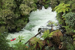
Okere Falls is a small town located 21 km from Rotorua on SH 33 between Rotorua and Tauranga on the North Island of New Zealand. The town is situated on the shore of the Okere Inlet of Lake Rotoiti, from which the Kaituna River flows north towards the Bay of Plenty.

Waitōtara is a town in South Taranaki, New Zealand. Waverley is 10 km to the north-west, and Whanganui is 34 km to the south-east. State Highway 3 passes through it. The Waitōtara River flows past the east side of the town.

Manutūkē is a settlement in the Gisborne District of New Zealand's North Island. It is located to the west of the city of Gisborne on State Highway 2, close to the mouth of the Waipaoa River.

Piopio is a small town in the Waitomo District. It is situated on State Highway 3 approximately 23 km from Te Kūiti.

Manakau is a settlement situated in the Horowhenua District, located at the boundary of the Manawatū-Whanganui and Wellington regions of New Zealand's North Island. It lies 8 km north of Ōtaki and 12 km south of Levin, and is connected to both via State Highway 1, which skirts Manakau's western edge. The township is situated 5 km inland from the coast of the Tasman Sea.

Hokio Beach or Hōkio is a village and rural community in the Horowhenua District and Manawatū-Whanganui region of New Zealand's North Island.

<span class="mw-page-title-main">Rotoiti, Bay of Plenty</span> Settlement in Rotorua Lakes District, New Zealand

Rotoiti is a settlement on the shore of Lake Rotoiti, in Rotorua Lakes within the Bay of Plenty Region of New Zealand's North Island.

<span class="mw-page-title-main">Tuai</span> Settlement in Hawkes Bay Region, New Zealand

Tuai is a village and rural community located around Lake Whakamarino, in the Wairoa District of the Hawke's Bay Region, on New Zealand's North Island.

References

  1. 1 2 "ArcGIS Web Application". statsnz.maps.arcgis.com. Retrieved 25 December 2022.
  2. 1 2 "Subnational population estimates (RC, SA2), by age and sex, at 30 June 1996-2023 (2023 boundaries)". Statistics New Zealand . Retrieved 25 October 2023. (regional councils); "Subnational population estimates (TA, SA2), by age and sex, at 30 June 1996-2023 (2023 boundaries)". Statistics New Zealand . Retrieved 25 October 2023. (territorial authorities); "Subnational population estimates (urban rural), by age and sex, at 30 June 1996-2023 (2023 boundaries)". Statistics New Zealand . Retrieved 25 October 2023. (urban areas)
  3. 2018 Census place summary: Rotoiti-Rotoehu
  4. 1 2 "Statistical area 1 dataset for 2018 Census". Statistics New Zealand. March 2020. 7014666 and 7014668.
  5. 1 2 "Te Kāhui Māngai directory". tkm.govt.nz. Te Puni Kōkiri.
  6. 1 2 "Māori Maps". maorimaps.com. Te Potiki National Trust.
  7. "Marae Announcements" (Excel). growregions.govt.nz. Provincial Growth Fund. 9 October 2020.
  8. "Te Arawa mourns kaumatua". New Zealand Media and Entertainment. Rotorua Daily Post. 8 March 2011.
  9. Godber, Albert Percy. "Te Takinga meeting house at Te Takinga Marae, Mourea, Lake Rotorua". natlib.govt.nz. National Library of New Zealand.