Utuhina

Last updated

Utuhina
Utuhina
Coordinates: 38°08′37″S176°13′51″E / 38.143591°S 176.230936°E / -38.143591; 176.230936
CountryNew Zealand
City Rotorua
Local authority Rotorua Lakes Council
Electoral wardTe Ipu Wai Auraki General Ward
Area
[1]
  Land67 ha (166 acres)
Population
 (June 2023) [2]
  Total1,600
Fordlands Mangakakahi Ohinemutu
Fordlands
Pfeil oben.svg
Pfeil links.svgUtuhinaPfeil rechts.svg
Pfeil unten.svg
Victoria
Hillcrest Hillcrest Glenholme

Utuhina is a suburb of Rotorua in the Bay of Plenty Region of New Zealand's North Island.

Contents

Demographics

Utuhina covers 0.67 km2 (0.26 sq mi) [1] and had an estimated population of 1,600 as of June 2023, [2] with a population density of 2,388 people per km2.

Historical population
YearPop.±% p.a.
20061,404    
20131,377−0.28%
20181,491+1.60%
Source: [3]

Utuhina had a population of 1,491 at the 2018 New Zealand census, an increase of 114 people (8.3%) since the 2013 census, and an increase of 87 people (6.2%) since the 2006 census. There were 522 households, comprising 723 males and 768 females, giving a sex ratio of 0.94 males per female. The median age was 36.6 years (compared with 37.4 years nationally), with 315 people (21.1%) aged under 15 years, 327 (21.9%) aged 15 to 29, 651 (43.7%) aged 30 to 64, and 201 (13.5%) aged 65 or older.

Ethnicities were 56.7% European/Pākehā, [4] 37.0% Māori, 7.8% Pacific peoples, 17.9% Asian, and 1.0% other ethnicities. People may identify with more than one ethnicity.

The percentage of people born overseas was 23.5, compared with 27.1% nationally.

Although some people chose not to answer the census's question about religious affiliation, 45.1% had no religion, 34.6% were Christian, 1.8% had Māori religious beliefs, 6.2% were Hindu, 0.2% were Muslim, 0.4% were Buddhist and 3.4% had other religions.

Of those at least 15 years old, 186 (15.8%) people had a bachelor's or higher degree, and 231 (19.6%) people had no formal qualifications. The median income was $27,300, compared with $31,800 nationally. 120 people (10.2%) earned over $70,000 compared to 17.2% nationally. The employment status of those at least 15 was that 585 (49.7%) people were employed full-time, 192 (16.3%) were part-time, and 66 (5.6%) were unemployed. [3]

Marae

Mataatua Marae was established in the 1960s as a gathering place for the Tūhoe people.

Local Tuhoe had been calling for Māori Land Court to set aside land for a Tuhoe marae reservation in Rotorua. The land was ultimately made available by the Ngāti Whakaue people; the meeting hall Aroha a te Arawa was named in recognition of Tuhoe's gratitude for the gift of the land.

Families began living on the land from 1962, and Eastern Maori MP Paraone Reweti opened a community centre on the site in 1969. [5]

In October 2020, the Government committed $3,996,258 from the Provincial Growth Fund to upgrade the marae and 7 others, creating 79 jobs. [6]

Education

Two co-educational state primary schools are located in Utuhina. Malfroy School is a Year 1 to 6 school, [7] with a roll of 313. [8] Rotorua School is a Year 1 to 8 school, [9] [10] with a roll of 391. [11]

Rotorua Boys' High School is a state secondary school, [12] [13] with a roll of 1209. [14]

John Paul College is a state-integrated Year 7 to 13 school, [15] [16] with a roll of 1115. [17]

Related Research Articles

<span class="mw-page-title-main">Dannevirke</span> Town in Manawatū-Whanganui, New Zealand

Dannevirke, is a rural service town in the Manawatū-Whanganui region of the North Island, New Zealand. It is the main centre of the Tararua District.

<span class="mw-page-title-main">Te Kūiti</span> Town in Waikato, New Zealand

Te Kūiti is a town in the north of the King Country region of the North Island of New Zealand. It lies at the junction of State Highways 3 and 30 and on the North Island Main Trunk railway, 80 kilometres (50 mi) south of Hamilton. The town promotes itself as the sheep shearing capital of the world and is host to the annual New Zealand National Shearing Championships.

<span class="mw-page-title-main">Whakatāne</span> Town in Bay of Plenty Region, New Zealand

Whakatāne is a town located in the Bay of Plenty Region in the North Island of New Zealand, 90 kilometres (56 mi) east of Tauranga and 89 kilometres (55 mi) northeast of Rotorua. The town is situated at the mouth of the Whakatāne River. The Whakatāne District is the territorial authority that encompasses the town, covering an area to the south and west of the town, excluding the enclave of Kawerau District.

<span class="mw-page-title-main">Morrinsville</span> Town in Waikato, New Zealand

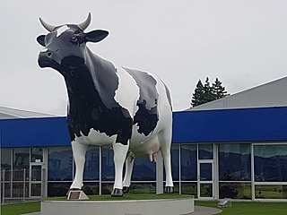
Morrinsville is a provincial town in the Waikato region of New Zealand's North Island, with an estimated population of 8,960 as of June 2023. The town is located at the northern base of the Pakaroa Range, and on the south-western fringe of the Hauraki Plains. Morrinsville is around 33 kilometres east of Hamilton and 22 kilometres west of Te Aroha. The town is bordered by the Piako River to the east and the Waitakaruru Stream to the south.

<span class="mw-page-title-main">Ōpōtiki</span> Town in the Bay of Plenty, New Zealand

Ōpōtiki is a town in the eastern Bay of Plenty in the North Island of New Zealand. It houses the headquarters of the Ōpōtiki District Council, the mayor of Ōpōtiki and comes under the Bay of Plenty Regional Council.

<span class="mw-page-title-main">Murupara</span> Town in the Bay of Plenty Region, New Zealand

Murupara is a town in the Whakatāne District and Bay of Plenty Region of New Zealand's North Island. The town is in an isolated part of the region between the Kaingaroa Forest and Te Urewera protected area, on the banks of the Rangitaiki River, 65 kilometres southeast of Rotorua. Indigenous Māori also make up over 90% of the population.

<span class="mw-page-title-main">Putāruru</span> Town in Waikato, New Zealand

Putāruru is a small town in the South Waikato District and the Waikato region of New Zealand's North Island. It lies on the western side of the Mamaku Ranges and in the upper basin of the Waihou River. It is on the Oraka Stream 65 kilometres south-east of Hamilton. State Highway 1 and the Kinleith Branch railway run through the town.

<span class="mw-page-title-main">Ōtaki, New Zealand</span> Settlement in Wellington Region, New Zealand

Ōtaki is a town in the Kāpiti Coast District of the North Island of New Zealand, situated halfway between the capital city Wellington, 70 km (43 mi) to the southwest, and Palmerston North, 70 km (43 mi) to the northeast.

<span class="mw-page-title-main">Maketu</span> Town in the Bay of Plenty, New Zealand

Maketu is a small town on the Western Bay of Plenty coast in New Zealand.

<span class="mw-page-title-main">Reporoa</span> Rural settlement in Waikato Region, New Zealand

Reporoa is a rural community in Rotorua Lakes within the Waikato region of New Zealand's North Island.

Onekawa is a suburb of the city of Napier, in the Hawke's Bay Region of the eastern North Island of New Zealand. Development of the suburb began in the late 1940s, after the land was acquired from then-Harbour Board.

<span class="mw-page-title-main">Kaiti, New Zealand</span> Suburb of Gisborne, New Zealand

Kaiti is a suburb of the New Zealand city of Gisborne. It is located immediately to the east of the city centre, on the opposing bank of the Waimata River.

Waimana is a rural valley in the Whakatāne District and Bay of Plenty Region of New Zealand's North Island. It is located in the northern Te Urewera. Waimana River, originally known as Tauranga River, runs through the valley, joining the Ohinemataroa River one kilometre south-west of Tāneatua.

Gonville is a residential suburb of Whanganui, New Zealand. It is under the local governance of the Whanganui District Council.

<span class="mw-page-title-main">Lynmore</span> Suburb of Rotorua, New Zealand

Lynmore is a suburb of Rotorua in the Bay of Plenty Region of New Zealand's North Island.

Ōwhata is a semi-rural suburb of Rotorua in the Bay of Plenty region of New Zealand's North Island.

<span class="mw-page-title-main">Glenholme, Rotorua</span> Suburb of Rotorua, New Zealand

Glenholme is a suburb of Rotorua in the Bay of Plenty Region of New Zealand's North Island.

Mangakakahi is a suburb of Rotorua in the Bay of Plenty Region of New Zealand's North Island.

<span class="mw-page-title-main">Western Heights, Rotorua</span> Suburb of Rotorua, New Zealand

Western Heights is a suburb of Rotorua in the Bay of Plenty Region of New Zealand's North Island.

Kaingaroa, also called Kaingaroa Forest or Kaingaroa Village, is a small town southeast of Rotorua within the Bay of Plenty region of New Zealand's North Island. The town is the headquarters of Kaingaroa Forest.

References

  1. 1 2 "ArcGIS Web Application". statsnz.maps.arcgis.com. Retrieved 27 December 2022.
  2. 1 2 "Population estimate tables - NZ.Stat". Statistics New Zealand . Retrieved 25 October 2023.
  3. 1 2 "Statistical area 1 dataset for 2018 Census". Statistics New Zealand. March 2020. Utuhina (199900). 2018 Census place summary: Utuhina
  4. https://www.stats.govt.nz/tools/2018-census-place-summaries/utuhina#ethnicity-culture-and-identity
  5. "New Centre at Rotorua". Te Ao Hou. 66: 36–37. March 1969.
  6. "Marae Announcements" (Excel). growregions.govt.nz. Provincial Growth Fund. 9 October 2020.
  7. "Malfroy School Ministry of Education School Profile". educationcounts.govt.nz. Ministry of Education.
  8. "Malfroy School Education Review Office Report". ero.govt.nz. Education Review Office.
  9. "Rotorua School Official School Website". rotoruaprimary.school.nz].
  10. "Rotorua School Ministry of Education School Profile". educationcounts.govt.nz. Ministry of Education.
  11. "Rotorua School Education Review Office Report". ero.govt.nz. Education Review Office.
  12. "Rotorua Boys' High School Official School Website". rotoruaboyshigh.school.nz.
  13. "Rotorua Boys' High School Ministry of Education School Profile". educationcounts.govt.nz. Ministry of Education.
  14. "Rotorua Boys' High School Education Review Office Report". ero.govt.nz. Education Review Office.
  15. "John Paul College Official School Website". jpc.co.nz.
  16. "John Paul College Ministry of Education School Profile". educationcounts.govt.nz. Ministry of Education.
  17. "John Paul College Education Review Office Report". ero.govt.nz. Education Review Office.