Fordlands | |
---|---|
Coordinates: 38°08′42″S176°13′26″E / 38.145°S 176.224°E | |
Country | New Zealand |
City | Rotorua |
Local authority | Rotorua Lakes Council |
Electoral ward | Te Ipu Wai Auraki General Ward |
Area | |
• Land | 99 ha (245 acres) |
Population (June 2023) [2] | |
• Total | 2,810 |
Pukehangi | Mangakakahi | |
Sunnybrook | Fordlands | Utuhina |
Pomare | Matipo Heights | Hillcrest |
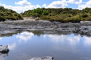
Fordlands is a western suburb of Rotorua in the Bay of Plenty Region of New Zealand's North Island.
The area is named for Harry Ford, whose model dairy farm became the suburb. [3]
It was described in 2017 as the most deprived suburb in New Zealand. [4] The suburb was an inspiration for the novel Once Were Warriors by Alan Duff. [5]
Fordlands covers 0.99 km2 (0.38 sq mi) [1] and had an estimated population of 2,810 as of June 2023, [2] with a population density of 2,838 people per km2.
Year | Pop. | ±% p.a. |
---|---|---|
2006 | 2,307 | — |
2013 | 2,118 | −1.21% |
2018 | 2,460 | +3.04% |
Source: [6] |
Fordlands had a population of 2,460 at the 2018 New Zealand census, an increase of 342 people (16.1%) since the 2013 census, and an increase of 153 people (6.6%) since the 2006 census. There were 723 households, comprising 1,164 males and 1,296 females, giving a sex ratio of 0.9 males per female. The median age was 28.4 years (compared with 37.4 years nationally), with 711 people (28.9%) aged under 15 years, 570 (23.2%) aged 15 to 29, 969 (39.4%) aged 30 to 64, and 210 (8.5%) aged 65 or older.
Ethnicities were 34.4% European/Pākehā, 67.8% Māori, 14.1% Pacific peoples, 6.2% Asian, and 1.1% other ethnicities. People may identify with more than one ethnicity.
The percentage of people born overseas was 10.6, compared with 27.1% nationally.
Although some people chose not to answer the census's question about religious affiliation, 49.8% had no religion, 35.7% were Christian, 7.7% had Māori religious beliefs, 0.7% were Hindu, 0.2% were Muslim, 0.2% were Buddhist and 0.6% had other religions.
Of those at least 15 years old, 162 (9.3%) people had a bachelor's or higher degree, and 417 (23.8%) people had no formal qualifications. The median income was $19,800, compared with $31,800 nationally. 63 people (3.6%) earned over $70,000 compared to 17.2% nationally. The employment status of those at least 15 was that 726 (41.5%) people were employed full-time, 234 (13.4%) were part-time, and 243 (13.9%) were unemployed. [6]
Tikitere, also known as "Hell's Gate", is a suburb in Rotorua's most active geothermal area on State Highway 30, between Lake Rotorua and Lake Rotoiti in the Bay of Plenty, New Zealand. It includes many geothermal features such as steaming lakes, mudpools, fumaroles, a mud volcano and the Kakahi Falls, the largest hot waterfall in the southern hemisphere.
Ohinemutu or Ōhinemutu is a suburb in Rotorua, New Zealand. It includes a living Māori village and the original settlement of Rotorua.
Koutu is a suburb of Rotorua in the Bay of Plenty Region of New Zealand's North Island. Koutu was originally a home for the people of Ngati Whakaue and Ngāti Uenukukopako and has been in existence since before the establishment of Rotorua Township.
Ngapuna is a suburb in eastern Rotorua in the Bay of Plenty Region of New Zealand's North Island.
Lynmore is a suburb of Rotorua in the Bay of Plenty Region of New Zealand's North Island.
Ōwhata is a semi-rural suburb of Rotorua in the Bay of Plenty region of New Zealand's North Island.
Fairy Springs is a suburb of Rotorua in the Bay of Plenty Region of New Zealand's North Island. It is located south of Ngongotahā, west of Koutu, east of Selwyn Heights, and north of Mangakakahi.
Mangakakahi is a suburb of Rotorua in the Bay of Plenty Region of New Zealand's North Island.
Selwyn Heights is a suburb of Rotorua in the Bay of Plenty Region of New Zealand's North Island.
Utuhina is a suburb of Rotorua in the Bay of Plenty Region of New Zealand's North Island.
Kawaha Point is a suburb of Rotorua in the Bay of Plenty Region of New Zealand's North Island.
Hillcrest is an inner city suburb of Rotorua in the Bay of Plenty Region of New Zealand's North Island.
Victoria is a suburb of Rotorua in the Bay of Plenty Region of New Zealand's North Island.
Rotorua Central is the central business district and central suburb of Rotorua, in the Bay of Plenty region of New Zealand's North Island.
Ngongotahā Valley is a valley formed by the Ngongotahā Stream west of Rotorua, in New Zealand. Springs on the stream were landscaped in 1939 and promoted as Paradise Valley Springs, and the main road into the valley is Paradise Valley Road.
Sunnybrook is a western suburb of Rotorua in the Bay of Plenty Region of New Zealand's North Island.
Pomare is a south-western suburb of Rotorua in the Bay of Plenty Region of New Zealand's North Island. Rotorua International Stadium is on the eastern side of Pomare.
Holdens Bay is an eastern suburb of Rotorua in the Bay of Plenty region of New Zealand's North Island.
Fenton Park is an eastern suburb in Rotorua in the Bay of Plenty Region of New Zealand's North Island. Fenton Street contains Rotorua's main motel strip and is sometimes referred to as "Motel Mile".
Northcote is a suburb on the northern side of Christchurch, New Zealand.