
Oneroa is a settlement on Waiheke Island in northern New Zealand.
Turua is a small village community on the banks of the Waihou River in the Hauraki Plains in the North Island of New Zealand. It is located close to the mouth of the river, 9 kilometres south of the Firth of Thames and 12 km south of Thames. It is connected by road to SH 25 in the north and SH 2 to the south.
Pukawa or Pukawa Bay is a bay and a small township on the southern shores of Lake Taupo on New Zealand's North Island. It is off State Highway 41 between Turangi and Taumarunui, in the Taupo District and Waikato region.

Waipapa is a small town in the Bay of Islands, Northland, New Zealand. It is around 10 minutes drive from Kerikeri, the nearest urban centre to Waipapa, located on State Highway 10. Waipapa itself has no school and most people travel into Kerikeri on a daily basis. It is governed by the Far North District council.

Ōmokoroa is a small urban area in the Western Bay of Plenty District of New Zealand. The suburb is considered part of Greater Tauranga, and is within the Coromandel electorate. Ōmokoroa began as a small rural holiday village, but is expanding to be a commuter town, with a 25-minute drive to Tauranga City.
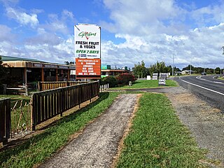
Te Kowhai is a small rural town situated 15 km north west of Hamilton City in New Zealand. It consists of mainly dairy and cattle farms and also includes a small dairy/takeaway, fresh vegetable and fruit store, cafe, bakery, a large park with a playground and skate park, and mechanics shop. Te Kowhai Aerodrome is situated near the township. The town is popular for new subdivisions.
Kaharoa is a rural area of New Zealand approximately 20 km from Rotorua and 45 km from Tauranga on the North Island. At its highest point the area is approx. 500m above sea level, with some areas able to see towards the coastline of the eastern Bay of Plenty.
Pamapuria is a locality in Northland, New Zealand. It lies on State Highway 1 about 10 km east of Kaitaia.
Tautoro is a locality about 8 km south-southeast of Kaikohe in Northland, New Zealand. Further to the south is the Awarua rural community.
Panguru is a community in the northern Hokianga harbour, in Northland, New Zealand. The Whakarapa Stream flows from the Panguru Range in the Warawara Forest to the west, through Panguru and into the Hokianga.
Rāwhiti or Te Rāwhiti is a small beachfront town about 27km from Russell in the Bay of Islands of New Zealand. Most of the land in the area is owned by Māori. There are two marae — Kaingahoa and Te Rāwhiti.
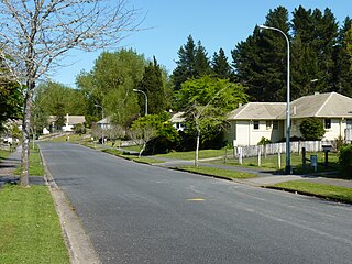
Fitzroy is a suburb in southern Hamilton in New Zealand. It is named after Robert FitzRoy, who commanded HMS Beagle and was later the Governor of New Zealand. It was declared a suburb in 1974.
Tahuna is a small rural settlement located 18 km north of Morrinsville. In the Māori language Tahuna means sandbank, likely to refer to the sandbanks along the nearby Piako River, where a Māori settlement started. Tahuna is seen as the upper limit for navigatable travel on the Piako River. The settlement has a rugby club, a lawn bowls club, a golf course and various shops.
Waitahanui is a village in the Taupō District, Waikato region, New Zealand. The village is on the eastern shore of Lake Taupō, 14 km (9 mi) south of the district seat of Taupō.
Marotiri is a rural community in the Taupō District and Waikato region of New Zealand's North Island. State Highway 32 runs through it.

Waitakaruru is a rural community in the Hauraki District and Waikato region of New Zealand's North Island. It is situated at the mouth of Waitakaruru River
Kerepehi is a rural community in the Hauraki District and Waikato region of New Zealand's North Island. The alternative spelling Kerepeehi was in use until 1933.

Haruru is a residential and commercial locality in the Far North District of New Zealand. State Highway 11 runs through the locality. Puketona is 10 kilometres west, and Paihia is 4 kilometres east, The name means a continuous noise or roar in the Māori language, which refers to the sound of Haruru Falls, a five metre high broad waterfall about a kilometre away.

Palm Beach is a settlement on Waiheke Island in northern New Zealand. The eponymous beach is named for phoenix palms at the eastern end, and has safe swimming and white sand.
Pomare is a south-western suburb of Rotorua in the Bay of Plenty Region of New Zealand's North Island. Rotorua International Stadium is on the eastern side of Pomare.
