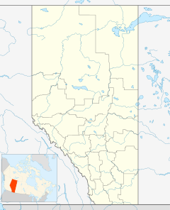
Adams Landing is an unincorporated community in Alberta within the John D'Or Prairie 215 Indian reserve. It is located south of Highway 58 and the community of John D'Or Prairie on the northern bank of the Peace River, downstream from its confluence with the Wabasca River. Adams Landing is approximately 120 kilometers (75 mi) east of High Level and has an elevation is 255 meters (837 ft).
In law, an unincorporated area is a region of land that is not governed by a local municipal corporation; similarly an unincorporated community is a settlement that is not governed by its own local municipal corporation, but rather is administered as part of larger administrative divisions, such as a township, parish, borough, county, city, canton, state, province or country. Occasionally, municipalities dissolve or disincorporate, which may happen if they become fiscally insolvent, and services become the responsibility of a higher administration. Widespread unincorporated communities and areas are a distinguishing feature of the United States and Canada. In most other countries of the world, there are either no unincorporated areas at all, or these are very rare; typically remote, outlying, sparsely populated or uninhabited areas.
Alberta is a western province of Canada. With an estimated population of 4,067,175 as of 2016 census, it is Canada's fourth most populous province and the most populous of Canada's three prairie provinces. Its area is about 660,000 square kilometres (250,000 sq mi). Alberta and its neighbour Saskatchewan were districts of the Northwest Territories until they were established as provinces on September 1, 1905. The premier has been Rachel Notley since May 2015.
John D'Or Prairie 215(Jean D’Or in French) is an Indian reserve of the Little Red River Cree Nation in northern Alberta, Canada. It is located 117 km (73 mi) east of the Town of High Level on Highway 58 and is surrounded by Mackenzie County. It is at an elevation of 282 metres (925 ft).
C.P. Hotchkiss reported in his field notes, in 1920, that boats of all sizes stopped at Adams Landing. [1]
Northern Alberta Railways was a Canadian railway which served northern Alberta and northeastern British Columbia. Jointly owned by both Canadian National Railway and Canadian Pacific Railway, NAR existed as a separate company from 1929 until 1981.
The Peace River Country is an aspen parkland region centring on the Peace River in Canada. It extends from northwestern Alberta to the Rocky Mountains in northeastern British Columbia, where a certain portion of the region is also referred to as the Peace River Block.
Division No. 17 is a census division in Alberta, Canada. It spans the central and northwest portions of northern Alberta and its largest urban community is the Town of Slave Lake. Division No. 17 is the largest census division in Alberta according to area and also has the lowest population density.
Division No. 19 is a census division in Alberta, Canada. It is located in the west-central portion of northern Alberta and surrounds the City of Grande Prairie.
The Wabasca River is a tributary of the Peace River in northern Alberta, Canada.
La Crete, also spelled La Crête, is a hamlet in northern Alberta, Canada, within Mackenzie County. It is located on Highway 697, approximately 135 kilometres (84 mi) southeast of High Level and 701 kilometres (436 mi) north of Edmonton, Alberta.
Central Alberta is a region located in the Canadian province of Alberta.
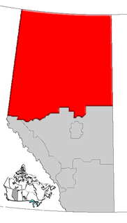
Northern Alberta is a region located in the Canadian province of Alberta.
Bezanson is a hamlet in northern Alberta, Canada within the County of Grande Prairie No. 1. It is located approximately 30 kilometres (19 mi) east of Grande Prairie on Highway 43, west of the Smoky River.
Red Earth Creek is a hamlet in Alberta, Canada within the Municipal District of Opportunity No. 17. It is located east of Highway 88, between the Town of Slave Lake and the Hamlet of Fort Vermilion, and has an elevation of 520 metres (1,710 ft).
Canyon Creek is a hamlet in northern Alberta, Canada within the Municipal District of Lesser Slave River No. 124. It is located on Highway 2, approximately 234 kilometres (145 mi) east of Grande Prairie.
Demmitt is a hamlet in northern Alberta, Canada within the County of Grande Prairie No. 1. It is located on Highway 43, approximately 77 kilometres (48 mi) northwest of Grande Prairie. The Northern Alberta Railway was built through the area in 1930 as it extended westwards towards Dawson Creek, British Columbia.
Dimsdale is a hamlet in northern Alberta, Canada, within the County of Grande Prairie No. 1. It was established on March 30th of 2001 and is located 2 kilometres (1.2 mi) south of Highway 43, approximately 13 kilometres (8.1 mi) west of Grande Prairie.
Driftpile is a settlement in Drift Pile River 150, in northern Alberta, Canada. It is located on Highway 2, approximately 191 kilometres (119 mi) east of Grande Prairie. Ryan Plante is currently mayor.
Guy is a hamlet in northern Alberta, Canada within the Municipal District of Smoky River No. 130. It is located on Highway 49, approximately 113 kilometres (70 mi) northeast of Grande Prairie. It is the home of Honey Bunny honey products.
Jean Cote, or Jean Côté, is a hamlet in northern Alberta, Canada within the Municipal District of Smoky River No. 130. It is located approximately 11 kilometres (6.8 mi) west of Highway 2 and 123 kilometres (76 mi) northeast of Grande Prairie.
Joussard is a hamlet in northern Alberta within Big Lakes County, located 2 kilometres (1.2 mi) north of Highway 2, approximately 182 kilometres (113 mi) east of Grande Prairie.
Garden River, also known as Garden Creek, is an unincorporated community in northern Alberta, Canada within Wood Buffalo National Park. It is located on the north shore of the Peace River at the terminus of Garden River Road, an extension of Highway 58, approximately 190 km (120 mi) east of the Town of High Level. It is a First Nations community of the Little Red River Cree Nation.
Coordinates: 58°23′22″N115°04′37″W / 58.38944°N 115.07694°W
A geographic coordinate system is a coordinate system that enables every location on Earth to be specified by a set of numbers, letters or symbols. The coordinates are often chosen such that one of the numbers represents a vertical position and two or three of the numbers represent a horizontal position; alternatively, a geographic position may be expressed in a combined three-dimensional Cartesian vector. A common choice of coordinates is latitude, longitude and elevation. To specify a location on a plane requires a map projection.
This Northern Alberta location article is a stub. You can help Wikipedia by expanding it. |