The Afar Regional State is one of the nine regional states (kililoch) of Ethiopia, and is the homeland of the Afar people. Formerly known as Region 2, its new capital as of 2007 is the recently constructed city of Semera, which lies on the paved Awash–Assab highway.
Ethiopia, officially the Federal Democratic Republic of Ethiopia, is a country in the northeastern part of Africa, popularly known as the Horn of Africa. It shares borders with Eritrea to the north, Djibouti to the northeast, and Somalia to the east, Sudan and South Sudan to the west, and Kenya to the south. With over 102 million inhabitants, Ethiopia is the most populous landlocked country in the world and the second-most populous nation on the African continent that covers a total area of 1,100,000 square kilometres (420,000 sq mi). Its capital and largest city is Addis Ababa, which lies a few miles west of the East African Rift that splits the country into the Nubian Plate and the Somali Plate.
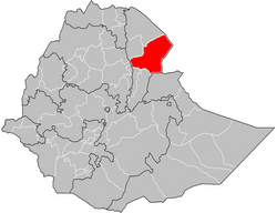
Administrative Zone 3 is one of five Zones of the Afar Region of Ethiopia. This zone is bordered on the south by the Oromia Region, on the southwest by the Amhara Region, on the west by the Administrative Zone 5, on the north by Administrative Zone 1, and on the east by the Somali Region.
The largest town in Zone 1 is Asayita. Rivers in this Zone include the Awash and its tributaries the Mille and Logiya Rivers. There are a chain of six interconnected lakes in this Zone, fed by the Awash: from north to south they are Gargori, Laitali, Gummare, Bario and Lake Abbe (or Abhe Bad).
The Awash is a major river of Ethiopia. Its course is entirely contained within the boundaries of Ethiopia and empties into a chain of interconnected lakes that begin with Lake Gargori and end with Lake Abbe on the border with Djibouti, some 100 kilometres from the head of the Gulf of Tadjoura. It is the principal stream of an endorheic drainage basin covering parts of the Amhara, Oromia and Somali Regions, as well as the southern half of the Afar Region. According to Huntingford, in the 16th century the Awash river was called the great Dir river and lay in the country of the Muslims.
The Mille River is a river of Ethiopia and a tributary of the Awash. It drains parts of the Semien (North) Wollo and Debub (South) Wollo Zones of the Amhara Region, as well as Administrative Zone 4 of the Afar Region. The explorer L.M. Nesbitt, who travelled through the area in 1928, was impressed by its size, and described the Mille as "probably the only real river which joins the Awash". The Ala River (A'ura) and Golima River (Golina) are small tributaries of the Mille.
The Logiya is a river of east-central Ethiopia. Having its source in the Ethiopian highlands, this stream flows eastwards to become a tributary of the Awash River near Dubti11°44′N41°0′E.
History
Following a split in the ranks of the Djiboutian political party Front for the Restoration of Unity and Democracy in 1994, 18,000 Djiboutians fled to this Zone. Most of these refugees are scattered along the main road from Ayasita to Bure, either integrated into local settlements, or - in the case of nomads - allowed to graze their animals in the areas of their host clans.[2]
Djibouti is a country located in the Horn of Africa. It is bordered by Eritrea in the north, Ethiopia in the west and south, and Somalia in the southeast. The remainder of the border is formed by the Red Sea and the Gulf of Aden at the east. Djibouti occupies a total area of 23,200 km2 (8,958 sq mi).
The Front for the Restoration of Unity and Democracy is a political party in Djibouti. It is aligned with the interests of the Afar people who live in that country, although it has supporters residing outside of Djibouti.
Bure is a small area about 80 kilometres (50 mi) west of Asseb, on the border between Eritrea and Ethiopia, and claimed by both countries. Bure lies across the important Awash-Asseb highway, which in the past has been an important trucking route.
In August 1999, a planned release of waters from the Koka Reservoir resulted in flooding by the Awash—although an investigation afterwards showed the flooding was caused by dike failures and silting of the Awash. Approximately 4,000 hectares of cropland in the Zone and 3 rural kebeles in Asayita, 5 in Afambo and 8 in Dubti woredas were affected.[3]
The Koka Reservoir is a reservoir in south-central Ethiopia. It was created by the construction of the Koka Dam across the Awash River. The reservoir has an area of 180 square kilometers.
A kebele is the smallest administrative unit of Ethiopia, similar to a ward, a neighbourhood or a localized and delimited group of people. It is part of a woreda (district), itself usually part of a Zone, which in turn are grouped into one of the Regions based on ethno-linguistic communities that comprise the Federal Democratic Republic of Ethiopia. Each kebele consists of at least five hundred families, or the equivalent of 3,500 to 4,000 persons. There is at least one in every town with more than 2,000 population. A keftanya, or representative, had jurisdiction over six to twelve kebeles.
Asayita is one of the woredas in the Afar Region of Ethiopia. Part of the Administrative Zone 1, Asayita is bordered on the south by Afambo, on the west by Dubti, then on the north by the Awash River which separates it from Elidar, and on the east by Djibouti. The major town in Asayita is Asayita.
Demographics
Based on the 2007 Census conducted by the Central Statistical Agency of Ethiopia (CSA), this Zone has a total population of 410,790,[4] of whom 224,656 are men and 186,134 women; with an area of 30,242.10 square kilometers, it has a population density of 13.58. While 82,886 or 20.18% are urban inhabitants, a further 178,557 or 43.47% were pastoralists. A total of 75,735 households were counted in this Zone, which results in an average of 5.4 persons to a household, and 78,104 housing units. Two largest ethnic groups reported in Zone 1 were the Afar (88.52%) and Amhara (9.97%); all other ethnic groups made up 1.51% of the population. Afar is spoken as a first language by 88.43%, and Amharic by 10.4%; the remaining 1.17% spoke all other primary languages reported. 96.55% of the population said they were Muslim, and 3.29% were Orthodox Christians.[5]
The Afar, also known as the Danakil, Adali and Odali, are an ethnic Cushitic peoples inhabiting the Horn of Africa. They primarily live in the Afar Region of Ethiopia and in northern Djibouti, although some also inhabit the southern point of Eritrea. Afars speak the Afar language, which is part of the Cushitic branch of the Afroasiatic family.
The Afar language is an Afroasiatic language belonging to the Cushitic branch. It is spoken by the Afar people inhabiting Djibouti, Eritrea and Ethiopia.
Islam is the second largest religion in Ethiopia with over 33,9% of the population practicing it in 2007. The faith arrived in Ethiopia at an early date, shortly before the hijira. Islam is the religion of the overwhelming majority of the Somali, Afar, Argobba, Harari, Berta, Alaba, and Silt'e and also has many adherents among the Gurage and the Oromo, the largest ethnic group in Ethiopia, as well as a minority of Amhara, the second largest ethnic group in the country.
The 1996 national census reported a total population for this Zone of 327,901, of whom 186,616 were men and 141,285 women; 42,213 or 12.9% of its population were urban dwellers at the time. The major ethnic groupings in 1996 were 88.09% Afar, 9.98% Amhara, 0.75% Tigrean, and 0.71% Oromo. Of the school-age school-age children, 4.86% (5.05% male and 4.60% female) were currently attending school, which is higher than the Regional average; 11.28% of the total population over the age of 10 (12.93% male and 9.14% female) are reported to be literate.[6]
The Oromo people are an ethnic group inhabiting Ethiopia. They are one of the largest ethnic groups in Ethiopia and represent 34.5% of Ethiopia's population. Oromos speak the Oromo language as a mother tongue, which is part of the Cushitic branch of the Afro-Asiatic language family. The word Oromo appeared in European literature for the first time in 1893 and then slowly became common in the second half of the 20th century.
Agriculture
Based on a sample enumeration of private land held in this Zone performed by the CSA in 2001, 43.1% is under cultivation, 2.82% pasture, 35.9% is fallow, and the remaining 5.15% is devoted to other uses. For the land under cultivation in this woreda, 53.32% in planted in cereals like maize and sorghum; data is missing for the land planted in pulses and vegetables, but 3.54 hectares was planted in fruit trees, 0.9 hectares in bananas and 0.91 in guavas. 5.53% of the farmers both raise crops and livestock, while 17.35% only grow crops and 77.12% only raise livestock. Land tenure in this Zone is distributed between 76.63% own their land, 7.65% rent, and the remaining 15.72% are held under other forms of tenure.[7]
↑ In Afar Region eight rural kebeles in Elidar Wereda, bordering Eritrea were not covered by census. To get the total population size of Zone 1, you should add the estimated population size (21,410) of eight rural kebeles of Elidar wereda.
This page is based on this Wikipedia article Text is available under the CC BY-SA 4.0 license; additional terms may apply. Images, videos and audio are available under their respective licenses.
Related Research Articles
Mustahil is one of the woredas in the Somali Region of Ethiopia. Part of the Gode Zone, Mustahil is bordered on the south by Somalia, on the west by Kelafo, on the north by the Korahe Zone, and on the east by Ferfer. The Shebelle River is flowing through this woreda. The major town in this woreda is Mustahīl.
Afambo is one of the woredas in the Afar Region of Ethiopia. It is named after Lake Afambo, located at the border of this woreda with Asayita, near the international border with Djibouti. Part of the Administrative Zone 1, Afambo is bordered on the south by the Somali Region, on the west by Dubti, on the north by Asayita, and on the east by Djibouti. The largest town in this woreda is Afambo.
Elidar is one of the woredas in the Afar Region of Ethiopia. Part of the Administrative Zone 1, Elidar is bordered on the south by the Awash River which separates it from Asayita, on the west by Dubti, on the northwest by Kori, on the north by the Administrative Zone 2, on the northeast by Eritrea, and on the east by Djibouti. Towns in Elidar include Bure, Diche Oto, Elidar and Manda.
Chifra is one of the woredas in the Afar Region of Ethiopia. Part of the Administrative Zone 1, Chifra is located near the base of the eastern escarpment of the Ethiopian highlands and bordered on the south by Mille, on the west by the Amhara Region, on the north by the Administrative Zone 4, and on the east by Dubti; the Logiya River defines part of the boundary with Zone 4. The administrative center of Chifra is Chifra.
Dubti is one of the woredas in the Afar Region of Ethiopia. Part of the Administrative Zone 1, Dubti is bordered on the south by the Somali Region, on the southwest by Mille, on the west by Chifra, on the northwest by the Administrative Zone 4, on the north by Kori, on the northeast by Elidar, on the east by Asayita, and on the southeast by Afambo. Towns in Dubti include Dubti, Logiya, and Semera.
Berahle is one of the woredas in the Afar Region of Ethiopia. Part of the Administrative Zone 2, Berahle's territory includes part of the Afar Depression. This woreda is bordered on the south by Afdera and Abala, on the southwest by the Tigray Region, on the west by Koneba, on the north by Dallol, and on the northeast by Eritrea. Towns in Berahle include Berhale and Tiyarabora.
Amibara is one of the woredas in the Afar Region of Ethiopia. Part of the Administrative Zone 3, Amibara is bordered on the south by Awash Fentale, on the west by the Awash River which separates it from Dulecha, on the northwest by the Administrative Zone 5, on the north by Gewane, on the east by the Somali Region, and on the southeast by Oromia Region. Towns in Amibara include Awash Arba, Awash Sheleko, Melka Sedi and Melka Were.
Awash Fentale is one of the woredas in the Afar Region of Ethiopia. Part of the Administrative Zone 3, Awash Fentale is bordered on the south by the Oromia Region, on the west by the Amhara Region, on the north by Dulecha, and on the east by Amibara. Towns in Awash Fentale include Awash Sebat Kilo and Sabure.
Gewane is one of the woredas in the Afar Region of Ethiopia. Part of the Administrative Zone 3, Gewane is bordered on the south by Amibara, on the west by Bure Mudaytu and Administrative Zone 5, on the north by the Administrative Zone 1, and on the east by the Somali Region; the Awash River defines parts of the boundary with Administrative Zone 5. The administrative centre is Gewane; other towns in Gewane include Meteka.
Bure Mudaytu is one of the woredas in the Afar Region of Ethiopia. Part of the Administrative Zone 3, Bure Mudaytu stretches along a narrow band covering the marshy lowlands along the Awash River, with the Administrative Zone 5 to the west and Gewane to the east. The administrative center of this woreda is Debel.
Dewe is one of the woredas in the Afar Region of Ethiopia. Part of the Administrative Zone 5, Dewe is located near the base of the eastern escarpment of the Ethiopian highlands, and bordered on the south by the Borkana River which separates it from Dalifage and Hadele Ele, on the west by the Amhara Region, on the north by Telalak, and on the east by Administrative Zone 3. The major settlement in this woreda is Wedarage. Dewe was the seat of the Sultanate of Dewe, one of the Afar's traditional sultanates in the Afar Region.
Simurobi Gele'alo is one of the woredas in the Afar Region of Ethiopia. Part of the Administrative Zone 5, Simurobi Gele'alo is located near the base of the eastern escarpment of the Ethiopian highlands, and bordered on the west by the Amhara Region, on the north by Hadele Ele, and on the east and south by the Administrative Zone 3; the Awash River defines a part of the southern end of the eastern boundary of this woreda with Administrative Zone 3. The major settlement in this woreda is Kumame.
Atsbi Wemberta is one of the woredas in the Tigray Region of Ethiopia. Located in the Misraqawi Zone at the eastern edge of the Ethiopian highlands, Atsbi Wenberta is bordered on the south by the Debub Misraqawi (Southeastern) Zone, on the west by Kilte Awulaelo, on the north by Saesi Tsaedaemba, and on the east by the Afar Region. The administrative center of this woreda is Atsbi ; other towns in Atsbi Wenberta include Haik Mesahil, Atsebi Dera, Kelisha Emni and Habes. The woreda is administratively divided into 18 Tabiyas (Kebelles).
Kewet is one of the woredas in the Amhara Region of Ethiopia. Part of the Semien Shewa Zone, Kewet is bordered on the southwest by Termaber, on the northwest by Menz Mam Midir, on the north by Efratana Gidim, and on the east by Afar Region. The major town in Kewet is Shewa Robit.
Bibugn is one of the woredas in the Amhara Region of Ethiopia. Part of the Misraq Gojjam Zone, Bibugn is bordered on the south by Sinan, on the west by the Mirab Gojjam Zone degadamot woreda, on the northwest by Goncha, and on the east by Hulet Ej Enese. Towns in Bibugn include Digua Tsion, Weyin Wuha and Wabirr.
.Digo tsion(ድጎፅዮን) is the center of Bibugn wereda.
There are over 15 kebelles in bibugn wereda:among those debiresina is one of a kebelle that found in the north part.
Sekela is one of the woredas in the Amhara Region of Ethiopia. Part of the Mirab (West) Gojjam Zone, Sekela is bordered on the southwest by Bure, on the west by the Agew Awi Zone, on the north by Mecha, on the northeast by Yilmana Densa, on the east by Kuarit, and on the southeast by Jabi Tehnan. The administrative center of Sekela is Gish Abay.
Fentale is one of the woredas in the Oromia Region of Ethiopia. Part of the Misraq Shewa Zone located in the Great Rift Valley, Fentale is bordered on the southeast by the Arsi Zone, on the southwest by Boset, on the northwest by the Amhara Region, and on the northeast by the Afar Region. The administrative center of Fentale is Metehara; other towns include Haroo Adii.