Admiralty (East) Public Transport Interchange 金鐘(東)公共運輸交匯處 | |
---|---|
Other names | Admiralty (East) Bus Terminus (Citybus/NWFB) Admiralty Railway Station (East) Bus Terminus (KMB) |
Location | Ground floor, United Centre, 95 Queensway Admiralty Central and Western |
Bus routes |
|
Connections |
|
History | |
Opened | TBD |
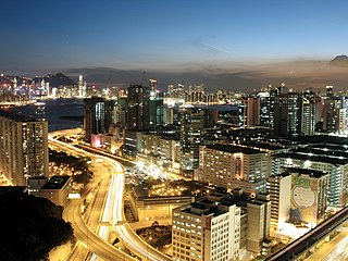
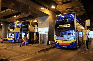
The Admiralty (East) Public Transport Interchange (Chinese :金鐘(東)公共運輸交匯處) is a major bus terminus located in Admiralty, Central and Western District, Hong Kong. Located above Admiralty Station of the MTR, the terminus hosts bus routes to most destinations in the Southern District west of Deep Water Bay, so the usage is relatively high.
Chinese is a group of related, but in many cases not mutually intelligible, language varieties, forming the Sinitic branch of the Sino-Tibetan language family. Chinese is spoken by the Han majority and many minority ethnic groups in China. About 1.2 billion people speak some form of Chinese as their first language.
A bus terminus is a designated place where a bus or coach starts or ends its scheduled route. The terminus is the designated place that a timetable is timed from. Termini can be located at bus stations, interchanges, bus garages or bus stops. Termini can both start and end at the same place, or may be in different locations for starting and finishing a route. Termini may or may not coincide with the use of bus stands.
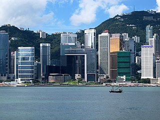
Admiralty is the eastern extension of the central business district on the Hong Kong Island of Hong Kong. It is located on the eastern end of the Central and Western District, bordered by Wan Chai to the east and Victoria Harbour to the north.
The interchange has different names named by different bus companies. The official name from the Government is Admiralty (East) Public Transport Interchange; Citybus and New World First Bus named it as the Admiralty (East) Bus Terminus (Chinese :金鐘(東)巴士總站); while the name from Kowloon Motor Bus is Admiralty Railway Station (East) Bus Terminus (Chinese :金鐘鐵路站(東)巴士總站).
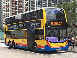
Citybus Limited is one of the three major bus operators in Hong Kong. It provides both franchised and non-franchised bus service. The franchised route network serves mainly Hong Kong Island, cross-harbour routes, North Lantau and Hong Kong International Airport. The non-franchised routes serve mainly City One Sha Tin. It also provides bus rental services and staff bus services for some large companies such as TVB and China Light and Power.
New World First Bus Services Limited (NWFB) is the third largest bus operator in Hong Kong.
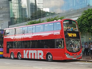
The Kowloon Motor Bus Company (1933) Limited, is a bus company operating franchised services in Hong Kong. It is the largest bus company in Hong Kong by fleet size and number of bus routes. It is a subsidiary of Transport International.
Admiralty (East) Public Transport Interchange is located at 95 Queensway, ground floor of the United Centre. A MTR entrance/exit is located next to the exit of the terminus.
The locations of berths for different routes is provided in the plan below.
Fixed Regulators' Room is installed next to the entrance of the terminus. An NWFB Customer Service Centre is located at this terminus, providing route information of Citybus and NWFB, souvenirs for sale and value-adding of Octopus cards.
The Octopus card is a reusable contactless stored value smart card for making electronic payments in online or offline systems in Hong Kong. Launched in September 1997 to collect fares for the territory's mass transit system, the Octopus card system is the second contactless smart card system in the world, after the Korean Upass, and has since grown into a widely used payment system for all public transport in Hong Kong, leading to the development of Oyster Card in London, Opal Card in New South Wales and many other similar systems around the world.
The Mass Transit Railway is a major public transport network serving Hong Kong. Operated by the MTR Corporation Limited (MTRCL), it consists of heavy rail, light rail, and feeder bus service centred on an 11-line rapid transit network serving the urbanised areas of Hong Kong Island, Kowloon, and the New Territories. The system currently includes 218.2 km (135.6 mi) of rail with 159 stations, including 91 heavy rail stations and 68 light rail stops. The MTR is one of the most profitable metro systems in the world; it had a farebox recovery ratio of 187% in 2015, the world's highest.
The Island line is one of eleven lines of the MTR, the mass transit system in Hong Kong. It runs from Kennedy Town in Western to Chai Wan in the Eastern District. The line first opened on 31 May 1985. It currently travels through 16.3 kilometres (10.1 mi) in 34 minutes along its route, serving 17 stations. The line is indicated by the colour, dark blue, on the MTR map.
The Tsuen Wan line is one of the eleven lines of the metro network in Hong Kong's MTR. It is indicated in red on the MTR map.
Kwun Tong is an area in Kwun Tong District, situated at the eastern part of the Kowloon Peninsula, and its boundary stretches from Lion Rock in the north to Lei Yue Mun in the south, and from the winding paths of Kowloon Peak in the east to the north coast of the former Kai Tak Airport runway in the west.
Tai Po Market is a station on the East Rail Line in the New Territories, Hong Kong. Located in Tai Po near Uptown Plaza, the station has three tracks and four platforms. Platform 1 is for northbound trains to border crossing stations at Lo Wu and Lok Ma Chau and platform 4 is for southbound trains to Hung Hom, Kowloon while platforms 2 and 3 use the same track and is reserved for peak hour traffic.
Central is an MTR station located in the Central area of Hong Kong Island. The station's livery is firebrick red but brown on the Tsuen Wan Line platforms. The station is the southern terminus of the Tsuen Wan Line, a stop on the Island Line, and connects to Hong Kong Station, which serves the Tung Chung Line and the Airport Express.
Tai Wai is an area in the New Territories of Hong Kong, located between Sha Tin New Town and the Lion Rock. It is the largest part of the Sha Tin District.
Admiralty is a Mass Transit Railway (MTR) station located on Hong Kong Island, in an area often referred to as Admiralty. The station's livery is blue, white and yellow. The station connects the Tsuen Wan line with the Island line and the South Island line. Before the opening of the Tsuen Wan branch line in 1982, it was part of the Kwun Tong line.
Chai Wan is the eastern terminus of the MTR Island Line on Hong Kong Island, Hong Kong. It is the only station on the Island Line that is elevated. The station is located at the junction of Chai Wan Road and Island Eastern Corridor, and it serves Siu Sai Wan and Chai Wan, a primarily residential and industrial town, and the bus terminus nearby has bus and minibus routes to Siu Sai Wan and Stanley, as well as the nearby residential developments. It was also the southernmost railway station in Hong Kong, and the southernmost rapid transit station in China, prior to the opening of Lei Tung Station on the South Island Line on 28 December 2016.
The Wan Chai Pier, or Wan Chai Ferry Pier, is a pier at the coast of Wan Chai North on the Hong Kong Island of Hong Kong. The pier is operated by Star Ferry, and provides ferry services to Tsim Sha Tsui. The pier is near the Hong Kong Convention and Exhibition Centre.
Austin is an underground MTR rapid transit station on the West Rail Line in Hong Kong, situated perpendicular to Wui Cheung Road and Austin Road West, and formerly adjacent to Jordan Road Ferry Pier Bus Terminus. It is the only intermediate station along the Kowloon Southern Link project, built to connect the West Rail Line and East Rail Line. Construction was finished in July 2009 and the station opened on 16 August 2009.
In Hong Kong, public bus, public light bus and residential bus routes bear their own route numbers.
Bus services in Hong Kong have a long history. As of 2016, five companies operate franchised public bus services. There is also a variety of non-franchised public buses services, including feeder bus services to railway stations operated by MTR, and residents' services for residential estates.
Jordan Road Ferry Pier or Ferry Point (1924–1998) is a demolished pier originally located at Jordan Road, Jordan, Hong Kong.
Citybus Route 1 is a bus route operated by Citybus (CTB) on Hong Kong Island, running between Felix Villas and Happy Valley (Upper) via Kennedy Town, Sheung Wan, Central and Wan Chai.
Tsuen Wan Pier, Tsuen Wan Ferry or Tsuen Wan Ferry Pier is a public pier at the south of Tsuen Wan, New Territories, Hong Kong, which is adjacent to the MTR Tsuen Wan West Station. It provided ferry service to Central via Tsing Yi, but the service ceased operation in 2000 after Western Harbour Tunnel and MTR Tung Chung Line were commissioned to provide faster route between New Territories West and Hong Kong Island.
The Central Bus Terminus is a major bus terminus located in Sheung Wan, Central and Western District, Hong Kong, next to the Hong Kong-Macau Ferry Terminal. It is one of the largest open-air bus terminus in Hong Kong and is home to a large variety of cross-harbour tunnel bus routes towards points in Kowloon and the New Territories, making the terminus one of the most important transport interchanges in Hong Kong.
The Pokfield Road Bus Terminus is a bus terminus located on Pok Fu Lam Road, Central and Western District, Hong Kong
The Central Bus Terminus is a major bus terminus located in Central, Central and Western District, Hong Kong. Situated on the ground floor of the Exchange Square commercial complex, the terminus is regarded as the central hub of bus routes in the Central District.
Kowloon Urban Route No. 20 is a Hong Kong bus route operated by Citybus, plying between Kai Tak and Tai Kok Tsui.
Coordinates: 22°16′43″N114°09′56″E / 22.27861°N 114.16556°E
A geographic coordinate system is a coordinate system that enables every location on Earth to be specified by a set of numbers, letters or symbols. The coordinates are often chosen such that one of the numbers represents a vertical position and two or three of the numbers represent a horizontal position; alternatively, a geographic position may be expressed in a combined three-dimensional Cartesian vector. A common choice of coordinates is latitude, longitude and elevation. To specify a location on a plane requires a map projection.