Afton, Texas | |
|---|---|
 Patton Springs School | |
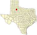
 Afton Location of Afton  Afton Afton (the United States) | |
| Coordinates: 33°45′46″N100°49′00″W / 33.76278°N 100.81667°W [1] | |
| Country | |
| State | |
| County | Dickens |
| Region | Llano Estacado |
| Established | 1893 |
| Elevation | 2,536 ft (773 m) |
| Time zone | UTC-6 (CST) |
| ZIP code | 79220 [2] |
| Area code | 806 |
Afton is an unincorporated community in northern Dickens County, Texas, United States. [3]