McAdoo, Texas

Last updated

McAdoo, Texas
McAdoo Texas grain elevator 2012.jpg
Small grain-handling facility in McAdoo
Relief map of Texas.png
Red pog.svg
McAdoo
Usa edcp relief location map.png
Red pog.svg
McAdoo
Coordinates: 33°44′02″N101°00′23″W / 33.73389°N 101.00639°W / 33.73389; -101.00639
Country Flag of the United States.svg  United States
State Flag of Texas.svg  Texas
County Dickens
Physiographic region Llano Estacado
Founded1915
Elevation
[1]
2,982 ft (909 m)
Time zone UTC-6 (Central (CST))
  Summer (DST) UTC-5 (CDT)
Area code 806
Website Handbook of Texas

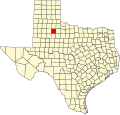
McAdoo is an unincorporated community in northwestern Dickens County, Texas, United States.

Contents

History

McAdoo is named for the former United States Secretary of the Treasury William Gibbs McAdoo, son-in-law of U.S. President Woodrow Wilson. The Texas politician, journalist, and attorney Marshall Formby was reared in McAdoo and is interred there at McAdoo Cemetery. Formby's nephew, Clint Formby, who was also reared in McAdoo, maintained the longest-running radio broadcast by a single host in the United States. [2]

Education

The McAdoo school was consolidated with the Spur Independent School District in 1985. [3] The former McAdoo Independent School District was disestablished on July 1, 1985. [4]

The Texas Legislature designated the county as being in the Western Texas College District. [5]

Economy

Wind energy

Invenergy LLC constructed a 150 MW wind power plant near this community. The project consists of 100 GE 1.5 MW wind turbines and came online in late summer/early fall 2008. The project is providing a large economic boost for the area and most of the population. [6]

See also

Related Research Articles

<span class="mw-page-title-main">Crosby County, Texas</span> County in Texas, United States

Crosby County is a county located in the U.S. state of Texas. As of the 2020 census, its population was 5,133. The county seat is Crosbyton. The county was founded in 1876 and later organized in 1886. Both the county and its seat are named for Stephen Crosby, a land commissioner in Texas.

<span class="mw-page-title-main">Ralls, Texas</span> City in Texas, United States

Ralls is a city in Crosby County, Texas, United States. It was named after John Robinson Ralls, who, with the help of W.E. McLaughlin, laid out the townsite in July 1911. As of the 2020 census, it had a population of 1,665, down from 1,944 at the 2010 census. Ralls is surrounded by productive farmlands that primarily produce cotton and grains, with lesser amounts of soybean, sunflower seed, and vegetables.

<span class="mw-page-title-main">Floydada, Texas</span> City in Texas, United States

Floydada is a city in and the county seat of Floyd County, Texas, United States. This rural community lies on the high plains of the Llano Estacado in West Texas and is sometimes referred to as the Pumpkin Capital of Texas. The population was 2,675 at the 2020 census, down from 3,038 at the 2010 census and 3,676 at the 2000 census.

New Deal is a U.S. town in Lubbock County, Texas. The population was 730 at the 2020 census. It is part of the Lubbock Metropolitan Statistical Area and the Llano Estacado region.

<span class="mw-page-title-main">Llano Estacado</span> Southwestern United States in New Mexico and Texas

The Llano Estacado, sometimes translated into English as the Staked Plains, is a region in the Southwestern United States that encompasses parts of eastern New Mexico and northwestern Texas. One of the largest mesas or tablelands on the North American continent, the elevation rises from 3,000 feet (900 m) in the southeast to over 5,000 feet (1,500 m) in the northwest, sloping almost uniformly at about 10 feet per mile (2 m/km).

<span class="mw-page-title-main">Cotton Center, Texas</span> Unincorporated community in Texas, United States

Cotton Center is an unincorporated community in western Hale County, Texas, United States, located about 12 miles southwest of Hale Center. Until the late 19th century, the Comanche tribe of Native Americans occupied the area. In 1907, with the coming of a branch of the Santa Fe Railroad, a number of farming operations were established. Cotton Center was originally created in 1925 as a consolidated school district, with a small unincorporated community site, containing the school, cotton gins, and various businesses to support the surrounding farms. In 1935, a local post office opened, and the first irrigation well was drilled. By the late 1940s, irrigation wells proliferated, pumping water from the Ogallala Aquifer. The community revolves around farming and is tied together by the school, which as of 2005 had 140 students in prekindergarten through grade 12.

Spur Independent School District is a public school district based in Spur, Texas, United States.

<span class="mw-page-title-main">Southland, Texas</span> Unincorporated community in Texas, United States

Southland is an unincorporated community in Garza County, Texas, United States. It lies along the eastern edge of the Llano Estacado on U.S. Route 84, twenty miles northwest of Post.

<span class="mw-page-title-main">Dougherty, Floyd County, Texas</span> Unincorporated community in Texas, United States

Dougherty is a small unincorporated community in Floyd County, Texas, United States.

<span class="mw-page-title-main">Notrees, Texas</span> Unincorporated community in Texas, United States

Notrees is an unincorporated community in west-central Ector County, Texas, United States. It is located on State Highway 302, approximately 20 miles northwest of Odessa. The community is part of the Odessa metropolitan statistical area.

<span class="mw-page-title-main">Blanco Canyon</span>

Blanco Canyon is a canyon located in the U.S. state of Texas. Eroded by the White River into the Caprock Escarpment on the east side of the Llano Estacado, the canyon runs for 34 miles (55 km) in a southeasterly direction, gradually widening from its beginning in southwestern Floyd County to 10 miles (16 km) across at its mouth in southeastern Crosby County. It also gradually deepens from 50 feet (15 m) at its beginning to 300 to 500 feet at its mouth. One side canyon, 5-mile long Crawfish Canyon, was cut by Crawfish Creek as it feeds into the White River from the west.

<span class="mw-page-title-main">White River (Texas)</span> River in Texas, United States

The White River is an intermittent stream in the South Plains of Texas and a tributary of the Brazos River of the United States. It rises 8 miles (13 km) west of Floydada in southwestern Floyd County at the confluence of Callahan and Runningwater Draws. From there, it runs southeast for 62 miles (100 km) to its mouth on the Salt Fork of the Brazos River in northwestern Kent County. Besides these two headwaters, which rise near Hale Center and in Curry County, New Mexico, respectively, other tributaries include Pete, Crawfish, and Davidson Creeks. The White River drains an area of 1,690 sq mi (4,377 km2).

<span class="mw-page-title-main">Pep, Texas</span> Unincorporated community in Texas, United States

Pep is an unincorporated community in northwestern Hockley County, Texas, United States, situated along Farm to Market Road 303. It is located on the high plains of the Llano Estacado just to the west of the historic Yellow House Ranch. Pep has a post office with the ZIP code 79353.

<span class="mw-page-title-main">Grassland, Texas</span> Town in Texas, United States

Grassland is an unincorporated community in Lynn County, West Texas, United States. According to the Handbook of Texas, the community had an estimated population of 61 in 2000.

<span class="mw-page-title-main">Plant X</span> Power plant in Texas

Plant X is a steam-electric power plant located in the partially vegetated sandhills south of the West Texas town of Earth in Lamb County, Texas. It is owned and operated by Southwestern Public Service Company, a subsidiary of Xcel Energy.

<span class="mw-page-title-main">Estacado, Texas</span> Unincorporated community in Texas, United States

Estacado is an unincorporated community in Crosby and Lubbock Counties in the U.S. state of Texas. According to the Handbook of Texas, the community had a population of 80 in 2000. It is located within the Lubbock metropolitan area.

<span class="mw-page-title-main">Barwise, Texas</span> Unincorporated community in Texas, United States

Barwise is a small, unincorporated community located on the level plains of the Llano Estacado about 10 mi (16 km) west of Floydada in western Floyd County, Texas. The town was founded in 1928 after the Fort Worth and Denver South Plains Railway Company laid tracks through the area. The rail spur that passes through Barwise extended from the Fort Worth and Denver Railway junction at Estelline to Lubbock and Plainview.

<span class="mw-page-title-main">Needmore, Terry County, Texas</span> Unincorporated community in Texas, United States

Needmore is a small unincorporated community in north central Terry County, Texas, United States.

<span class="mw-page-title-main">Canyon Valley, Texas</span> Ghost town in Texas, United States

Canyon Valley is a ghost town in southern Crosby County, Texas, United States. Today, only a few farms and ranches are scattered across the area.

<span class="mw-page-title-main">Whiteflat, Texas</span> Ghost town in Texas, United States

Whiteflat is a ghost town in Motley County, Texas, United States. The population was estimated to be 3 at the 2000 census.

References

  1. "McAdoo". Geographic Names Information System . United States Geological Survey, United States Department of the Interior.
  2. Brickey, Henri (March 6, 2008). "Hereford radioman still going after decades". Lubbock Avalanche-Journal . Archived from the original on May 27, 2012. Retrieved December 21, 2009.
  3. Jenkins, Edloe A. (July 28, 2020). "McAdoo, TX". Texas State Historical Association . In 1985 the McAdoo school was consolidated with the Spur Independent School District.
  4. "CONSOLIDATIONS, ANNEXATIONS AND NAME CHANGES FOR TEXAS PUBLIC SCHOOLS" (PDF). Texas Education Agency. September 10, 2018. Retrieved October 30, 2019. - The page states that McAdoo consolidated with "Rusk", but this is contradicted by the Handbook of Texas.
  5. "Sec. 130.210. WESTERN TEXAS COLLEGE DISTRICT SERVICE AREA" . Retrieved September 22, 2024.
  6. Brickey, Henri (February 20, 2008). "Wind farm whips up activity around McAdoo". Avalanche-Journal. Archived from the original on August 21, 2008.