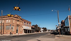
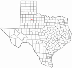
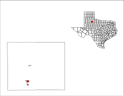
Spur, Texas | |
---|---|
Coordinates: 33°28′40″N100°51′25″W / 33.47778°N 100.85694°W | |
Country | United States |
State | Texas |
County | Dickens |
Area | |
• Total | 1.60 sq mi (4.15 km2) |
• Land | 1.60 sq mi (4.15 km2) |
• Water | 0.00 sq mi (0.00 km2) |
Elevation | 2,287 ft (697 m) |
Population | |
• Total | 863 |
• Density | 538.4/sq mi (207.9/km2) |
Time zone | UTC-6 (Central (CST)) |
• Summer (DST) | UTC-5 (CDT) |
ZIP code | 79370 |
Area code | 806 |
FIPS code | 48-69848 [3] |
GNIS feature ID | 1369049 [4] |
Spur is a city in Dickens County, Texas, United States. The population was 863 at the 2020 census, [2] down from 1,318 at the 2010 census. A city council resolution passed in July 2014 proclaimed Spur the "nation's first tiny house-friendly town."
Spur began after E. P. Swenson and associates purchased Spur Ranch in 1907 and subdivided land for settlers. The Burlington Railroad then built a railway northwest from Stamford to the future site of Spur. [5]
On November 1, 1909, the Stamford and Northwestern's first train arrived at the new depot, marking the opening of Spur. Spur was incorporated in 1911. [5]
Spur is located in southern Dickens County at 33°28′40″N100°51′25″W / 33.47778°N 100.85694°W (33.477650, –100.857018). [6] Texas State Highway 70 passes through the city, leading north 11 miles (18 km) to Dickens, the county seat, and southeast 24 miles (39 km) to Jayton.
According to the United States Census Bureau, the city has a total area of 1.6 square miles (4.2 km2), all land. [1]
According to the Köppen climate classification system, Spur has a semi-arid climate, BSk on climate maps. [7]
Climate data for Spur, Texas (1991–2020 normals, extremes 1911–1964, 1986–present) | |||||||||||||
---|---|---|---|---|---|---|---|---|---|---|---|---|---|
Month | Jan | Feb | Mar | Apr | May | Jun | Jul | Aug | Sep | Oct | Nov | Dec | Year |
Record high °F (°C) | 86 (30) | 94 (34) | 102 (39) | 106 (41) | 111 (44) | 117 (47) | 111 (44) | 112 (44) | 108 (42) | 104 (40) | 93 (34) | 87 (31) | 117 (47) |
Mean daily maximum °F (°C) | 55.5 (13.1) | 59.5 (15.3) | 68.0 (20.0) | 76.6 (24.8) | 84.4 (29.1) | 91.6 (33.1) | 94.9 (34.9) | 94.1 (34.5) | 86.0 (30.0) | 76.8 (24.9) | 65.0 (18.3) | 56.0 (13.3) | 75.7 (24.3) |
Daily mean °F (°C) | 41.0 (5.0) | 44.5 (6.9) | 52.5 (11.4) | 60.7 (15.9) | 70.1 (21.2) | 78.2 (25.7) | 81.5 (27.5) | 80.6 (27.0) | 72.7 (22.6) | 62.1 (16.7) | 50.4 (10.2) | 42.0 (5.6) | 61.4 (16.3) |
Mean daily minimum °F (°C) | 26.6 (−3.0) | 29.4 (−1.4) | 37.1 (2.8) | 44.7 (7.1) | 55.9 (13.3) | 64.9 (18.3) | 68.0 (20.0) | 67.1 (19.5) | 59.3 (15.2) | 47.4 (8.6) | 35.9 (2.2) | 28.0 (−2.2) | 47.0 (8.3) |
Record low °F (°C) | −10 (−23) | −17 (−27) | −3 (−19) | 20 (−7) | 31 (−1) | 43 (6) | 51 (11) | 45 (7) | 32 (0) | 13 (−11) | 10 (−12) | −8 (−22) | −17 (−27) |
Average precipitation inches (mm) | 0.74 (19) | 0.84 (21) | 1.31 (33) | 1.93 (49) | 2.77 (70) | 3.31 (84) | 2.36 (60) | 2.39 (61) | 2.46 (62) | 2.10 (53) | 1.21 (31) | 1.07 (27) | 22.49 (571) |
Average snowfall inches (cm) | 0.4 (1.0) | 1.3 (3.3) | 0.0 (0.0) | 0.1 (0.25) | 0.0 (0.0) | 0.0 (0.0) | 0.0 (0.0) | 0.0 (0.0) | 0.0 (0.0) | 0.0 (0.0) | 0.4 (1.0) | 0.7 (1.8) | 2.9 (7.4) |
Average precipitation days (≥ 0.01 in) | 2.3 | 3.2 | 3.9 | 4.0 | 5.5 | 6.4 | 4.6 | 5.3 | 5.6 | 4.4 | 3.3 | 2.6 | 51.1 |
Average snowy days (≥ 0.1 in) | 0.3 | 0.5 | 0.0 | 0.0 | 0.0 | 0.0 | 0.0 | 0.0 | 0.0 | 0.1 | 0.4 | 0.5 | 1.8 |
Source: NOAA [8] [9] |
Census | Pop. | Note | %± |
---|---|---|---|
1920 | 1,100 | — | |
1930 | 1,899 | 72.6% | |
1940 | 2,136 | 12.5% | |
1950 | 2,183 | 2.2% | |
1960 | 2,170 | −0.6% | |
1970 | 1,747 | −19.5% | |
1980 | 1,690 | −3.3% | |
1990 | 1,300 | −23.1% | |
2000 | 1,088 | −16.3% | |
2010 | 1,318 | 21.1% | |
2020 | 863 | −34.5% | |
U.S. Decennial Census [10] |
Race | Number | Percentage |
---|---|---|
White (NH) | 463 | 53.65% |
Black or African American (NH) | 18 | 2.09% |
Asian (NH) | 1 | 0.12% |
Pacific Islander (NH) | 2 | 0.23% |
Some Other Race (NH) | 1 | 0.12% |
Mixed/Multi-Racial (NH) | 32 | 3.71% |
Hispanic or Latino | 346 | 40.09% |
Total | 863 |
As of the 2020 United States census, there were 863 people, 387 households, and 195 families residing in the city.
As of the census [3] of 2000, 1,088 people, 472 households, and 288 families resided in the city. The population density was 673.4 inhabitants per square mile (260.0/km2). The 641 housing units averaged 396.7 per square mile (152.8/km2). The racial makeup of the city was 72.52% White, 3.40% African American, 0.83% Native American, 0.18% Asian, 0.37% Pacific Islander, 21.14% from other races, and 1.56% from two or more races. About 31.25% of the population was Hispanic or Latino of any race.
Of the 472 households, 22.5% had children under the age of 18 living with them, 47.5% were married couples living together, 10.6% had a female householder with no husband present, and 38.8% were not families. Around 37.1% of all households were made up of individuals, and 20.8% had someone living alone who was 65 years of age or older. The average household size was 2.22 and the average family size was 2.89.
In the city, the population was distributed as 22.9% under the age of 18, 6.1% from 18 to 24, 22.3% from 25 to 44, 23.4% from 45 to 64, and 25.3% who were 65 years of age or older. The median age was 44 years. For every 100 females, there were 83.8 males. For every 100 females age 18 and over, there were 82.0 males.
The median income for a household in the city was $24,286, and for a family was $32,772. Males had a median income of $25,972 versus $18,631 for females. The per capita income for the city was $14,601. 19.8% of the population and 16.2% of families were below the poverty line. 24.8% of those under the age of 18 and 21.7% of those 65 and older were living below the poverty line.
The city of Spur is served by the Spur Independent School District.
Spur's regulations are friendly to tiny houses, with some of the only requirements being a provision for a foundation to be laid, as well as plumbing and electrical wiring installed. [13] Flush toilets are required, as well as a wood or metal frame. In general, experimental strawbale houses, yurts, or underground houses are not permitted. Lastly, house plans must be approved. [14]
Kent County is a county located in the U.S. state of Texas. As of the 2020 census, its population was 753, making it the sixth-least populous county in Texas. Its county seat is Jayton. The county was created in 1876 and later organized in 1892. It is named for Andrew Kent, who died at the Battle of the Alamo. Kent County is a prohibition or entirely dry county, one of four remaining in the state.
Dickens County is a county located in the U.S. state of Texas. As of the 2020 census, its population was 1,770. Its county seat is Dickens. The county was created in 1876 and later organized in 1891. Both the county and its seat are named for J. Dickens, who died at the Battle of the Alamo.
Channel Lake is an unincorporated community and census-designated place (CDP) in Antioch Township, Lake County, Illinois, United States. Per the 2020 census, the population was 1,581.
Diboll is a city in Angelina County, Texas, United States. The population was 4,457 at the 2020 census. Diboll is named for J. C. Diboll, a local timber salesman.
Jourdanton is a city in and the county seat of Atascosa County, Texas, United States. The population is 4,094. It is part of the San Antonio metropolitan statistical area. The mayor is Robert "Doc" Williams. The city manager is Bobby J. Martinez. The police chief is Eric Kaiser. The fire chief is Jay Fojtik.
Meridian is a city and the county seat of Bosque County in central Texas, United States. It is forty-seven miles northwest of Waco. The population was 1,493 at the 2010 census.
Caldwell is a city in and the county seat of Burleson County, Texas, United States. The population was 3,993 at the 2020 census. It is part of the Bryan-College Station metropolitan area.
Coleman is a town in and the county seat of Coleman County, Texas, United States. As of the 2010 census, its population was 4,709.
Paducah is a town in Cottle County, Texas, United States. The population was 1,186 at the 2010 census, down from 1,498 in 2000. It is the county seat of Cottle County. It is just south of the Texas Panhandle and east of the Llano Estacado.
Crosbyton is a city in and the county seat of Crosby County, Texas, United States. The population was 1,741 at the 2010 census. Crosbyton is part of the Lubbock Metropolitan Statistical Area.
Dickens is a city in and the county seat of Dickens County, Texas, United States. The population was 286 at the 2010 census, down from 332 at the 2000 census.
Hamilton is a city in and the county seat of Hamilton County, Texas, United States, located in the state's central region. Its population was 2,895 at the 2020 census.
Spearman is a city in and the county seat of Hansford County, Texas, United States. As of the 2010 census, the city population was 3,368. It is known for its collection of windmills from the J.B. Buchanan windmill collection.
Haskell is a city in central Haskell County, Texas, United States. As of the 2010 census, the city population was 3,322. It is the Haskell county seat.
Jayton is a city in and the county seat of Kent County, Texas, United States. It is located in the northeastern portion of the county, and the population was 511 as of the 2020 census.
Madisonville is a city in Madison County, Texas, United States. The population was 4,420 at the 2020 census. It is the county seat of Madison County. Both the City of Madisonville and the County of Madison were named for U.S. President James Madison, the fourth chief executive.
Newton is a city in and the county seat of Newton County, Texas, United States. The population was 1,633 at the 2020 census.
Strawn is a city in Palo Pinto County, Texas, United States. The population was 653 at the 2010 census. Strawn, on State Highway 16 and 108, Farm to Market Road 2372, and the Missouri Pacific Railroad in southwestern Palo Pinto County, was one of several towns developed about 1880 when the Texas and Pacific Railway began service. The site, known earlier as North Fork for its location on Palo Pinto Creek, was laid out on the land of two early ranchers, Stephen Bethel Strawn and James N. Stuart. Stuart built the area's first house in 1875. A community to the west, Russell's Pocket, and one to the east, Davidsonville, were merged to form Strawn.
Rankin is a city in Upton County, Texas, United States. Its population was 778 at the 2010 census. It is named after F.E. Rankin, a local rancher. It is the county seat of the thinly populated county; in 2010, only 3,355 people lived in the entire county, and McCamey was the only larger town. During the early 20th century, the town grew due to the discovery of oil in the nearby Yates Oil Field. However, following a second oil boom in the '80s the town saw a decline in its economy and population.
Wheeler is a city, and the county seat of Wheeler County, Texas, United States, located on the eastern border of the Texas Panhandle. The population was last reported at 1,592 in the 2010 census.
Any tiny house that features wood or metal framing, flush toilets connected to city utilities and electrical work properly done, is welcome in Spur.
Spur has sold 60 abandoned lots for roughly $500 apiece, and about 20 "tiny housers" are expected to be moved in by the end of summer.