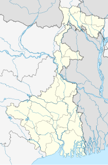
Naldurg is a town and a municipal council in Osmanabad district in the Indian state of Maharashtra.

Firozpur, also known as Ferozepur, is a city on the banks of the Sutlej River in Firozpur District, Punjab, India. It was founded by Sultan Firoz Shah Tughluq (1351–88), a ruler of the Tughluq dynasty, who reigned over the Sultanate of Delhi from 1351 to 1388.

Barkot is a town and a nagar palika in Uttarkashi District in the state of Uttarakhand, India. It is located on the banks of the Yamuna river. Barkot is the last big town near Yamunotri Dham. There are many village near Barkot city Uprari, Sara, Chakargaon, Paunti, Sunaldi, Dandagaon, Chatanga.

Bipra Noapara is a census town in Domjur CD Block of Howrah Sadar subdivision in Howrah district in the Indian state of West Bengal. It is a part of Kolkata Urban Agglomeration.

Cart Road is a census town in the Kurseong CD block in the Kurseong subdivision of the Darjeeling district in the state of West Bengal, India.

Dakshin Jhapardaha is a census town in Domjur CD Block of Howrah Sadar subdivision in Howrah district in the state of West Bengal, India. It is close to Domjur and also a part of Kolkata Urban Agglomeration.

Dhola is a census town and former petty Rajput princely state in Bhavnagar district, in the state of Gujarat, western India.

Dhusaripara is a census town in Samserganj CD Block in Jangipur subdivision of Murshidabad district in the state of West Bengal, India.

Ghorawal is a town and a nagar panchayat in Sonbhadra district in the Indian state of Uttar Pradesh.

Iluppur is a panchayat town in Pudukkottai district in the Indian state of Tamil Nadu.

Kachhwa is a town and a nagar panchayat in Mirzapur district in the Indian state of Uttar Pradesh.

Kesabpur is a census town in Domjur CD Block of Howrah Sadar subdivision in Howrah district in the Indian state of West Bengal. It is a part of Kolkata Urban Agglomeration.

Khantora is a census town in Domjur CD Block of Howrah Sadar subdivision in Howrah district in the Indian state of West Bengal. It is a part of Kolkata Urban Agglomeration.

Makardaha is a census town in Domjur CD Block of Howrah Sadar subdivision in Howrah district in the Indian state of West Bengal. It is a part of Kolkata Urban Agglomeration.

Nallur (Nalloor) is a panchayat town in Kanniyakumari district in the Indian state of Tamil Nadu.

Panchla is a census town in Panchla CD Block of Howrah Sadar subdivision in Howrah district in the Indian state of West Bengal.
Thengamputhur is a panchayat town in Kanyakumari district in the Indian state of Tamil Nadu.

Suni is a town and a nagar panchayat in Shimla district in the Indian state of Himachal Pradesh.

Pushpagiri, at 1,712 metres (5,617 ft), is the highest peak in Pushpagiri Wildlife Sanctuary in the Western Ghats of Karnataka. It is located in the Somwarpet Taluk, 20 kilometres (12 mi) from Somwarpet in the northern part of Kodagu district on the border between Dakshina Kannada and Kodagu district and hassan districts. It is 4th highest peak of Karnataka. The Sanskrit name of the mountain is Puṣpagiri while its Prakrit form is Puphagiri, which is mentioned in the Nagarjunakond Second Apsidal Temple inscription, although this may refer to a different mountain to the north of Cuddapah, in Andhra Pradesh.

Dhakuria is a census town in Gaighata CD Block in Bangaon subdivision in North 24 Parganas district in the state of West Bengal, India.


