This article needs additional citations for verification .(October 2023) |
Agerola | |
|---|---|
 | |
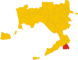 Agerola within the Province of Naples | |
Location of Agerola  | |
 Agerola Location of Agerola in Italy  Agerola Agerola (Campania) | |
| Coordinates: 40°38′N14°33′E / 40.633°N 14.550°E | |
| Country | Italy |
| Region | Campania |
| Metropolitan city | Naples (NA) |
| Frazioni | Bomerano, Campora, Pianillo, Ponte, San Lazzaro, Santa Maria |
| Government | |
| • Mayor | Tommaso Naclerio |
| Area | |
• Total | 19.6 km2 (7.6 sq mi) |
| Elevation | 630 m (2,070 ft) |
| Population (30 April 2017) [2] | |
• Total | 7,708 |
| • Density | 390/km2 (1,000/sq mi) |
| Demonym | Agerolesi |
| Time zone | UTC+1 (CET) |
| • Summer (DST) | UTC+2 (CEST) |
| Postal code | 80051 |
| Dialing code | 081 |
| Website | Official website |
Agerola is a comune (municipality) in the Metropolitan City of Naples in the Italian region Campania, located about 35 km southeast of Naples. It is part of the Amalfi Coast.
