
Amalfi is a town and comune in the province of Salerno, in the region of Campania, Italy, on the Gulf of Salerno. It lies at the mouth of a deep ravine, at the foot of Monte Cerreto, surrounded by dramatic cliffs and coastal scenery. The town of Amalfi was the capital of the maritime republic known as the Duchy of Amalfi, an important trading power in the Mediterranean between 839 and around 1200.

Positano is a village and comune on the Amalfi Coast, in Campania, Italy, mainly in an enclave in the hills leading down to the coast.

The Amalfi Coast is a stretch of coastline in southern Italy overlooking the Tyrrhenian Sea and the Gulf of Salerno. It is located south of the Sorrentine Peninsula and north of the Cilentan Coast.

Ravello is a comune (municipality) situated above the Amalfi Coast, in the province of Salerno, Campania, with approximately 2,500 inhabitants. Its scenic location makes it a popular tourist destination, and earned it a listing as a UNESCO World Heritage Site in 1997.

Maiori is a town and comune on the Amalfi coast in the province of Salerno. It has been a popular tourist resort since Roman times, with the longest unbroken stretch of beach on the Amalfi coastline.

Atrani is a city and comune on the Amalfi Coast in the province of Salerno in the Campania region of south-western Italy. It is located to the east of Amalfi, several minutes drive down the coast.
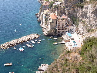
Conca dei Marini is a town and comune in the province of Salerno in the Campania region of south-western Italy. It is situated on a hill close to the coast and between Amalfi and Furore.
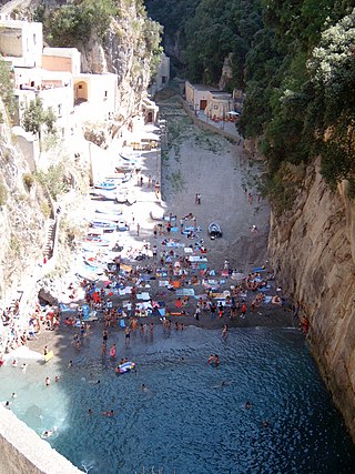
Furore is a town and comune in the province of Salerno in the Campania region of south-western Italy. Furore is located on the Amalfi Coast.
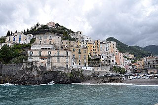
Minori is a comune in the province of Salerno, in the Campania region of south-western Italy. As a part of the Amalfi Coast, it was declared a UNESCO World Heritage Site in 1997.

Praiano is a town and comune of the province of Salerno in the Campania region of southwest Italy. It is situated on the Amalfi Coast, a prime tourist location for the region and Italy alike, between the towns of Amalfi and Positano.

Vietri sul Mare is a comune (municipality) in the province of Salerno, in the Italian region of Campania. It is situated just west of Salerno, separated from the Port of Salerno by only a harbour wall. The town is known for its polychrome ceramics, a tradition since at least the 15th century, and is considered to be the gateway to the Amalfi Coast.
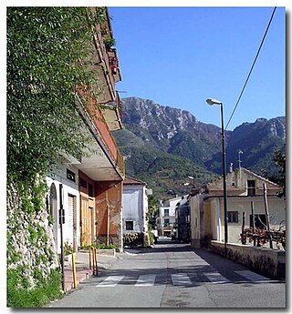
Tramonti is a town and comune in the province of Salerno in the Campania region of south-western Italy. It is located in the territory of the Amalfi Coast.

Scala is a town and comune in the province of Salerno in the Campania region of south-western Italy. It is located on a rocky hill c. 400 m above sea-level and is part of the Amalfi Coast.

Agerola is a comune (municipality) in the Metropolitan City of Naples in the Italian region Campania, located about 35 km southeast of Naples. It is part of the Amalfi Coast.

Massa Lubrense is a comune (municipality) in the Metropolitan City of Naples in the Italian region Campania, located about 25 kilometres (16 mi) southeast of Naples. As of 31 December 2004, it had a population of 13,404 and an area of 19.7 km2.

Meta is a comune (municipality) in the Metropolitan City of Naples in the Italian region Campania, located about 25 km southeast of Naples.

Piano di Sorrento is a comune (municipality) in the Metropolitan City of Naples in the Italian region Campania, located about 25 km (16 mi) southeast of Naples. Piano di Sorrento borders the following municipalities: Meta, Sant'Agnello, Vico Equense.

Sant'Agnello is a comune (municipality) in the Metropolitan City of Naples in the Italian region Campania, located about 25 km southeast of Naples.

Malfa is a comune (municipality) on the island of Salina, one of the Aeolian Islands, in the Metropolitan City of Messina, Sicily, southern Italy. It is located about 140 kilometres (87 mi) northeast of Palermo and about 80 kilometres (50 mi) northwest of Messina.
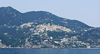
Raito is an Italian hamlet (frazione) of the municipality of Vietri sul Mare in the Province of Salerno, Campania. It is part of the Amalfi Coast and its population is 996.


