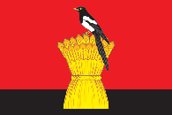
Adamovsky District is an administrative and municipal district (raion), one of the thirty-five in Orenburg Oblast, Russia. It is located in the east of the oblast. The area of the district is 6,500 square kilometers (2,500 sq mi). Its administrative center is the rural locality of Adamovka. Population: 26,079 ; 31,133 (2002 Census); 29,608 (1989 Census). The population of Adamovka accounts for 29.7% of the total district's population.

Alexandrovsky District is an administrative and municipal district (raion), one of the thirty-five in Orenburg Oblast, Russia. It is located in the west of the oblast. The area of the district is 3,100 square kilometers (1,200 sq mi). Its administrative center is the rural locality of Alexandrovka. Population: 15,702 ; 19,962 (2002 Census); 22,329 (1989 Census). The population of Alexandrovka accounts for 25.4% of the total district's population.

Asekeyevsky District is an administrative and municipal district (raion), one of the thirty-five in Orenburg Oblast, Russia. It is located in the northwest of the oblast. The area of the district is 2,400 square kilometers (930 sq mi). Its administrative center is the rural locality of Asekeyevo. Population: 21,050 ; 24,492 (2002 Census); 24,682 (1989 Census). The population of the administrative center accounts for 24.7% of the total district's population.

Belyayevsky District is an administrative and municipal district (raion), one of the thirty-five in Orenburg Oblast, Russia. It is located in the center of the oblast. The area of the district is 3,687 square kilometers (1,424 sq mi). Its administrative center is the rural locality of Belyayevka. Population: 17,074 ; 20,108 (2002 Census); 19,877 (1989 Census). The population of Belyayevka accounts for 29.2% of the total district's population.

Buzuluksky District is an administrative and municipal district (raion), one of the thirty-five in Orenburg Oblast, Russia. It is located in the west of the oblast. The area of the district is 3,800 square kilometers (1,500 sq mi). Its administrative center is the town of Buzuluk. Population: 31,071 ; 33,113 (2002 Census); 30,374 (1989 Census).

Dombarovsky District is an administrative and municipal district (raion), one of the thirty-five in Orenburg Oblast, Russia. It is located in the southeast of the oblast. The area of the district is 3,600 square kilometers (1,400 sq mi). Its administrative center is the rural locality of Dombarovsky. Population: 15,994 ; 19,188 (2002 Census); 20,016 (1989 Census). The population of the administrative center accounts for 53.9% of the total district's population.

Grachyovsky District is an administrative and municipal district (raion), one of the thirty-five in Orenburg Oblast, Russia. The area of the district is 1,700 square kilometers (660 sq mi). Its administrative center is the rural locality of Grachyovka. Population: 13,495 ; 16,198 (2002 Census); 15,946 (1989 Census). The population of Grachyovka accounts for 45.4% of the total district's population.

Ileksky District is an administrative and municipal district (raion), one of the thirty-five in Orenburg Oblast, Russia. It is located in the southwest of the oblast. The area of the district is 3,700 square kilometers (1,400 sq mi). Its administrative center is the rural locality of Ilek. Population: 25,150 ; 28,793 (2002 Census); 28,533 (1989 Census). The population of Ilek accounts for 38.8% of the district's total population.

Kurmanayevsky District is an administrative and municipal district (raion), one of the thirty-five in Orenburg Oblast, Russia. It is located in the west of the oblast. The area of the district is 2,900 square kilometers (1,100 sq mi). Its administrative center is the rural locality of Kurmanayevka. Population: 17,705 ; 21,364 (2002 Census); 23,239 (1989 Census). The population of Kurmanayevka accounts for 24.4% of the district's total population.

Kvarkensky District is an administrative and municipal district (raion), one of the thirty-five in Orenburg Oblast, Russia. The area of the district is 5,200 square kilometers (2,000 sq mi). Its administrative center is the rural locality of Kvarkeno. Population: 18,655 ; 23,525 (2002 Census); 23,890 (1989 Census). The population of Kvarkeno accounts for 21.0% of the district's total population.
Matveyevsky District is an administrative and municipal district (raion), one of the thirty-five in Orenburg Oblast, Russia. It is located in the northwest of the oblast. The area of the district is 1,800 square kilometers (690 sq mi). Its administrative center is the rural locality of Matveyevka. Population: 12,267 ; 15,627 (2002 Census); 15,704 (1989 Census). The population of Matveyevka accounts for 24.8% of the district's total population.

Perevolotsky District is an administrative and municipal district (raion), one of the thirty-five in Orenburg Oblast, Russia. It is located in the center of the oblast. The area of the district is 2,742 square kilometers (1,059 sq mi). Its administrative center is the rural locality of Perevolotsky. Population: 28,345 ; 29,088 (2002 Census); 30,357 (1989 Census). The population of the administrative center accounts for 33.9% of the total district's population.

Pervomaysky District is an administrative and municipal district (raion), one of the thirty-five in Orenburg Oblast, Russia. It is located in the southwest of the oblast. The area of the district is 5,055 square kilometers (1,952 sq mi). Its administrative center is the rural locality of Pervomaysky. Population: 25,626 ; 30,161 (2002 Census); 25,153 (1989 Census). The population of the administrative center accounts for 24.8% of the total district's population.

Ponomaryovsky District is an administrative and municipal district (raion), one of the thirty-five in Orenburg Oblast, Russia. It is located in the northwest of the oblast. The area of the district is 2,069 square kilometers (799 sq mi). Its administrative center is the rural locality of Ponomaryovka. Population: 15,463 ; 17,790 (2002 Census); 17,978 (1989 Census). The population of Ponomaryovka accounts for 33.6% of the total district's population.

Sakmarsky District is an administrative and municipal district (raion), one of the thirty-five in Orenburg Oblast, Russia. It is located in the center of the oblast. The area of the district is 2,061 square kilometers (796 sq mi). Its administrative center is the rural locality of Sakmara. Population: 29,179 ; 28,569 (2002 Census); 26,384 (1989 Census). The population of Sakmara accounts for 17.2% of the total district's population.

Saraktashsky District is an administrative and municipal district (raion), one of the thirty-five in Orenburg Oblast, Russia. It is located in the northeast of the oblast. The area of the district is 3,600 square kilometers (1,400 sq mi). Its administrative center is the rural locality of Saraktash. Population: 40,145 ; 42,307 (2002 Census); 40,887 (1989 Census). The population of Saraktash accounts for 42.9% of the total district's population.

Sharlyksky District is an administrative and municipal district (raion), one of the thirty-five in Orenburg Oblast, Russia. It is located in the northwest of the oblast. The area of the district is 2,900 square kilometers (1,100 sq mi). Its administrative center is the rural locality of Sharlyk. Population: 18,032 ; 22,128 (2002 Census); 23,797 (1989 Census). The population of Sharlyk accounts for 42.0% of the total district's population.

Sol-Iletsky District is an administrative district (raion), one of the thirty-five in Orenburg Oblast, Russia. It is located in the south of the oblast. The area of the district is 5,100 square kilometers (2,000 sq mi). Its administrative center is the town of Sol-Iletsk,. Population: 25,424 ; 28,425 (2002 Census); 52,939 (1989 Census).

Sorochinsky District is an administrative district (raion), one of the thirty-five in Orenburg Oblast, Russia. It is located in the west of the oblast. The area of the district is 2,800 square kilometers (1,100 sq mi). Its administrative center is the town of Sorochinsk. As of the 2010 Census, the total population of the district was 14,192.

Tyulgansky District is an administrative and municipal district (raion), one of the thirty-five in Orenburg Oblast, Russia. The area of the district is 1,887 square kilometers (729 sq mi). Its administrative center is the rural locality of Tyulgan. As of the 2010 Census, the total population of the district was 19,725, with the population of Tyulgan accounting for 45.4% of that number.


