
Jackson County is a county located in the U.S. state of Michigan. Its population was 160,366 as of the 2020 Census. The county seat is Jackson. The county was set off in 1829 and organized in 1832. It is named for U.S. President Andrew Jackson and considered to be one of Michigan's "Cabinet counties", named for members of Jackson's Cabinet.
Texas Charter Township, officially named the Charter Township of Texas, is a charter township of Kalamazoo County, in the U.S. state of Michigan. As of the 2010 census, the township population was 14,697, up from 10,919 at the 2000 census. It encompasses the entire portion of the survey township T3S R12W.
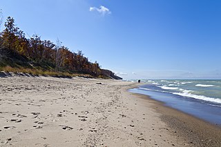
Indiana Dunes National Park is a United States national park located in northwestern Indiana managed by the National Park Service. It was authorized by Congress in 1966 as the Indiana Dunes National Lakeshore and was redesignated as the nation's 61st national park on February 15, 2019. The park runs for about 20 miles (32 km) along the southern shore of Lake Michigan and covers 15,349 acres (6,212 ha). Along the lakefront, the eastern area is roughly the lake shore south to U.S. 12 or U.S. 20 between Michigan City, Indiana, on the east and the Cleveland-Cliffs steel plant on the west. To the west of the steel plant lies West Beach and a small extension south of the steel mill continues west along Salt Creek to Indiana 249. The western area is roughly the shoreline south to U.S. 12 between the Burns Ditch west to Broadway in downtown Gary, Indiana. The area conservation scheme is enhanced by the older Indiana Dunes State Park. In addition, there are several outlying areas, including Pinhook Bog, in LaPorte County to the east; the Heron Rookery in Porter County, the center of the park; and the Calumet Prairie State Nature Preserve and the Hobart Prairie Grove, both in Lake County, the western end of the park.
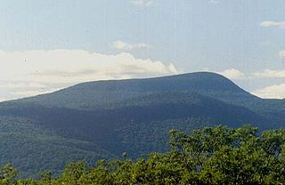
Slide Mountain is the highest peak in the Catskill Mountains of the U.S. state of New York. It is located in the town of Shandaken in Ulster County. While the 4,180-foot (1,270 m) contour line on topographic maps is generally accepted as its height, the exact elevation of the summit has never been officially determined by the U.S. Coast and Geodetic Survey, and many informal surveys suggest the mountain may actually top 4,200 feet (1,300 m) above sea level.
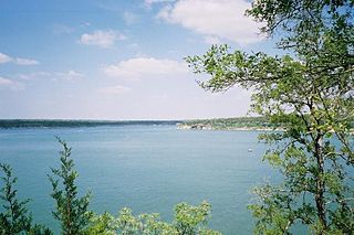
Lake Georgetown is a reservoir on the north fork of the San Gabriel River in central Texas in the United States. Lake Georgetown is a U.S. Army Corps of Engineers reservoir formed on the San Gabriel by the North San Gabriel Dam, which is located about three miles west of Georgetown, Texas. The dam, lake, and all adjacent property are managed by the Fort Worth District of the U.S. Army Corps of Engineers. The dam was officially completed on October 5, 1979, and serves to provide flood control for the community of Georgetown. Lake Georgetown is also a source of drinking water for Georgetown and the nearby city of Round Rock. The lake is also a popular recreational destination.
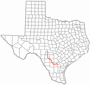
The Frio River is a river in the U.S. state of Texas. The word frío is Spanish for cold, a clear reference to the spring-fed coolness of the river.

Swartswood State Park is a 3,460-acre (14.0 km2) protected area located in the Swartswood section of Stillwater and Hampton townships in Sussex County, New Jersey, in the United States. Established in 1915 by the state's Forest Park Reservation Commission, it was the first state park established by the state of New Jersey for the purposes of recreation at the state's third-largest freshwater lake. Today, Swartswood State Park is operated and maintained by the New Jersey Division of Parks and Forestry.
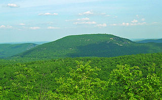
Bear Mountain is one of the best-known peaks of New York's Hudson Highlands. Located partially in Orange County in the town of Highlands and partially in Rockland County in the town of Stony Point, it lends its name to the nearby Bear Mountain Bridge and Bear Mountain State Park that contains it.

Portage River is a 38.6-mile-long (62.1 km) river that flows southward through Kalamazoo County and St. Joseph County, Michigan. Its headwaters are 8 miles (13 km) east of the city of Kalamazoo at Portage Lake, and the river flows southwest to its mouth within the city limits of Three Rivers, where it drains into the St. Joseph River.

The Tanner Trail is a hiking trail located on the South Rim of the Grand Canyon National Park, located in the U.S. state of Arizona. The trailhead is located at Lipan Point, a prominent lookout located to the east of the Grand Canyon Village, and the trail ends at the Colorado River at Tanner Rapids.
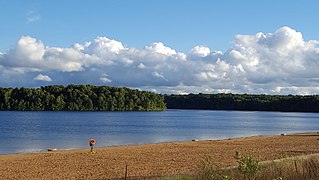
Fort Custer State Recreation Area is a 3,033-acre (12 km2) State Recreation Area located between Battle Creek and Kalamazoo, Michigan. The area features lakes, the Kalamazoo River, over 25 miles of multi-use trails, second growth oak barrens and dry-mesic southern (oak-hickory) forests.
Southern Shores Field Service Council is a field service council of the Michigan Crossroads Council.

Waterloo State Recreation Area is the third-largest park in Michigan, encompassing over 21,000 acres (85 km2) of forest, lakes and wetlands. Located in northeast Jackson County and parts of Washtenaw County, the park is the largest in the Lower Peninsula of Michigan and features 4 campgrounds, 11 lakes, a nature center, and over 50 miles (80 km) of trails - some for horses, bicycles, hiking and cross-country skiing. Waterloo SRA includes the Black Spruce Bog Natural Area, a National Natural Landmark and borders the 11,000-acre (45 km2) Pinckney Recreation Area on the east and the 950-acre (3.8 km2) Phyllis Haehnle Memorial Audubon Sanctuary to the west. The land preserved by the park is not all contiguous and numerous private landholdings and roads run through the park area. The area is characterized by moraines, kettle lakes, swamps and bogs left by retreating glaciers after the last ice age. The park was created by the federal government during the Great Depression and is long-term leased to the state.

The Akron, OH Metropolitan Statistical Area, sometimes referred to as Greater Akron, is defined by the United States Office of Management and Budget as an area consisting of two counties, Summit and Portage, in Northeast Ohio and anchored by the city of Akron. As of the 2020 census, the MSA had a population of 702,219. The Akron MSA is also part of the larger Cleveland–Akron–Canton, OH Combined Statistical Area, which has a population of 3,633,962 people as of the 2020 census, the largest metropolitan area in Ohio.
Southwestern Michigan Council is a defunct local council of the Boy Scouts of America that served youth in Kalamazoo, Michigan serving Northern Van Buren County, Kalamazoo County, St. Joseph County, Branch County, and Western Calhoun County

Monte Bello Open Space Preserve is a 3,133-acre (12.68 km2) open space preserve, located near Palo Alto in the Santa Cruz Mountains, in San Mateo and Santa Clara Counties, California, United States. The preserve encompasses the upper Stevens Creek watershed in the valley between Monte Bello Ridge and Skyline Ridge. "Monte Bello" means "beautiful mountain" in Italian, and refers to Black Mountain which is the highest part of Montebello Ridge. The straight valley of upper Stevens Creek is also the rift valley of the San Andreas Fault.

The Michigan Crossroads Council (MCC) is a local council of the Boy Scouts of America that encompasses the Lower Peninsula of Michigan. The council was formed in 2012 by the merger of nine councils.

The Letort Spring Run Nature Trail (LSRNT) is a rail trail in Carlisle, Pennsylvania. The trail stretches between Carlisle Borough's Letort Park and a trailhead approximately 2 miles (3.2 km) south at South Spring Garden Street. It parallels and twice crosses the Letort Spring Run, a limestone stream nationally recognized for its role in fly fishing heritage. The trail is an expression of the Letort Regional Authority's mission to promote appreciation of the Letort, as well as to protect the stream, greenway, and watershed from degradation.

Brule Glacial Spillway is a Wisconsin Department of Natural Resources-designated State Natural Area that encompasses the valley of the upper reaches of the Bois Brule River. This valley was carved by the outlet of Glacial Lake Duluth, which occupied what is now the western portion of Lake Superior, during the retreat of the Superior lobe of Wisconsin glaciation. This outlet flowed southwestward through the valley, to what is now the St. Croix River. As the glacier melted, and the level of Lake Superior dropped, the direction of flow shifted to its present northeastward course, towards Lake Superior. A high point in a vast bog near Solon Springs marks the Saint Lawrence River Divide between the watersheds of the Gulf of Mexico and the Atlantic Ocean. This divide was used for thousands of years, by Native Americans, European explorers, fur traders, and settlers as a portage between the two watersheds.

The Sentier Nepisiguit Mi'gmaq Trail is a 147 kilometre wilderness hiking and backpacking trail in New Brunswick, Canada that follows the Nepisiguit River from the Daly Point’s Nature Reserve in Bathurst to Mount Carleton Provincial Park. Officially opened for hiking in 2018, the trail is a recommissioned ancient Mi'gmaq portage route and is one of the eleven signature hiking trails in New Brunswick.


