Weiden an der March is a municipality in the district of Gänserndorf in Lower Austria, Austria.
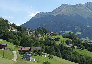
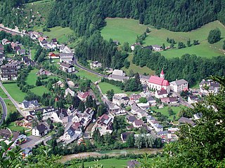
Bartholomäberg is a municipality and a village in the district of Bludenz in the Austrian state of Vorarlberg.

Sankt Peter in der Au is a town in the district of Amstetten in Lower Austria in Austria.
Altenmarkt an der Triesting is a town in the district of Baden in Lower Austria in Austria.
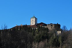
Pottenstein is a town in the district of Baden in Lower Austria in Austria.

Weissenbach an der Triesting is a town in the district of Baden in Lower Austria in Austria.
Hohenau an der March is a town in the district of Gänserndorf in the Austrian state of Lower Austria, close to Vienna and the borders with the Czech Republic and Slovakia.

Mannsdorf an der Donau is a town in the district of Gänserndorf in the Austrian state of Lower Austria.
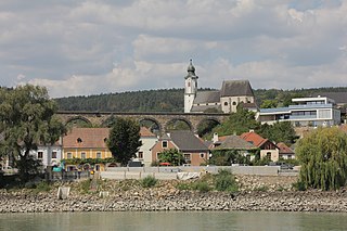
Emmersdorf an der Donau is a town in the district of Melk in the Austrian state of Lower Austria.

Asparn an der Zaya is a town in the district of Mistelbach in the Austrian state of Lower Austria.

Willendorf an der Schneebergbahn is a town in the district of Neunkirchen in the Austrian state of Lower Austria. It is not to be confused with Willendorf in der Wachau where the Venus of Willendorf was discovered.

Herzogenburg is a town in the district of Sankt Pölten-Land in the Austrian state of Lower Austria.

Kirchberg an der Pielach is a town in the district of Sankt Pölten-Land in the Austrian state of Lower Austria.
Leogang is a municipality in the district of Zell am See, in the state of Salzburg in Austria. It is a famous winter sports and summer mountain hiking resort.
Nußdorf ob der Traisen is a municipality in the district of Sankt Pölten-Land in Lower Austria, Austria.

Schwarzenbach an der Pielach is a municipality in the district of Sankt Pölten-Land in the Austrian state of Lower Austria.
Göstling an der Ybbs is a municipality in the district of Scheibbs in the Austrian state of Lower Austria.

Höchst is a municipality in the district of Bregenz in the Austrian state of Vorarlberg.

Neukirchen an der Vöckla is a municipality in the district of Vöcklabruck in the Austrian state of Upper Austria.
Fladnitz an der Teichalm is a municipality in the district of Weiz in the Austrian state of Styria.