
Kapfenberg, with 22,182 inhabitants in 2023, is the third largest city in Styria, Austria, and lies in the valley of the Mürz near the town of Bruck an der Mur. The town's landmark is Burg Oberkapfenberg. Every year in June, the Ritterfest takes place at the castle, which is one of the largest events of its kind in Austria.

Krimml is a municipality in Zell am See District, in the federal state of Salzburg, Austria, in the Pinzgau region.

Sankt Lambrecht is a market town in the district of Murau in Styria, Austria. It is known for St. Lambrecht's Abbey, one of the most important Benedictine monasteries in Austria. The monastery complex and its gardens are part of the Zirbitzkogel-Grebenzen nature park.

Ramsau am Dachstein is a municipality in the district of Liezen, state of Styria, Austria. It is also the name of the elevated plateau between the Dachstein range and the Enns valley on which this municipality is located.
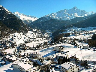
Sölden is a municipality in the Ötztal valley of Tyrol, Austria.

Saalfelden am Steinernen Meer is a town in the district of Zell am See in the Austrian state of Salzburg. With approximately 16,000 inhabitants, Saalfelden is the district's largest town and the third of the federal state after Salzburg and Hallein.
Hohenzell is a municipality in Upper Austria. It is situated in the district of Ried im Innkreis in the Innviertel and has 2,002 inhabitants. The responsible jurisdiction is Ried im Innkreis.

Mehrnbach is a municipality in Upper Austria. It is situated in the district of Ried im Innkreis in the Innviertel.

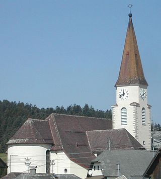
Sankt Urban is a town in the district of Feldkirchen in the Austrian state of Carinthia.

Ebbs is a municipality in the Kufstein district of Tyrol in Austria. The village is located in the Judicial district of Kufstein and in 2016 had a population of 5,480.

Scharnitz is a municipality in the district of Innsbruck-Land in the Austrian state of Tyrol located 16.4 kilometres (10.2 mi) north of Innsbruck and 9 kilometres (5.6 mi) from Seefeld in Tirol on the German border. It is one of the largest municipalities and has 10 parts: Au, Eisack, Gießenbach, Inrain, Jägerviertel, Oberdorf, Schanz, Schießstand, Siedlung, Unterdorf. The village was founded in the early Middle Ages and was once an important commercial route between Germany and Italy. The main source of income is tourism, both in summer and winter. Scharnitz is the western entry point to the Hinterau valley, where the source of river Isar is located.
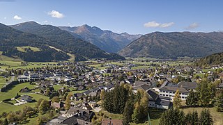
St. Michael im Lungau is a market town in the district of Tamsweg in the Austrian state of Salzburg.

Franking is a municipality in the district Braunau am Inn in the Austrian state of Upper Austria.

Vorchdorf is a market town in the district of Gmunden in Upper Austria, Austria, as well as the name of the municipal area ("Gemeinde") that the town and others occupy. As of the 2005 census, the town of Vorchdorf had a population of 7,287 inhabitants.

Hargelsberg is a municipality in the district Linz-Land in the Austrian state of Upper Austria.

Eitzing is a municipality in the district of Ried im Innkreis in the Austrian state of Upper Austria.

Ulrichsberg is a municipality in the district of Rohrbach in the Austrian state of Upper Austria.
Oberkappel is a municipality in the district of Rohrbach in the state of Upper Austria.

Sankt Lorenzen im Mürztal is a municipality with 3674 inhabitants in the judicial district of Bruck an der Mur and in the political district of Bruck-Mürzzuschlag in Styria, Austria.


