Alberta municipal censuses, 2014

Last updated

Alberta municipal censuses, 2014
Flag of Alberta.svg
  2013 April 1June 30, 2014 2015  


Alberta's Urban Municipalities.png
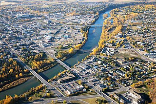
Distribution of Alberta's 269 urban municipalities

Alberta has provincial legislation allowing its municipalities to conduct municipal censuses between April 1 and June 30 inclusive. [1] [2] Municipalities choose to conduct their own censuses for multiple reasons such as: to better inform municipal service planning and provision; to capitalize on per capita based grant funding from higher levels of government; or to simply update their populations since the last federal census. [3]

Alberta Province of Canada

Alberta is a western province of Canada. With an estimated population of 4,067,175 as of 2016 census, it is Canada's fourth most populous province and the most populous of Canada's three prairie provinces. Its area is about 660,000 square kilometres (250,000 sq mi). Alberta and its neighbour Saskatchewan were districts of the Northwest Territories until they were established as provinces on September 1, 1905. The premier has been Rachel Notley since May 2015.

Four provinces and territories in Canada have legislation that allow municipalities to conduct a municipal census. These include the provinces of Alberta and Saskatchewan and the territories of Nunavut and Yukon. Of these four provinces and territories, municipalities in Alberta were the only ones that exercise the option to conduct a municipal census as of 2006.

Census Acquiring and recording information about the members of a given population

A census is the procedure of systematically acquiring and recording information about the members of a given population. The term is used mostly in connection with national population and housing censuses; other common censuses include agriculture, business, and traffic censuses. The United Nations defines the essential features of population and housing censuses as "individual enumeration, universality within a defined territory, simultaneity and defined periodicity", and recommends that population censuses be taken at least every 10 years. United Nations recommendations also cover census topics to be collected, official definitions, classifications and other useful information to co-ordinate international practice.

Contents

Alberta had 357 municipalities between April 1 and June 30, 2014, down from 358 as at June 30, 2013, [lower-alpha 1] which marked the closure of the 2014 legislated municipal census period. At least 39 of these municipalities (10.9%) conducted a municipal census in 2014. Alberta Municipal Affairs recognized those conducted by 37 of these municipalities. [5] By municipal status, it recognized those conducted by 13 of Alberta's 17 cities, 18 of 108 towns, 3 of 93 villages, 1 of 51 summer villages and 2 of 64 municipal districts. [5] [lower-alpha 2] In addition to those recognized by Municipal Affairs, censuses were conducted by the Town of Drayton Valley and the Municipal District of Lesser Slave River No. 124. [6] [7]

2014 in Canada Canada-related events during the year of 2014

Events from the year 2014 in Canada.

Alberta Municipal Affairs is a ministry of the Executive Council of Alberta. Its major responsibilities include assisting municipalities in the provision of local government, administering the assessment of linear property in Alberta, administering a safety system for the construction and maintenance of buildings and equipment, and managing Alberta's network of municipal and library system boards.

Drayton Valley Town in Alberta, Canada

Drayton Valley is a town in central Alberta, Canada. It is located on Highway 22, approximately 133 kilometres (83 mi) southwest of Edmonton. It is surrounded by Brazeau County, known for its vast oil fields. The town is located between the North Saskatchewan River and the Pembina River.

Some municipalities achieved population milestones as a result of their 2014 censuses. Airdrie and Cochrane grew beyond the 50,000 and 20,000 marks respectively, while both Beaumont and Cold Lake exceeded 15,000. The towns of Morinville, St. Paul and Raymond surpassed 9,000, 6,000 and 4,000 residents respectively, while the Municipal District (MD) of Lesser Slave River No. 124 exceeded 3,000.

Airdrie, Alberta City in Alberta, Canada

Airdrie is a city in Alberta, Canada within the Calgary Region. It is located north of Calgary within the Calgary–Edmonton Corridor at the intersection of Queen Elizabeth II Highway and Highway 567.

Cochrane, Alberta Town in Alberta, Canada

Cochrane is a town in the Canadian province of Alberta. The town is located 18 km (11 mi) west of the Calgary city limits along Highway 1A. With a population of 26,320 in 2017, Cochrane is the second largest town in Alberta and one of the fastest growing communities in Canada. It is part of Calgary's census metropolitan area and a member community of the Calgary Regional Partnership (CRP). The town is surrounded by Rocky View County.

Beaumont, Alberta City in Alberta, Canada

Beaumont is a city in Leduc County within the Edmonton Metropolitan Region of Alberta, Canada. It is located at the intersection of Highway 625 and Highway 814, adjacent to the City of Edmonton and 6.0 kilometres (3.7 mi) northeast of the City of Leduc. The Nisku Industrial Park and the Edmonton International Airport are located 4.0 kilometres (2.5 mi) to the west and 8.0 kilometres (5.0 mi) to the southwest respectively.

Municipal census results

The following summarizes the results of the numerous municipal censuses conducted in 2014.

2014 municipal census summary [5] 2011 federal census comparison [8] [9] Previous municipal census comparison
MunicipalityStatusCensus
date
2014
pop.
2011
pop.
Absolute
growth
Absolute
change
Annual
growth
rate
Prev.
pop.
[9] [10] [11] [12]
Prev.
census
year
[9] [10] [11] [12]
Absolute
growth
Annual
growth
rate
Airdrie City April 15, 201454,89142,56412,32729%8.8%49,56020135,33110.8%
Banff Town June 16, 20148,4217,58483711%3.6%7,25120111,1705.1%
Barons Village June 16, 201431831531%0.3%3262010−80.6%
Beaumont Town May 1, 201415,82813,2842,54419.2%6.0%14,91620139126.1%
Bentley Town May 1, 20141,1221,073494.6%1.5%1,1322009−10−0.2%
Blackfalds Town June 30, 20147,8586,3001,55824.7%7.6%7,27520135838.0%
Bonnyville Town April 1, 20146,9216,21670511.3%3.6%6,8372012840.6%
MD of Bonnyville No. 87 Municipal district April 1, 201411,83610,1011,73517.2%5.4%
Boyle Village June 4, 2014948916323.5%1.2%9182009300.6%
Bruderheim Town April 1, 20141,3481,15519316.7%5.3%1,2982012501.9%
Calgary City April 1, 20141,195,1941,096,83398,3619%2.9%1,156,686 [13] [lower-alpha 3] 201338,5083.3%
Calmar Town June 7, 20142,1011,9701316.6%2.2%2,0332009680.7%
Camrose City April 1, 201418,03817,2867524.4%1.4%17,23620118021.5%
Canmore Town May 21, 201413,07712,2887896.4%2.1%12,31720117602.0%
Chestermere Town May 1, 201417,20314,8242,37916%5.1%15,76220131,4419.1%
Cochrane Town April 1, 201420,70817,5803,12817.8%5.6%18,75020131,95810.4%
Cold Lake City April 1, 201415,73613,8391,89713.7%4.4%14,40020121,3364.5%
Crossfield Town May 1, 20142,9182,853652.3%0.8%2,8612010570.5%
Devon Town June 5, 20146,6506,5101402.2%0.7%6,53420091160.4%
Drayton Valley [6] Town April 30, 20147,0496,5792006
Edmonton City April 1, 2014877,926812,20165,7258.1%2.6%817,498201260,4283.6%
Forestburg Village April 15, 2014880831495.9%1.9%8632004170.2%
Fort Saskatchewan City April 28, 201422,80819,0513,75719.7%6.2%21,79520131,0134.6%
Lacombe City April 7, 201412,72811,7071,0218.7%2.8%11,73320099951.6%
Leduc City April 28, 201428,58324,2794,30417.7%5.6%27,24120131,3424.9%
MD of Lesser Slave River No. 124 [7] Municipal district May 1, 20143,0742,9291455%1.6%2,84020032340.7%
Lethbridge City April 1, 201493,00483,5179,48711.4%3.7%90,41720132,5872.9%
Morinville Town April 15, 20149,4028,5698339.7%3.1%8,50420118983.4%
Okotoks Town May 7, 201427,33124,5112,82011.5%3.7%26,31920131,0123.8%
Olds Town April 9, 20148,6178,2353824.6%1.5%8,51120131061.2%
Penhold Town May 14, 20142,8422,37546719.7%6.2%2,47620123667.1%
Raymond Town April 14, 20144,0813,7433389%2.9%3,9822013992.5%
Red Deer City May 5, 201498,58590,5648,0218.9%2.9%97,10920131,4761.5%
Spruce Grove City April 1, 201429,52626,1713,35512.8%4.1%24,64620104,8804.6%
St. Albert City April 7, 201463,25561,4661,7892.9%1.0%60,99420122,2611.8%
St. Paul TownMay 15, 20146,0045,40060411.2%3.6%5,84420121600.7%
Waiparous Summer village May 21, 201464422252.4%15.1%722007−8−1.7%
Wetaskiwin City May 1, 201412,62112,525960.8%0.3%12,28520093360.5%
Woodlands County Municipal district May 1, 20144,6124,3063067.1%2.3%2,98019911,6321.9%

Breakdowns

Hamlets

The following is a list of hamlets that had populations determined by the 2014 municipal census conducted by their administering municipal districts.

Hamlet (place) small settlement in a rural area

A hamlet is a small human settlement. In different jurisdictions and geographies, hamlets may be the size of a town, village or parish, be considered a smaller settlement or subdivision or satellite entity to a larger settlement. The word and concept of a hamlet have roots in the Anglo-Norman settlement of England, where the old French hamlet came to apply to small human settlements. In British geography, a hamlet is considered smaller than a village and distinctly without a church.

2014 municipal census summary
Hamlet Municipality2014
population
Ardmore MD of Bonnyville No. 87 359 [15]
Beaver Crossing MD of Bonnyville No. 87
Beaverdam MD of Bonnyville No. 87 18 [15]
Blue Ridge Woodlands County
Canyon Creek MD of Lesser Slave River No. 124
Cherry Grove MD of Bonnyville No. 87 405 [15]
Chisholm MD of Lesser Slave River No. 124
Flatbush MD of Lesser Slave River No. 124
Fort Assiniboine Woodlands County
Fort Kent MD of Bonnyville No. 87 246 [15]
Goose Lake Woodlands County
La Corey MD of Bonnyville No. 87 59 [15]
Marten Beach MD of Lesser Slave River No. 124
Smith MD of Lesser Slave River No. 124
Therien MD of Bonnyville No. 87 71 [15]
Wagner MD of Lesser Slave River No. 124
Widewater MD of Lesser Slave River No. 124

Shadow population counts

Alberta Municipal Affairs defines shadow population as "temporary residents of a municipality who are employed by an industrial or commercial establishment in the municipality for a minimum of 30 days within a municipal census year." [3] The Town of Banff and the MD of Bonnyville No. 87 conducted shadow population counts in 2014. The following presents the results of these counts for comparison with its concurrent municipal census results.

2014 municipal census shadow population summary [5]
MunicipalityStatusPermanent
population
Shadow
population
Combined
population
Banff Town 8,4219659,386
MD of Bonnyville No. 87 Municipal district 11,8361,39713,233

Notes

  1. The Village of Tilley dissolved to become a hamlet under the jurisdiction of the County of Newell on August 31, 2013. [4]
  2. No censuses were conducted among Alberta's 5 specialized municipalities, 3 special areas and 8 improvement districts. [5]
  3. The City of Calgary's 2013 municipal census population was originally reported as 1,149,552. [14] This population was revised to 1,156,686 in July 2014. [13] The city's revised 2013 census report explains it was "adjusted upward due to a correction to the automated conversion process." [13]

See also

Related Research Articles

Bonnyville Town in Alberta, Canada

Bonnyville is a town situated in east-central Alberta between Cold Lake and St. Paul. The surrounding Municipal District (MD) of Bonnyville No. 87's municipal office is located in Bonnyville.

Municipal District of Bonnyville No. 87 Municipal district in Alberta, Canada

The Municipal District of Bonnyville No. 87 is a municipal district in northeastern Alberta, Canada in Division No. 12. It is located adjacent to the province of Saskatchewan on the east.

Chestermere City in Alberta, Canada

Chestermere, originally named Chestermere Lake, is a city in the Canadian province of Alberta, within Rocky View County. It is largely a commuter town of Calgary and is a member municipality of the Calgary Regional Partnership. The city, which surrounds Chestermere Lake, was known as Chestermere Lake from 1977 to 1993.

Crossfield, Alberta Town in Alberta, Canada

Crossfield is a town in southern Alberta, Canada within Rocky View County. It is located on Highway 2A 43 km (27 mi) north of the City of Calgary.

Carmangay Village in Alberta, Canada

Carmangay is a village in southern Alberta, Canada. It is located 62 kilometres (39 mi) north of Lethbridge and 150 kilometres (93 mi) south of Calgary, along the Canadian Pacific Railway, east of Highway 23. It takes its name from C.W. Carman, who bought 1,500 acres (6.1 km2) at $3.50 per acre to grow wheat in 1904, and his wife, Gertrude Gay.

Lougheed, Alberta Village in Alberta, Canada

Lougheed is a village in central Alberta, Canada. It is located 94 km south-east of Camrose, along Highway 13.

Municipal District of Lesser Slave River No. 124 Municipal district in Alberta, Canada

The Municipal District of Lesser Slave River No. 124 is a municipal district in north-central Alberta, Canada. Its municipal office is located in the Town of Slave Lake. Located in Census Division 17, the municipal district takes its name from Lesser Slave River, which drains Lesser Slave Lake into the Athabasca River.

Point Alison Summer village in Alberta, Canada

Point Alison is a summer village in Alberta, Canada. It is located on the northern shore of Wabamun Lake, and south of the Village of Wabamun.

2013 Alberta municipal censuses

Alberta has provincial legislation allowing its municipalities to conduct municipal censuses between April 1 and June 30 inclusive. Municipalities choose to conduct their own censuses for multiple reasons such as to better inform municipal service planning and provision, to capitalize on per capita based grant funding from higher levels of government, or to simply update their populations since the last federal census.

2012 Alberta municipal censuses

Alberta has provincial legislation allowing its municipalities to conduct municipal censuses between April 1 and June 30 inclusive. Municipalities choose to conduct their own censuses for multiple reasons such as to better inform municipal service planning and provision, to capitalize on per capita based grant funding from higher levels of government, or to simply update their populations since the last federal census.

2015 Alberta municipal censuses

Alberta has provincial legislation allowing its municipalities to conduct municipal censuses between April 1 and June 30 inclusive. Municipalities choose to conduct their own censuses for multiple reasons such as to better inform municipal service planning and provision, to capitalize on per capita based grant funding from higher levels of government, or to simply update their populations since the last federal census.

2016 Alberta municipal censuses

Alberta has provincial legislation allowing its municipalities to conduct municipal censuses between April 1 and June 30 inclusive. Due to the concurrency of Statistics Canada conducting the Canada 2016 Census in May 2016, the Government of Alberta offered municipalities the option to alter their 2016 municipal census timeframes to either March 1 through May 31 or May 1 through July 31. Municipalities choose to conduct their own censuses for multiple reasons such as to better inform municipal service planning and provision, to capitalize on per capita based grant funding from higher levels of government, or to simply update their populations since the last federal census.

2017 Alberta municipal censuses

Alberta has provincial legislation allowing its municipalities to conduct municipal censuses between April 1 and June 30 inclusive. Municipalities choose to conduct their own censuses for multiple reasons such as to better inform municipal service planning and provision, to capitalize on per capita based grant funding from higher levels of government, or to simply update their populations since the last federal census.

2018 Alberta municipal censuses

Alberta has provincial legislation allowing its municipalities to conduct municipal censuses between April 1 and June 30 inclusive. Municipalities choose to conduct their own censuses for multiple reasons such as to better inform municipal service planning and provision, to capitalize on per capita based grant funding from higher levels of government, or to simply update their populations since the last federal census.

References

  1. "Municipal Government Act: Revised Statutes of Alberta 2000 Chapter M-26 (Office Consolidation)". Alberta Queen's Printer. November 24, 2010. Retrieved June 24, 2013.
  2. "Municipal Government Act: Determination of Population Regulation, Alberta Regulation 63/2001 (Office Consolidation)" (PDF) (PDF). Alberta Queen's Printer. 2013. p. 3. Retrieved December 30, 2013.
  3. 1 2 "Municipal Census Manual: Requirements and Guidelines for Conducting a Municipal Census" (PDF) (PDF). Alberta Municipal Affairs. January 2013. p. 7. ISBN   978-1-4601-0359-3 . Retrieved June 24, 2013.
  4. "O.C. 250/2013". Alberta Queen's Printer. August 13, 2013. Retrieved December 31, 2013.
  5. 1 2 3 4 5 "2014 Municipal Affairs Population List" (PDF) (PDF). Alberta Municipal Affairs. ISBN   978-1-4601-2067-5 . Retrieved January 31, 2015.
  6. 1 2 Courtney Whalen (May 5, 2014). "Online municipal census launches next week". Drayton Valley Western Review. Canoe Sun Media . Retrieved January 31, 2015.
  7. 1 2 "Agenda: Municipal District #124 Council Meeting   2014 Municipal Census Update" (PDF) (PDF). Municipal District of Lesser Slave River No. 124. July 8, 2014. pp. 69 70. Retrieved July 18, 2014.
  8. "Population and dwelling counts, for Canada, provinces and territories, and census subdivisions (municipalities), 2011 and 2006 censuses (Alberta)". Statistics Canada. February 8, 2012. Retrieved February 8, 2012.
  9. 1 2 3 "2013 Municipal Affairs Population List" (PDF) (PDF). Alberta Municipal Affairs. November 20, 2013. ISBN   978-1-4601-1418-6 . Retrieved December 4, 2013.
  10. 1 2 "2011 Municipal Affairs Population List" (PDF) (PDF). Alberta Municipal Affairs. October 5, 2011. ISBN   978-0-7785-9738-4 . Retrieved December 28, 2013.
  11. 1 2 "2006 Official Population List" (PDF) (PDF). Alberta Municipal Affairs. February 5, 2007. ISBN   0-7785-4994-1 . Retrieved December 28, 2013.
  12. 1 2 "Official Population List 1996" (PDF) (PDF). Alberta Municipal Affairs. October 1, 1996. Retrieved December 28, 2013.
  13. 1 2 3 "2013 Civic Census Results Revised 2014 July" (PDF) (PDF). City of Calgary. July 2014. pp. 3 & 9. Retrieved July 22, 2014.
  14. "2013 Civic Census Results" (PDF) (PDF). City of Calgary. July 2013. p. 3. Retrieved July 22, 2014.
  15. 1 2 3 4 5 6 "MD of Bonnyville 2014 Census Results" (PDF). Municipal District of Bonnyville No. 87. p. 1. Retrieved February 1, 2015.