Allen Confluence Gravels

Last updated
Allen Confluence Gravels
Site of Special Scientific Interest

River Allen from Cupola bridge - geograph.org.uk - 471161.jpg

River Allen from Cupola bridge showing the northern extent of the SSSI
Northumberland UK location map.svg
Red pog.svg
Location within Northumberland
Area of Search Northumberland
Grid reference NY800587
Coordinates 54°55′22″N2°18′43″W / 54.92284°N 2.31191°W / 54.92284; -2.31191 Coordinates: 54°55′22″N2°18′43″W / 54.92284°N 2.31191°W / 54.92284; -2.31191
Interest Biological
Area 4.9 hectares (12 acres)
Notification 1968
Location map DEFRA MAGIC map
Natural England website

The Allen Confluence Gravels is the name given to a Site of Special Scientific Interest (SSSI) in Northumberland, England. The site, listed since 1968, has an 'outstanding assemblage of river margin invertebrates.' [1] [2]

Site of Special Scientific Interest conservation designation denoting a protected area in the United Kingdom

A Site of Special Scientific Interest (SSSI) in Great Britain or an Area of Special Scientific Interest (ASSI) in the Isle of Man and Northern Ireland is a conservation designation denoting a protected area in the United Kingdom and Isle of Man. SSSI/ASSIs are the basic building block of site-based nature conservation legislation and most other legal nature/geological conservation designations in the United Kingdom are based upon them, including national nature reserves, Ramsar sites, Special Protection Areas, and Special Areas of Conservation. The acronym "SSSI" is often pronounced "triple-S I".

Northumberland County of England

Northumberland is a county in North East England. The northernmost county of England, it borders Cumbria to the west, County Durham and Tyne and Wear to the south and the Scottish Borders to the north. To the east is the North Sea coastline with a 64 miles (103 km) path. The county town is Alnwick, although the County council is based in Morpeth.

Invertebrate Animals without a vertebrate column

Invertebrates are animals that neither possess nor develop a vertebral column, derived from the notochord. This includes all animals apart from the subphylum Vertebrata. Familiar examples of invertebrates include arthropods, mollusks, annelids, and cnidarians.

Contents

Location and natural features

The Allen Confluence Gravels site is situated in the north-east of England, at the confluence of the River West Allen and River East Allen as they transition into the River Allen, some 3 miles (4.8 km) north-west of the village of Allendale in the south-west of the Northumberland. [1]

Confluence Meeting of two or more bodies of flowing water

In geography, a confluence occurs where two or more flowing bodies of water join together to form a single channel. A confluence can occur in several configurations: at the point where a tributary joins a larger river ; or where two streams meet to become the source of a river of a new name ; or where two separated channels of a river rejoin at the downstream end.

River Allen, Northumberland river in Northumberland, United Kingdom

The River Allen is a river in the English county of Northumberland. The Allen is a tributary of the River South Tyne. It gives its name to Allendale. Allen Banks and Staward Gorge is upstream on this river from the confluence with the Tyne.

Allendale, Northumberland village in Allendale civil parish, Northumberland, England

Allendale, often marked on maps as Allendale Town, is a village and civil parish in south west Northumberland, England. At the 2001 census, the parish had a population of 2,120, decreasing to 2,021 at the 2011 Census. Allendale is within the North Pennines Area of Outstanding Natural Beauty (AONB) – the second largest of the 40 AONB's in England and Wales. The local economy is predominantly based on agriculture and tourism, although of late it has become a popular commuter town for Newcastle upon Tyne.

The site is listed for its outstandingly diverse habitat for river-margin invertebrates. The site has a number of distinct habitat areas, including consolidated sand and shingle, well vegetated and rarely flooded; unstable shingle and sand banks subject to regular flooding; and damp woodland. Two species of rare ground beetles ( Bembidion schueppeli and B. litorale ) are found in areas having partially vegetated sandy banks. The water beetle Helophorus arvernicus is found in the muddy water margin. [2]

Ground beetle Family of beetles

Ground beetles are a large, cosmopolitan family of beetles, Carabidae, with more than 40,000 species worldwide, around 2,000 of which are found in North America and 2,700 in Europe. It is one of the ten most speciose animal families, as of 2015.

Water beetle

A water beetle is a generalized name for any beetle that is adapted to living in water at any point in its life cycle. Most water beetles can only live in fresh water, with a few marine species that live in the intertidal zone or littoral zone. There are approximately 2000 species of true water beetles native to lands throughout the world.

The ground beetle Clivina collaris is found on flatter areas of the site, together with Caviphantes saxetorum , a money spider found under stones. On higher parts of sandy banks are found Aegalia sabuleti , a small chafer and Diplocephalus protuberans , another money spider. [2]

Clivina collaris is a species of ground beetle in the subfamily Scaritinae. It was described by Herbst in 1784.

Beetle order of insects

Beetles are a group of insects that form the order Coleoptera, in the superorder Endopterygota. Their front pair of wings are hardened into wing-cases, elytra, distinguishing them from most other insects. The Coleoptera, with about 400,000 species, is the largest of all orders, constituting almost 40% of described insects and 25% of all known animal life-forms; new species are discovered frequently. The largest of all families, the Curculionidae (weevils) with some 70,000 member species, belongs to this order. Found in almost every habitat except the sea and the polar regions, they interact with their ecosystems in several ways: beetles often feed on plants and fungi, break down animal and plant debris, and eat other invertebrates. Some species are serious agricultural pests, such as the Colorado potato beetle, while others such as Coccinellidae eat aphids, scale insects, thrips, and other plant-sucking insects that damage crops.

Shingle fauna includes Bembidion monticola and B. stomoides , species of ground beetle; Fleutiauxellus maritimus , a small click beetle; Arctosa cinerea , a large wolf spider and Diplocephalus connatus , a money spider found in Britain only at this and one other north-east site. [2]

Click beetle family of insects

Insects in the family Elateridae are commonly called click beetles. Other names include elaters, snapping beetles, spring beetles or skipjacks. This family was defined by William Elford Leach (1790–1836) in 1815. They are a cosmopolitan beetle family characterized by the unusual click mechanism they possess. There are a few closely related families in which a few members have the same mechanism, but all elaterids can click. A spine on the prosternum can be snapped into a corresponding notch on the mesosternum, producing a violent "click" that can bounce the beetle into the air. Clicking is mainly used to avoid predation, although it is also useful when the beetle is on its back and needs to right itself. There are about 9300 known species worldwide, and 965 valid species in North America.

<i>Arctosa cinerea</i> species of arachnid

Arctosa cinerea is one of the most conspicuous wolf spider of central Europe, with a palearctic distribution and also found in Congo. The spider reaches a length of 17 mm, and occurs only on sandy beaches of rivers, lakes and oceans. Its grey-brown color makes for a good camouflage, and so it is not often seen, even if it wanders around during daylight. They dig holes in the ground, which they cover with silk, or hide under rocks.

Wolf spider family of spiders

Wolf spiders are members of the family Lycosidae, from the Ancient Greek word "λύκος" meaning "wolf". They are robust and agile hunters with excellent eyesight. They live mostly in solitude and hunt alone, and do not spin webs. Some are opportunistic hunters pouncing upon prey as they find it or even chasing it over short distances. Some wait for passing prey in or near the mouth of a burrow.

The site's damp woodland supports a number of uncommon moths including Acasis viretata , the yellow-tarred brindle; Aporophyla nigra , the black rustic; and Idaea straminata , the plain wave moth. It also supports a ground beetle, Pterostichus cristatus found only in Northumberland and Durham; and a number of rare spiders including Centromerus persimilis . [2]

Moth Group of mostly-nocturnal insects in the order Lepidoptera

Moths comprise a group of insects related to butterflies, belonging to the order Lepidoptera. Most lepidopterans are moths, and there are thought to be approximately 160,000 species of moth, many of which have yet to be described. Most species of moth are nocturnal, but there are also crepuscular and diurnal species.

<i>Acasis viretata</i> moth

The yellow-barred brindle is a moth of the family Geometridae. It is found from most of Europe to eastern Asia. It is also present in North America.

<i>Aporophyla nigra</i> species of insect

The Black Rustic is a moth of the Noctuidae family. It is found from North Africa, through southern and central Europe to Anatolia, in the north it is found up to Scotland and southern Norway. It is also found in the Caucasus, in Israel and Lebanon.

Alpine penny-cress ( Thlaspi alpestre ) found at the site indicates heavy metal contamination of the river probably arising from mineral mines in the river's catchment area. [2]

The condition of Allen Confluence Gravels was judged to be favourable in 2010, although concern was expressed about the incidence of Himalayan balsam ( Impatiens glandulifera ). [3]

See also

Related Research Articles

Exposed riverine sediments

Exposed riverine sediments, or ERS, are composed of silt, sand and gravel deposited by streams but exposed as water level falls.

Sulham Woods is a 74 hectares Site of Special Scientific Interest (SSSI) in Berkshire, England near the villages of Purley-on-Thames, Tilehurst, Sulham, and Tidmarsh.

Maulden Wood

Maulden Wood is a woodland situated in Bedfordshire, England, near the village of Maulden, on the greensand ridge that stretches from Leighton Buzzard to Gamlingay. It includes Maulden Wood and Pennyfather's Hill, a 148.8 hectare, biological Site of Special Scientific Interest (SSSI).

Witton-le-Wear (SSSI)

Witton-le-Wear (SSSI) is a Site of Special Scientific Interest located in the valley of the River Wear, immediately east of the village of Witton-le-Wear in County Durham, England.

Hexhamshire Moors

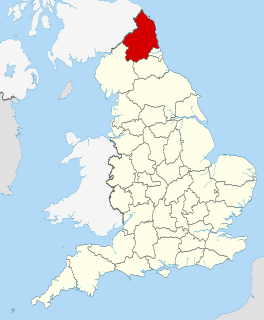
Hexhamshire Moors is a Site of Special Scientific Interest covering an extensive area of moorland in the Wear Valley district of north-west County Durham and the Tynedale district of south-west Northumberland, England.

Dixton Wood

Dixton Wood is a 13.14-hectare (32.5-acre) biological Site of Special Scientific Interest in Gloucestershire, notified in 2000. Dixton Wood is recognised as a Special Area of Conservation (SAC) under the EU Habitats Directive.

Allendale Moors

Allendale Moors is a Site of Special Scientific Interest (SSSI) in Northumberland, England. The upland moorland ridge site is listed for its heath, flush and upland grassland which provide a habitat for a nationally important assemblage of moorland breeding birds.

Alnmouth Saltmarsh and Dunes

Alnmouth Saltmarsh and Dunes is a Site of Special Scientific Interest (SSSI) in Northumberland, England. It is the largest saltflat on the north-east coast, located on the south bank of the River Aln estuary, and notable for the varied plant community found on the interface between the saltflats and the dunes. It overlaps with and forms part of the much larger Northumberland Shore SSSI.

Arcot Hall Grasslands and Ponds

Arcot Hall Grasslands and Ponds is the name given to a Site of Special Scientific Interest (SSSI) near Cramlington in Northumberland, England, notable as the largest lowland species-rich grassland in North East England. The site is composed of grassland, heath, ponds, and associated damp habitats now rare in Northumberland.

Aules Hill Meadows

Aules Hill Meadows is the name given to a Site of Special Scientific Interest (SSSI) in Northumberland, England. The site, listed since 1992, is a set of four traditionally managed northern hay meadows, now rare in Northumberland.

Barelees Pond

Barelees Pond is the name given to a Site of Special Scientific Interest (SSSI) in north Northumberland, England. The site is a kettle hole, a deep pond formed in the void remaining after a submerged glacial calf block melted. Barelees Pond is illustrative of vegetative habitat evolution as peat sediment gradually fills the pond.

Campfield Kettle Hole

Campfield Kettle Hole is the name given to a Site of Special Scientific Interest (SSSI) in north Northumberland, England. The site is thought to be the remains of a kettle hole, a pond formed in the void remaining after a submerged glacial calf block melted. In contemporary times Campfield Kettle Hole is a mix of bog and pond.

Barrow Meadow

Barrow Meadow is the name given to a Site of Special Scientific Interest (SSSI) in north Northumberland, England. The site is a species-rich hay meadow of a sort now rare in Northumberland.

Beltingham River Shingle

Beltingham River Shingle is the name given to a Site of Special Scientific Interest (SSSI) in Northumberland in the north-east of England, notable for an unusual community of flora tolerant to the high levels of naturally occurring heavy metals in the sediment of a section of the River South Tyne.

Briarwood Banks

Briarwood Banks is the name given to a woodland Site of Special Scientific Interest (SSSI) in north Northumberland, North East England. Composed mainly of elm, oak and ash, the site is semi-natural and now recovering from the removal of planted conifers.

Burnfoot River Shingle and Wydon Nabb

Burnfoot River Shingle and Wydon Nabb is the name given to a Site of Special Scientific Interest (SSSI) in Northumberland, North East England. Burnfoot River Shingle is a calaminarian grassland on the River South Tyne where the local flora is influenced by high levels of naturally occurring heavy metals. Wydon Nabb is an escarpment displaying the Haltwhistle Dyke, a magmatic intrusion of igneous dolerite set amidst sedimentary sandstone and shale.

References