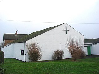
The Metropolitan Borough of Doncaster is a metropolitan borough with prospective city status in South Yorkshire, in the Yorkshire and the Humber region of England. It is named after its principal settlement, Doncaster, and includes the surrounding suburbs of Doncaster as well as numerous towns and villages. The district has large amounts of countryside. At 219 sq miles, it is the largest metropolitan borough in England by area.

The Swale is a tidal channel of the Thames estuary that separates the Isle of Sheppey from the rest of Kent. On its banks is a 6,509.4-hectare (16,085-acre) biological Site of Special Scientific Interest which stretches from Sittingbourne to Whitstable in Kent. It is also a Ramsar internationally important wetland site and a Special Protection Area under the European Union Directive on the Conservation of Wild Birds. Parts of it are a Nature Conservation Review site, Grade I, National Nature Reserves, a Kent Wildlife Trust nature reserve and a Local Nature Reserve.

The Yorkshire Wildlife Trust is a charitable non-governmental organisation, one of the UK's 46 county-based Wildlife Trusts. It's focus is nature conservation and it works to achieve a nature-rich Yorkshire with healthy and resilient ecosystems that support both Yorkshire's wildlife and its people.
Rawcliffe is a village and civil parish in the East Riding of Yorkshire, England. It is situated approximately 4 miles (6.4 km) west of Goole. It lies on the banks of the River Aire just north of the M62 and on the A614 road. Rawcliffe, along with nearby Airmyn, was the location of one of the first reliable reports of the practice of warping in agriculture in the 1730s.
Sprotbrough and Cusworth is a civil parish in the Metropolitan Borough of Doncaster in South Yorkshire, England, with most of its settlements on the western edge of the Doncaster built-up area. It lies between 1 mile (1.6 km) and 4 miles (6.4 km) to the west of Doncaster and is split by the A1(M) motorway. It had a population of 12,166 in 2001 and 12,134 at the 2011 Census.
Doncaster was a Parliamentary constituency covering the town of Doncaster in England. It was created in 1885 and abolished in 1983.

Beaumont-cum-Moze is a civil parish in the Tendring district of Essex, England. According to the 2001 census it had a population of 352, reducing to 339 at the 2011 Census. The parish includes the hamlets of Beaumont and Moze Cross.
Bentley with Arksey is an unparished area that was a civil parish and urban district adjacent to the town of Doncaster in the West Riding of Yorkshire from 1866 to 1974.

Thorpe Marsh Power Station was a 1 GW coal-fired power station near Barnby Dun in South Yorkshire, England. The station was commissioned in 1963 and closed in 1994. In 2011, permission was given for the construction of a gas-fired power station on the site.

Bentley is a suburb of Doncaster in South Yorkshire, England two miles north of the town of Doncaster. The population of the ward within the Metropolitan Borough of Doncaster at the 2011 Census was 14,191. The Bentley built-up area subdivision had a population of 27,145.

Arksey is a village in the Metropolitan Borough of Doncaster in South Yorkshire, England. It had an estimated population of 1,303 as of 2010. It was the birthplace of the children's writer Barbara Euphan Todd on 9 January 1890. Arksey has four satellite hamlets: Shaftholme, Tilts, Almholme and Stockbridge.

Shaftholme is a small hamlet in South Yorkshire, England, in the parish of Arksey that is located half a mile north of Bentley and two miles north of Doncaster.
The Sheriff of Hallamshire was a shrievalty title which was in existence from 1962 until 1974 in Yorkshire, United Kingdom.

Allerthorpe Common is a Site of Special Scientific Interest (SSSI) and nature reserve in the East Riding of Yorkshire, England. It is located close to the town of Pocklington.

Scawthorpe is a suburb of Doncaster in South Yorkshire, England on the A638 road. It is split between the Doncaster Metropolitan Borough Council wards of Roman Ridge and Bentley.

Bentley Priory Nature Reserve is a Site of Special Scientific Interest and Local Nature Reserve in Stanmore in the London Borough of Harrow, surrounding the stately home of Bentley Priory. It is a 55 hectare mosaic of ancient woodland, unimproved neutral grassland, scrub, wetland, streams and an artificial lake, an unusual combination of habitats in Greater London.
Bentley is a ward in the metropolitan borough of Doncaster, South Yorkshire, England. The ward contains 22 listed buildings that are recorded in the National Heritage List for England. Of these, one is listed at Grade I, the highest of the three grades, and the others are at Grade II, the lowest grade. The ward contains the suburb of Bentley, the villages of Almholme, Arksey, and Toll Bar, and the surrounding area. There is a group of listed buildings in Arksey, including the church, the vicarage, the former school and its wall, a group of almshouses, a hall, and a pinfold. Elsewhere, the listed buildings include another church, another pinfold, houses and cottages, a former watermill, farmhouses and farm buildings, a road causeway, a road bridge, and four mileposts.

Ea Beck is a small river in South Yorkshire, England, that flows eastwards into the River Don at Thorpe-in-Balne. The Environment Agency lists the beck as starting at South Elmsall, but mapping lists the beck with several names along its course. The beck has twice flooded areas and villages that it passes through in the 21st century.

Thorpe Marsh Nature Reserve is a 77-hectare (190-acre) nature reserve located south-west of Thorpe in Balne, north of Doncaster in South Yorkshire. The reserve is managed and maintained by a team of volunteers under the Yorkshire Wildlife Trust as well as Doncaster Metropolitan Borough Council.


