Alpujarra Granadina

Last updated
Alpujarra Granadina
Chimeneas nevadas de Capileira.jpg
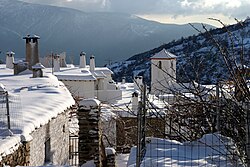
Winter landscape in Capileira.
Alpujarra Granadina flag.svg
LocationAlpujarra Granadina.png
Alpujarra Granadina within Granada
Coordinates: 36°54′1″N3°25′26″W / 36.90028°N 3.42389°W / 36.90028; -3.42389 Coordinates: 36°54′1″N3°25′26″W / 36.90028°N 3.42389°W / 36.90028; -3.42389
Country Spain
Autonomous community Andalusia
Province Granada
Seat Órgiva
Subdivision 25 municipalities
Area
  Total1,143 km2 (441 sq mi)
Population
 (2014)
  Total24,736
  Density22/km2 (56/sq mi)
Demonym(s) Alpujarreños
Time zone UTC+1 (CET)
  Summer (DST) UTC+2 (CEST)
Largest municipality Órgiva

Alpujarra Granadina is a Spanish comarca in the Province of Granada. Along with Alpujarra Almeriense, it forms the historical region of the Alpujarras.

Contents

Overview

Located in the west of the Alpujarras, it borders the Granadan comarcas of Accitania (Guadix) to the north, the Vega de Granada to the northwest, the Valle de Lecrín to the west, and the Costa Tropical to the south, as well as the Almerían comarcas of Poniente Almeriense to the southeast and the Alpujarra Almeriense to the east.

Subdivision

The comarca is divided into 25 municipalities (municipios). [1] (2014 populations shown in parentheses):

See also

Related Research Articles

Province of Granada Province of Spain

Granada is a province of southern Spain, in the eastern part of the autonomous community of Andalusia. It is bordered by the provinces of Albacete, Murcia, Almería, Jaén, Córdoba, Málaga, and the Mediterranean Sea. Its capital city is also called Granada.

Sierra Nevada (Spain) Mountain range in southern Spain

Sierra Nevada is a mountain range in the region of Andalucia, in the province of Granada and, a little further, Málaga and Almería in Spain. It contains the highest point of continental Spain: Mulhacén, at 3,479 metres (11,414 ft) above sea level.

In Spain traditionally and historically, some autonomous communities are also divided into comarcas.

Alpujarras

The Alpujarra is a natural and historical region in Andalusia, Spain, on the south slopes of the Sierra Nevada and the adjacent valley. The average elevation is 1,200 metres (4,000 ft) above sea level. It extends over two provinces, Granada and Almería; it is sometimes referred to in the plural as "Las Alpujarras". There are several interpretations of this Arabic-origin name: the most convincing is that it derives from al-basharāt (البَشَرَات), meaning something like "sierra of pastures". The administrative centre of the part in Granada is Órgiva, while that of the part in Almería is Alhama de Almería.

Sierra Nevada National Park (Spain)

Sierra Nevada National Park is a national park located in the Sierra Nevada within the provinces of Granada and Almería in Andalusia, Spain. It was declared a national park on 14 January 1999. It stretches from the Alpujarra to El Marquesado and the Lecrín Valley, covering a total area of 85,883 hectares, making it the largest national park in Spain until the expansion of the Cabrera Archipelago Maritime-Terrestrial National Park from 10,021 to 90,800 hectares in 2019.

Órgiva Municipality in Andalusia, Spain

Órgiva is a Spanish town municipality in comarca of Alpujarra Granadina in the province of Granada, Andalusia. It has a population of around 6,000 and lies in the Alpujarra valley between the Sierra de Lújar and Sierra Nevada.

Trevélez Municipality in Andalusia, Spain

Trevélez is a village in the province of Granada, Spain. Its population in 2011 was estimated at 823. The river Trevélez flows through the village. They are located in the western part of the Alpujarras region. Two of the highest mountains in Spain, Mulhacen and Alcazaba, are just to the north of the village, a few hours' walk away.

Capileira Municipality in Andalusia, Spain

Capileira is the highest and most northerly of the three villages in the gorge of the Poqueira river in the La Alpujarra district of the province of Granada, in Spain. It is located at latitude 36° 57' N and longitude 3° 21' W, about 1 km north of Bubión. Its altitude is officially recorded as 1436 metres, though there is a considerable altitude difference between the oldest part of the village, which is at the lower, southern end, and the highest part, where tourist-oriented development is currently concentrated. The area of the municipality is 57 km².

Valle de Lecrín Comarca in Andalusia, Spain

The Lecrin Valley is a comarca in the center-south part of the province of Granada, Andalusia, southern Spain. This territory borders the Vega de Granada to the north, the Alpujarra Granadina to the east, the Costa Tropical to the south, and the Alhama to the west.

Autovía A-44 Road in trans-European E-road network

The Autovía A-44 is a highway in Andalucia, Spain. It is also known as the Autovía de Granada / Sierra Nevada. The entirety of the route also forms the entirety of European route E 902, a B class road in the International E-road network. A-44 / E 902 connects the coastal municipality of Motril to the inland town of Bailén.

Alpujarra de la Sierra Municipality in Granada, Spain

Alpujarra de la Sierra is a municipality located in the province of Granada, Spain. According to the 2007 census (INE), the city has a population of 1168 inhabitants.

Rubite Village in Granada, Spain

Rubite is a municipality located in the province of Granada, Spain. According to the 2004 census (INE), the village had a population of 492 inhabitants. Rubite is a locality and Spanish municipality situated at the east central of the region "La Costa Granadina" in the province of Granada, independent community of Andalusia. On the shores of the Mediterranean Sea, Rubite is bordered by the municipalities of Lújar, Órgiva and Polopos.

Costa Granadina Comarca in Andalusia, Spain

Costa Granadina is a comarca in southern Spain, corresponding to the Mediterranean coastline of the province of Granada. It is also but less frequently called the Costa Tropical or Costa Granadina. It is crossed by the N-340 coastal highway that runs southwest–northeast along Spain's Mediterranean coast, to the border with France. Within the last 4 years the A7 motorway has been extended along the coast from Nerja in the Málaga province to Motril where it links the A7 motorway to the A44 motorway which heads north from Motril to the city of Granada.

Veleta (Sierra Nevada)

Veleta or Pico del Veleta is the second highest peak of the Iberian peninsula and the Sierra Nevada. Its height is given variously as 3,394 metres (11,135 ft), 3,396 metres (11,142 ft) and 3,398 metres (11,148 ft).

Poniente Almeriense Comarca in Andalusia, Spain

Poniente Almeriense is a comarca in Almería, Spain. It is sometimes also known as the "sea of plastic" due to the numerous greenhouses that cover the area. The comarca contains ten municipalities and 259,357 inhabitants in an area of 971 km2. The "sea of plastic" was one of the subjects of We feed the world, a 2005 documentary; and the setting of Spanish crime drama Mar de plástico.

Cumbres del Guadalfeo

Cumbres del Guadalfeo is a Spanish geographical indication for Vino de la Tierra wines located in the Alpujarras mountains, in the autonomous region of Andalusia. Vino de la Tierra is one step below the mainstream Denominación de Origen indication on the Spanish wine quality ladder.

La Taha Municipality in Andalusia, Spain

La Taha, is a municipality in the Alpujarras region of the province of Granada, Spain. The modern municipality consists of three distinct villages, though several of these are themselves clusters of distinct settlements. It lies to the east of the villages of the Río Poqueira gorge, and to the south and west of Trevélez. The villages are all on south-facing slopes overlooking the Río Trevélez.

Mancomunidad de Municipios Marquesado del Zenete

The Mancomunidad de Municipios Marquesado del Zenete or Mancomunidad del Marquesado del Zenete is a voluntary grouping (mancomunidad) of municipalities, located in the province of Granada, autonomous community of Andalusia, Spain. They take their name from the Marquisate of Cenete, the former seigneury in this area, which in turn takes its name from the Arabic sened, meaning the slope that constitutes one side of a mountain range. That refers to the north slope of the Sierra Nevada, where the municipalities are located.

Alpujarra Almeriense Comarca in Andalusia, Spain

Alpujarra Almeriense is a Spanish comarca in the Province of Almería, Andalusia. Along with Alpujarra Granadina, is part of the Andalusian region of the Alpujarras.

Alpujarras or Las Alpujarras may refer to various places in Spain:

References