
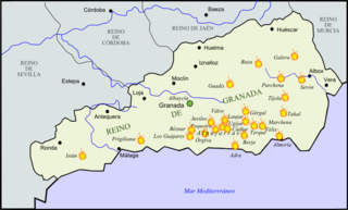
Granada is a province of southern Spain, in the eastern part of the autonomous community of Andalusia. It is bordered by the provinces of Albacete, Murcia, Almería, Jaén, Córdoba, Málaga, and the Mediterranean Sea. Its capital city is also called Granada.

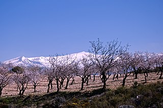
Sierra Nevada is a mountain range in the Andalusian province of Granada in Spain. It contains the highest point of continental Spain: Mulhacén, at 3,479 metres (11,414 ft) above sea level.

Mulhacén, with an elevation of 3,479 metres (11,414 ft), is the highest mountain in peninsular Spain and in all of the Iberian Peninsula. It is part of the Sierra Nevada range in the Penibaetic System. It is named after Abu'l-Hasan Ali, known as Muley Hacén in Spanish, the penultimate Muslim ruler of Granada in the 15th century who, according to legend, was buried on the summit of the mountain. It is still known in present-day Arabic as Jabal Mawla el-Hassan.

The Alpujarra is a natural and historical region in Andalusia, Spain, on the south slopes of the Sierra Nevada and the adjacent valley. The average elevation is 1,200 metres (4,000 ft) above sea level. It extends over two provinces, Granada and Almería; it is sometimes referred to in the plural as "Las Alpujarras". There are several interpretations of this Arabic-origin name: the most convincing is that it derives from al-basharāt (البَشَرَات), meaning something like "sierra of pastures". The administrative centre of the part in Granada is Órgiva, while that of the part in Almería is Alhama de Almería.

Sierra Nevada National Park is a national park located in the Sierra Nevada within the provinces of Granada and Almería, in Spain. It was declared a national park on 14 January 1999. It stretches from the Alpujarra to El Marquesado and the Lecrín Valley, covering a total area of 85,883 hectares, making it the largest national park in Spain until the expansion of the Cabrera Archipelago Maritime-Terrestrial National Park from 10,021 to 90,800 hectares in 2019.

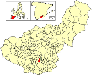
Órgiva is a Spanish town municipality in comarca of Alpujarra Granadina in the province of Granada, Andalusia. It has a population of around 6,000 and lies in the Alpujarra valley between the Sierra de Lújar and Sierra Nevada.

Trevélez is a village in the province of Granada, Spain. Its population in 2011 was estimated at 823. The river Trevélez flows through the village. They are located in the western part of the Alpujarras region. Two of the highest mountains in Spain, Mulhacén and Alcazaba, are just to the north of the village, a few hours' walk away.
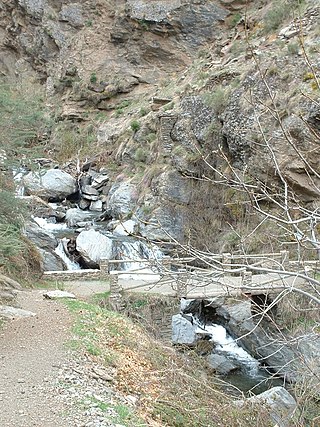
The Poqueira is a river in La Alpujarra region in the province of Granada, in Spain. It is formed by the confluence of streams that rise near the summit of Mulhacén, the highest peak of the Sierra Nevada mountains. The river cuts through a dramatic gorge, then joins the Río Trevélez shortly before flowing into the Río Guadalfeo.
Bubión is a village in Las Alpujarras region of Granada in Spain. It is located at latitude 36° 57' N, longitude 3° 21' W, at 1,350 metres above sea level. Its postal code is 18412. Together with Capileira and Pampaneira it has become a focus for the tourist trade in La Alpujarra, because of the spectacular location of the three villages on the gorge of the Río Poqueira and below the peaks of the Sierra Nevada. The three villages, with their characteristic Moorish features - narrow, winding streets, flat roofs - have been designated as a Conjunto Histórico Artístico, a region of special artistic and historical importance.

The Guadalfeo is a small river in the province of Granada, Spain between the Sierra Nevada mountain range and the coastal ranges of Sierra de la Contraviesa and Lújar.
The second rebellion of the Alpujarras, sometimes called the War of the Alpujarras or the Morisco Revolt, was triggered by Philip II of Spain's Pragmática Sanción de 1567 and was the second Morisco revolt against the Castilian Crown in the mountainous Alpujarra region and on the Granada Altiplano region, northeast of the city of Granada. The rebels were Moriscos, the nominally Catholic descendants of the Mudéjares following the first rebellion of the Alpujarras (1499–1501).

Capileira is the highest and most northerly of the three villages in the gorge of the Poqueira river in the La Alpujarra district of the province of Granada, in Spain. It is located at latitude 36° 57' N and longitude 3° 21' W, about 1 km north of Bubión. Its altitude is officially recorded as 1436 metres, though there is a considerable altitude difference between the oldest part of the village, which is at the lower, southern end, and the highest part, where tourist-oriented development is currently concentrated. The area of the municipality is 57 km2.
Cáñar is a small village in the Alpujarras comarca of the province of Granada in Spain. It is located a few kilometres north of the road from Órgiva to Pampaneira and the high Alpujarras. The GR 7 long-distance footpath, following the ancient highway through the Alpujarras, runs through the village.

Almegíjar is a Spanish village and municipality located in the province of Granada, Andalusia. According to the 2005 census (INE), it has a population of 435 inhabitants.
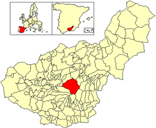
Güéjar Sierra is a village and municipality located in the province of Granada, Spain. According to the INE, it had a population of 2,988 at the start of 2010. The village is situated in the north-western part of the Sierra Nevada mountain range, at an altitude of 1,088 metres. The municipality borders Pinos Genil, Dúdar, Quéntar, La Peza, Lugros, Jérez del Marquesado, Trevélez, Capileira and Monachil. Its boundary with Trevélez and Capileira runs along the highest ridge of the Sierra Nevada, and over Mulhacén, making these the three highest municipalities in peninsular Spain. The Genil and Maitena rivers rise in Güéjar.

Costa Granadina is a comarca in southern Spain, corresponding to the Mediterranean coastline of the province of Granada. It is also but less frequently called the Costa Tropical or Costa de Granada. It is crossed by the N-340 coastal highway that runs southwest–northeast along Spain's Mediterranean coast, to the border with France. Within the last 4 years the A7 motorway has been extended along the coast from Nerja in the Málaga province to Motril where it links the A7 motorway to the A44 motorway which heads north from Motril to the city of Granada.

La Taha, is a municipality in the Alpujarras region of the province of Granada, Spain. The modern municipality consists of three distinct villages, though several of these are themselves clusters of distinct settlements. It lies to the east of the villages of the Río Poqueira gorge, and to the south and west of Trevélez. The villages are all on south-facing slopes overlooking the Río Trevélez.

Alcazaba is a mountain in Spain. Standing at 3,369 m (11,053 ft), it is the third highest mountain of the Sierra Nevada range and the fifth in the Iberian Peninsula. The impressive north face can be seen from the town of Granada. The name Alcazaba derives from the word "fortification" in Arabic.
Pico del Caballo, Cerro del Caballo or simply Caballo ("horse") is a 3,011-metre (9,879 ft) high mountain in the Sierra Nevada, Spain. It is the westernmost three-thousander of the range.

The Sierra Nevada Ski Station is a ski resort in the Sierra Nevada in the province of Granada in southeastern Spain. The ski area is on the northwestern slopes of Veleta, the third highest peak in Peninsular Spain and the most southerly ski resort in Europe.


