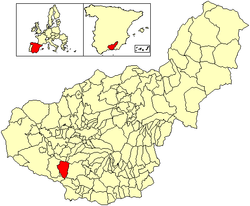
Zafarraya is a municipality in the province of Granada, Spain, with a population of 2,200 (2003).

Alhama de Granada is a town in the province of Granada, approx. 50 km from the city of Granada. The name is derived from the thermal baths located there, which are called الـحَـمّـة al-hammah in Arabic.

Canillas de Aceituno is a municipality in the province of Málaga in the autonomous community of Andalusia in southern Spain. It is located in the east of the province and is one of the municipalities comprising the comarca of Axarquia and the judicial district of Vélez-Málaga. It is a small village, located at the foot of the "La Maroma" mountains in Spain.

The Lecrin Valley is a comarca in the center-south part of the province of Granada, Andalusia, southern Spain. This territory borders the Vega de Granada to the north, the Alpujarra Granadina to the east, the Costa Tropical to the south, and the Alhama to the west.

Alcaucin is a town and municipality in the province of Málaga, part of the autonomous community of Andalusia in southern Spain. It borders with the province of Granada. The municipality is situated approximately 54 kilometers to the city of Málaga. It is 507 km from the capital of Madrid. The name was derived from al-kautín, the Arabic of "the arches." It has a population of approximately 1,600 residents, partly living in the hamlet of Puente Don Manuel. Natives of the town are called Alcaucineños and have the nickname of tiznaos.

Cómpeta is a town and municipality in the comarca of Axarquía, and province of Málaga, part of the autonomous community of Andalusia in southern Spain. The municipality is situated approximately 18 kilometres from the coast, and 52 kilometres from Málaga, the provincial capital. It is situated at 638 metres above sea level in the foothills of La Maroma. The population is spread over the southern slopes of the Sierra de Almijara.
Periana is a town and municipality in the province of Málaga, part of the autonomous community of Andalusia in southern Spain. It belongs to the comarca of La Axarquía. The municipality is situated approximately 23 kilometres from Vélez and 48 from the provincial capital of Málaga near the Sierra de Alhama. It has a population of approximately 3,500 residents. The natives are called Perianenses and their nickname is Los Manga Anchas or “The Wide-sleeved Ones”.

Albondón is a village located in the province of Granada, Spain. According to the 2005 census (INE), the city has a population of 929 inhabitants.

Albuñuelas is a village at the head of the Lecrin Valley, Granada, Spain. It is made up of three neighbourhoods (barrios): Alto, Bajo and Fernán Núñez. It is situated on the European route Nº 4.

Arenas del Rey is a village located in the province of Granada, Spain. According to the 2006 census (INE), the city had a population of 1,231 inhabitants.

Otívar is a municipality located at 267.80 metres above sea level in the Province of Granada, Spain. According to the 2004 census (INE), the village has a population of 1,113 inhabitants.

Santa Cruz del Comercio is a municipality located in the province of Granada, Spain. According to the 2005 census (INE), the city has a population of 544 inhabitants.

Tábara is a municipality located in the province of Zamora, Castile and León, Spain. According to the 2004 census (INE), the municipality has a population of 950 inhabitants. Tábara is the capital of the Tierra de Tábara comarca.

Agrón is a Spanish town and municipality located in the eastern part of the region of Alhama, in the province of Granada, autonomous community of Andalusia. It is surrounded by the municipalities of Ventas de Huelma, Escúzar, Alhendín, Jayena, Arenas del Rey and Cacín. Other nearby towns are Pantano de los Bermejales and Ácula. Agrón is one of the fifty-two entities that make up the Metropolitan Area of Granada.
Pórtugos is a municipality in the province of Granada, Spain. As of 2010, it has a population of 401 inhabitants.

Comarca de Alhama is a comarca in the province of Granada, Spain. The southern portion of the comarca contains the Sierras of Tejeda, Almijara and Alhama Natural Park.

The Sierra de Tejeda is a mountain range in the Penibaetic System of mountains between the provinces of Málaga and Granada in Spain. Together with the Sierra de Almijara to the east and the Sierra de Alhama to the west it constitutes a limestone massif that acts as a physical border between the two provinces, separating the Axarquía from the depression of Granada. The mountains contain the Sierras of Tejeda, Almijara and Alhama Natural Park.

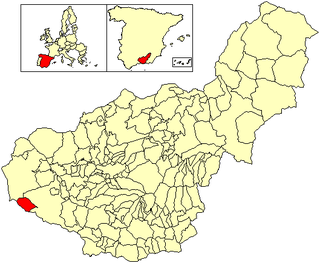
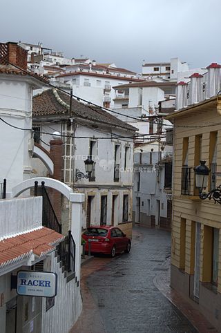
Ventas de Zafarraya is a village in the municipality of Alhama de Granada, Granada, Spain. It is just north of a mountain pass between spurs of the Sierra de Alhama to the west and the Sierra de Tejeda to the east, on the main road from Vélez-Málaga to Alhama de Granada. The village was destroyed by an earthquake in 1884, but was rebuilt.

The 1884 Andalusian earthquake occurred on 25 December 1884 at 9:08 p.m in the south of Spain, and had an estimated magnitude of 6.7 . It shook a poor region where many of the houses were built without foundations, with lime or mud mortar, and with weak joints. More than 10,000 buildings were badly damaged, of which 4,399 were completely destroyed. There were over 1,200 deaths and 1,500 serious injuries, however, many people were in the streets celebrating Christmas hence casualties were not higher. The heavy snow that followed the earthquake caused further suffering and deaths. Help was slow to arrive at first, but as the news spread food and blankets arrived, then tents, and then donations from around the world helped with reconstruction.