Chiclana de la Frontera is a town and municipality in southwest Spain, in the province of Cádiz, Andalucía, near the Gulf of Cádiz. It belongs to the association of municipalities of the Bay of Cádiz, the provincial capital of Cádiz, Jerez de la Frontera, San Fernando, El Puerto de Santa María, Puerto Real and Rota which form the third largest metropolitan area in Andalusia, behind Seville and Málaga, and the twelfth largest in Spain. It is located 20 kilometres south-east from Cádiz, and borders the municipalities of San Fernando and Puerto Real to the north and Conil de la Frontera to the south. In 1877, the municipality's population was 11,677; in 2012, it was 81,473. It has a surface area is 203 square kilometres (78 sq mi) and a population density of 401 inhabitants / km2. The average elevation is 11 metres (36 ft) above sea level. The economy depends largely upon modern industry, especially salt processing and tourism, and the municipality is known for its beaches such as the 6 kilometres (3.7 mi) long Playa de la Barrosa, hotels and golf courses in the resort of Novo Sancti Petri. The municipality contains the largest number of hotel beds in the Province of Cádiz and the Costa de la Luz. The town's newspaper, Viva Chiclana is distributed on Thursday mornings.

The Lecrin Valley is a comarca in the center-south part of the province of Granada, Andalusia, southern Spain. This territory borders the Vega de Granada to the north, the Alpujarra Granadina to the east, the Costa Tropical to the south, and the Alhama to the west.

Domingo Pérez de Granada is a village and municipality of Granada province, Spain, placed at 46 kilometers from Granada.

Cástaras is a municipality located in the province of Granada, Spain. According to the 2005 census (INE), the city has a population of 251 inhabitants.

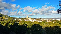
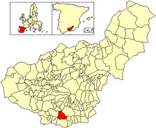
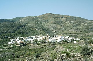
Lecrín is a municipality located in the province of Granada, Spain. According to the 2004 census (INE), the city has a population of 2269 inhabitants. Although the municipality was formed only in 1970, the six areas of which it is comprised have existed for much longer. Lecrín's six constituent areas are Mondújar, Talará, Béznar, Acequias, Chite and Murchas.

Lentegí is a municipality located in the province of Granada, Spain. According to the 2006 census (INE), the city has a population of 342 inhabitants.

Lobras is a municipality located in the province of Granada, Spain. According to the 2005 census (INE), the city has a population of 126 inhabitants.
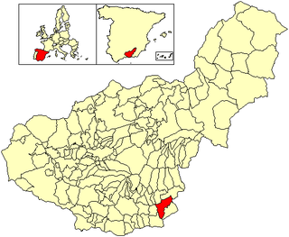
Murtas is a municipality located in the province of Granada, Spain. Spanning an area of 71.7 km2, according to the 2016 census (INE), the city has a population of 495 inhabitants. In 2005 the population was recorded as 741.

Nigüelas is a municipality located in the province of Granada, Spain. According to the 2012 census (INE), the town has a population of 1203.

Soportújar is a municipality located in the province of Granada, Spain. According to the 2015 census (INE), the city has a population of 296 inhabitants.
Vélez de Benaudalla is a municipality in the province of Granada, Spain. According to the 2008 census (INE), the city has a population of 2,980 inhabitants.

Villamena is a municipality located in the province of Granada, Spain. According to the 2005 census (INE), the city has a population of 1010 inhabitants.

Jun is a Spanish locality and township situated in the north-centre part of la Vega de Granada, in the province of Granada, autonomous community of Andalucía. It limits with the municipalities of Pulianas, Granada, Alfacar and Víznar.

Los Guájares is a municipality in the province of Granada, Spain. As of 2010, it has a population of 1191 inhabitants.
Pórtugos is a municipality in the province of Granada, Spain. As of 2010, it has a population of 401 inhabitants.

Sorvilán is a municipality in the province of Granada, Spain. As of 2010, it has a population of 614 inhabitants.
Turón is a municipality in the province of Granada, Spain. As of 2010, it has a population of 297 inhabitants.
El Valle is a municipality in the province of Granada, Spain. As of 2010, it has a population of 1130 inhabitants.

Torrenueva Costa is a newly-created (2018) Spanish Municipality in the province of Granada and in the autonomous community Andalucía. It is located in the central part of the region of the Granada coast, and was formerly part of the municipality of Motril, from which it was constitutionally separated on 2 October 2018. Beside this locality are found the centres of El Varadero, La Chucha and Carchuna. It fills the occidental part of the cape Sacratif. The name of Torrenueva is taken from a century XVII defensive watchtower situated in the locality, in the south edge of the highway N-340 between Málaga and Almería, which runs through the locality. As an eminently touristic location, its beaches are populated by numerous swimmers from many sources-mainly from the rest of the granadine province, Jaén and Ciudad Real- during the summer months. In low season, local population is very low.