
Alcaucin is a town and municipality in the province of Málaga, part of the autonomous community of Andalusia in southern Spain. It borders with the province of Granada. The municipality is situated approximately 54 kilometers to the city of Málaga. It is 507 km from the capital of Madrid. The name was derived from al-kautín, the Arabic of "the arches." It has a population of approximately 1,600 residents, partly living in the hamlet of Puente Don Manuel. Natives of the town are called Alcaucineños and have the nickname of tiznaos.

Alicún de Ortega is a village located at the province of Granada, Spain. According to the 2005 census (INE), it has a population of 563 inhabitants.
Benamaurel is a village located in the province of Granada, Spain. According to the 2006 census (INE), the city has a population of 2328 inhabitants. The municipality includes the following localities: Puente Arriba, San Marcos, Cuevas de la Blanca, Huerta Real, Cuevas del Negro y Cuevas de Luna. There is a market held every Sunday morning and a 3-day Moors and Christians festival held in April.

Cenes de la Vega is a municipality located in the province of Granada, Spain. According to the 2020 census (INE), the city has a population of 8,153 inhabitants.

Cogollos de Guadix is a municipality located in the province of Granada, Spain. According to the 2005 census (INE), the city has a population of 741 inhabitants.
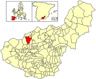
Colomera is a municipality located in the province of Granada, Spain. According to the 2011 census (INE), the city has a population of 1507 inhabitants.

Dehesas de Guadix is a municipality located in the province of Granada, Spain. According to the 2005 census (INE), the city has a population of 556 inhabitants.

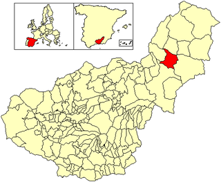
Deifontes is a municipality located in the province of Granada, Spain. According to the 2006 census (INE), the city had a population of 2478 inhabitants.
Escúzar is a municipality located in the province of Granada, Spain. According to the 2005 census (INE), the city has a population of 785 inhabitants.

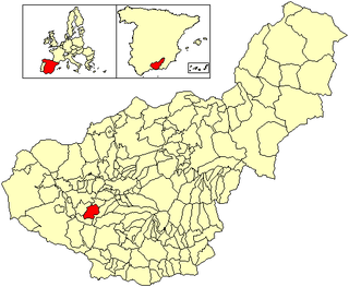
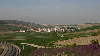
Jayena is a municipality located in the province of Granada, Spain. According to the 2005 census (INE), the city has a population of 1237 inhabitants.

Maracena is a municipality located in the province of Granada, Spain. According to the 2005 census (INE), the city has a population of 18819 inhabitants. It is located in the central part of the Vega de Granada, being one of the fifty-two entities that make up the metropolitan area of Granada.It borders the municipalities of Peligros, Pulianas, Granada, Atarfe and Albolote. Other nearby towns are Pulianillas and Monteluz.

Moraleda de Zafayona is a municipality located in the province of Granada, Spain. According to the 2004 census (INE), the town's population was 2769.

Nívar is a municipality located in the province of Granada, Spain, situated in the autonomous community of Andalusia. It is located in the centre-part of the county known as Vega de Granada, which its situated in the northeast skirt of Sierra de la Alfaguara. It is just 14 km away from the capital of the province. At the same time, it is confined by the municipalities of Cogollos Vega, Huétor Santillán, Alfacar and Güevéjar. According to the 2005 census (INE), the municipality has a population of 681 inhabitants.

Peligros is a municipality located in the province of Granada, Spain. According to the 2013 census (INE), the city has a population of 11,126 inhabitants. It is located next to Pulianas, Maracena, Albolote, Calicasas and Güevejar. It includes a small urbanization called Monteluz.
Purullena is a municipality located in the province of Granada, Spain. According to the 2004 census (INE), the city has a population of 2286 inhabitants.

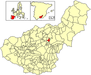
Jun is a Spanish locality and township situated in the north-centre part of la Vega de Granada, in the province of Granada, autonomous community of Andalucía. It limits with the municipalities of Pulianas, Granada, Alfacar and Víznar.

Beas de Guadix is a municipality in the province of Granada, Spain. As of 2010, it has a population of 396 inhabitants.
Gobernador is a municipality in the province of Granada, Spain. As of 2010, it has a population of 286 inhabitants.
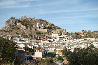
Moclín is a municipality in the province of Granada, Spain. As of 2010, it has a population of 4237 inhabitants.
Polopos is a village in the municipality Polopos-La Mamola in the province of Granada, Spain. As of 2010, the municipality has a population of 1856 inhabitants, most of which live in the coastal village La Mamola. Polopos used to be the main village with 1200 villagers living there in the 18th and 19th century. Most of the families moved away in the second half of the 20th century to find work in the cities or to live on the coast. As of 2019 it was home to 53 people.


