
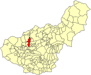
Granada is a province of southern Spain, in the eastern part of the autonomous community of Andalusia. It is bordered by the provinces of Albacete, Murcia, Almería, Jaén, Córdoba, Málaga, and the Mediterranean Sea. Its capital city is also called Granada.
Andújar is a Spanish municipality of 38,539 people (2005) in the province of Jaén, in Andalusia. The municipality is divided by the Guadalquivir River. The northern part of the municipality is where the Natural Park of the Sierra de Andújar is situated. To the south are agricultural fields and countryside. The city proper located on the right bank of the Guadalquivir and the Madrid-Córdoba railway. In the past, Andújar was widely known for its porous earthenware jars, called alcarrazas or botijos, which keep water cool in the hottest weather, and were manufactured from a whitish clay found in the neighbourhood.

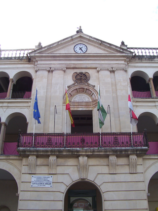
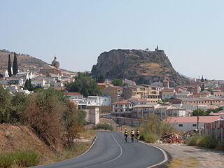
Baza is a town in the province of Granada in Andalusia, twice a former Catholic bishopric and now a Latin Catholic titular see as Basti.

Alosno is a town and municipality located in the province of Huelva, Spain. According to the 2013 census, the village has a population of 1,840 inhabitants. The Filon Sur Mine, in Alosno municipality, is a notable source of fine specimens of the mineral goethite. Nearby is a 4500+ year old copper smelting archeological site named Cabezo Juré.

El Ejido is a municipality of Almería province, in the autonomous community of Andalusia, Spain. It is located 32 km from Almería with a surface area of 227 km2, and as reported in 2014 had 84,144 inhabitants. El Ejido is the centre of production for fruit and vegetables in the "Comarca de El Poniente". The work opportunities the city provides attract many foreign farmhands, who look for jobs mainly in the greenhouses there. Some greenhouses have begun using computer-controlled hydroponics systems, thus saving on labour, improving efficiency and the local economy.

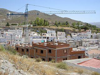
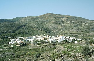
Purchena is a small town in Almería, southern Spain. It is situated at the foot of the Sierra de los Filabres, in the middle of the Almanzora River Valley, surrounded by woods which ascend towards the mountains, an environment which contrasts with the rest of the municipalities of the area which are set in much more arid surroundings.

Trebujena is a city and municipality located in the province of Cádiz, part of Andalusia in southern Spain. The area is known for its labor movement and its vineyards.
Laujar de Andarax is a municipality of Almería province, in the autonomous community of Andalusia, Spain.

Vélez-Blanco is a municipality of Almería province, in the autonomous community of Andalusia, Spain. In 2018, the population was 1,938.
La Carolina is a city and municipality located in the province of Jaén, Spain. According to the 2014 census, the municipality has a population of 15,808 inhabitants.
Añora is a city located in the province of Córdoba, Spain. According to the 2014 census, the municipality has a population of 1,555 inhabitants. Its postal code is 14450.

Peñarroya-Pueblonuevo is a Municipality located in the province of Córdoba, Spain. According to the 2018 census, the municipality has a population of 10,870 inhabitants. Its postal code is 14200.
Albolote is a city located in the province of Granada, Spain. It is one of the thirty-four entities which together form Granada's Metropolitan Area. It is formed by several populations: El Aire, El Chaparral, and Parque del Cubillas y Pretel. There are also several residential areas throughout the legal borders of the municipality. Inside those limits you can also find Granada's Penitential Center. According to Spain's Instituto Nacional de Estadística, the city had a total population of 15,563 in 2005.
Dúrcal with a population of 7,286 (2012) is a Spanish municipality located in the north-eastern part of the Valle de Lecrín in the Province of Granada, one of the 51 entities that make up the metropolitan area of Granada. It borders the municipalities of Dílar, Lanjarón, Nigüelas, Villamena, and the Padul. Other nearby towns are Padul and Mondújar. The council consists of durqueño nuclei Dúrcal, which is the capital district Lecrín Valley, and Marchena. Much of its township is located in the Sierra Nevada National Park.
Las Gabias is a Spanish city and municipality located in the central southern part of the Vega of Granada, in the province of Granada, in the autonomous community of Andalusia, approximately 8 km from the provincial capital of Granada. It borders the municipalities of Vegas del Genil, Cúllar Vega, Churriana de la Vega, Alhendín, La Malahá, Chimeneas and Santa Fe. Las Gabias includes the localities of "Gabia Grande", the municipal capital, and "Gabia Chica" that were a unified with the region in 1973, in addition to the annexation of Híjar, Los Llanos, Pedro Verde and San Javier. The name may have originated from Hisn Caviar, which means "military tower", in allusion to the one that still exists in Gabia Grande. It is one of the most populous municipalities in Spain as well as one of the youngest, with the median age of inhabitants being only 34.3 years of age. In 2016, the population of Las Gabias surpassed 20,000, making it the third most populous municipality in the Granada Metropolitan Area, surpassed only by Granada and Armilla.

Estepa is a municipality in the extreme south-east of the province of Seville. It had a population of 12.631 in 2013. The town is located north of the Sierra del Becerro mountains.

La Calahorra is a municipality, part of the Comarca de Guadix, located in the middle of the Province of Granada, Spain. According to the 2019 census, the town has a population of 673 inhabitants.
Íllora is a municipality in the province of Granada, located in Andalucia. Spain. It is surrounded by the following villages: Moclín, Pinos Puente, Valderrubio, Moraleda de Zafayona, Villanueva Mesía, Montefrío, and with the municipality of Alcalá la Real. The municipality consists of Íllora, Alomartes, Tocón, Escóznar, Obéilar- also known as La Estación de Íllora–, Brácana, Ventas de Algarra, Vallequemado and La Alhondiguilla.
Turón is a municipality in the province of Granada, Spain. As of 2010, it has a population of 297 inhabitants.
The current configuration of the province of Granada is the result of a long process of territorial organization that reached its culmination in 1833, by means of the decree of provincialization promulgated by Javier de Burgos, Ministry of Development of the government of the regent Maria Christina of Bourbon. Until that date, what now constitutes the province of Granada was integrated within the limits of the so-called Kingdom of Granada.


