The Arctic Archipelago, also known as the Canadian Arctic Archipelago, is an archipelago lying to the north of the Canadian continental mainland, excluding Greenland and Iceland.

Luis Enrique Martínez García, known as Luis Enrique, is a Spanish football manager and former player. He is the manager of Ligue 1 club Paris Saint-Germain.

The Haviland Crater, also called the Brenham Crater, is a meteorite crater (astrobleme) in Kiowa County, Kansas.

Lawn,, is a town located at the tip of the Burin Peninsula on Newfoundland's South coast, Newfoundland and Labrador. Lawn is spread around a small harbour in a relatively lush valley. According to one local tradition it was this lushness that inspired Captain James Cook to name the place Lawn Harbour. But it has also been speculated that a Frenchman named the community after a doe caribou that he spotted there.

Somoto is a city and a municipality located in the hills of northern Nicaragua, and capital of the department of Madriz. It is around 20 km south-west of Ocotal and 51 km north-west of Estelí. It sits on the Pan-American Highway around 16 km from the Honduran border crossing at El Espino.

Club Deportivo y Social Vida, or simply Vida, is a Honduran professional football club based in La Ceiba, Atlántida.

The Raton Basin is a geologic structural basin in southern Colorado and northern New Mexico. It takes its name from Raton Pass and the town of Raton, New Mexico. In extent, the basin is approximately 50 miles (80 km) east-west, and 90 miles (140 km) north-south, in Huerfano and Las Animas Counties, Colorado, and Colfax County, New Mexico.
Villaverde del Río is a city located in the province of Seville, Spain. According to the 2005 census (INE), the city has a population of 6685 inhabitants.

Hornachuelos is a city located in the province of Córdoba, Spain. According to the 2006 census (INE), the city has a population of 4662 inhabitants.

Nueva Carteya is a city located in the province of Córdoba, Spain. According to the 2006 census (INE), the city has a population of 5566 inhabitants.
Palenciana is a city located in the province of Córdoba, Spain. According to the 2006 census (INE), the city has a population of 1584 inhabitants.
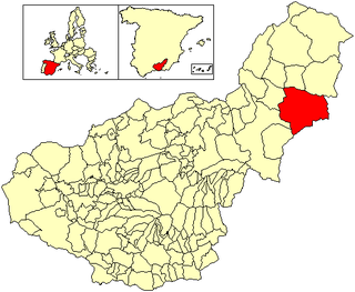
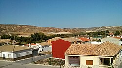
Cúllar is a municipality located in the province of Granada, Spain. According to the 2005 census (INE), the city has a population of 4898 inhabitants. The linguist Gregorio Salvador Caja is one of its most famous personalities.

Dehesas de Guadix is a municipality located in the province of Granada, Spain. According to the 2005 census (INE), the city has a population of 556 inhabitants.

Nívar is a municipality located in the province of Granada, Spain, situated in the autonomous community of Andalusia. It is located in the centre-part of the county known as Vega de Granada, which its situated in the northeast skirt of Sierra de la Alfaguara. It is just 14 km away from the capital of the province. At the same time, it is confined by the municipalities of Cogollos Vega, Huétor Santillán, Alfacar and Güevéjar. According to the 2005 census (INE), the municipality has a population of 681 inhabitants.

Víznar is a municipality located in the province of Granada, Spain, only a few miles from the city of Granada itself. According to the 2005 census (INE), the town has a population of 789 inhabitants.
The Escuela Médico Militar is a medical school of the Mexican army and Mexican air force for medical training. The school is located in Mexico City, Mexico.

Western Leone is a Western-style theme park in the province of Almeria, Andalusia (Spain). Located at the 378.9 km mark on the A-92 motorway, it is the smallest of three such theme parks in the Tabernas Desert; the other two are Mini Hollywood and Texas Hollywood. Western Leone was originally built to film Sergio Leone's Once Upon a Time in the West (1968); the large red house, around which many of the scenes in the film revolve, is maintained as an attraction, along with other buildings of a Western town. It has also been used to film other Spaghetti Westerns.

Casasola de Arión is a village in Valladolid, Castile-Leon, Spain. The municipality covers an area of 27.65 square kilometres (10.68 sq mi) and as of 2011 had a population of 314 people.

During the reconquista, the siege of Córdoba was a successful investment by the forces of Ferdinand III, king of Castile and León, marking the end of the Islamic rule over the city that had begun in 711.
Events in the year 1981 in Mexico.