This article needs additional citations for verification .(November 2021) |
Diezma | |
|---|---|
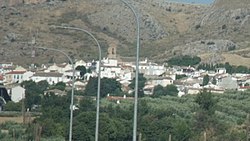 View of Diezma | |
 Flag  Coat of arms | |
 Diezma Location in Spain. | |
| Coordinates: 37°19′N3°20′W / 37.317°N 3.333°W | |
| Country | Spain |
| Province | Granada |
| Comarca | Guadix |
| Government | |
| • Mayor | José Jesús García Rodríguez |
| Area | |
• Total | 41 km2 (16 sq mi) |
| Elevation | 1,233 m (4,045 ft) |
| Population (2018) [1] | |
• Total | 755 |
| • Density | 18/km2 (48/sq mi) |
| Time zone | UTC+1 (CET) |
| • Summer (DST) | UTC+2 (CEST) |
Diezma is a municipality located in the province of Granada, Spain.
Contents
It lies between the Sierra de Huétor Natural Park and the new reservoir of Francisco Abellán.