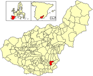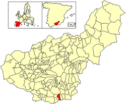
The Alpujarra is a natural and historical region in Andalusia, Spain, on the south slopes of the Sierra Nevada and the adjacent valley. The average elevation is 1,200 metres (4,000 ft) above sea level. It extends over two provinces, Granada and Almería; it is sometimes referred to in the plural as "Las Alpujarras". There are several interpretations of this Arabic-origin name: the most convincing is that it derives from al-basharāt (البَشَرَات), meaning something like "sierra of pastures". The administrative centre of the part in Granada is Órgiva, while that of the part in Almería is Alhama de Almería.

Órgiva is a Spanish town municipality in comarca of Alpujarra Granadina in the province of Granada, Andalusia. It has a population of around 6,000 and lies in the Alpujarra valley between the Sierra de Lújar and Sierra Nevada.
Bubión is a village in Las Alpujarras region of Granada in Spain. It is located at latitude 36° 57' N, longitude 3° 21' W, at 1,350 metres above sea level. Its postal code is 18412. Together with Capileira and Pampaneira it has become a focus for the tourist trade in La Alpujarra, because of the spectacular location of the three villages on the gorge of the Río Poqueira and below the peaks of the Sierra Nevada. The three villages, with their characteristic Moorish features - narrow, winding streets, flat roofs - have been designated as a Conjunto Histórico Artístico, a region of special artistic and historical importance.

Motril is a town and municipality of Spain belonging to the province of Granada, in the autonomous community of Andalusia.

Lújar is a village in southern Spain in the Sierra Nevada, a couple of kilometres inland from the coast and the city of Motril along a fairly precipitous road. Its population is approximately 500.

Valdepeñas is a municipality in the province of Ciudad Real, in the autonomous community of Castile-La Mancha, Spain. It is also the seat of the judicial district that covers the localities of Moral de Calatrava, Santa Cruz de Mudela, Viso del Marqués, Torrenueva, Castellar de Santiago and Almuradiel.

Montefrio is a municipality in the province of Granada. The ruins of a Moorish castle sit near the highest point. Being built midway between the Sierra de Priego and Sierra Parapanda, and commanding the open valley between these ranges, it became one of the chief frontier fortresses of the Moors in the 15th century.

The Lecrin Valley is a comarca in the center-south part of the province of Granada, Andalusia, southern Spain. This territory borders the Vega de Granada to the north, the Alpujarra Granadina to the east, the Costa Tropical to the south, and the Alhama to the west.

The Penibaetic System is the southernmost of the three systems of mountain ranges of the Baetic System in the southern Iberian Peninsula. It includes the highest point in the peninsula, 3,478 m high Mulhacén in the Sierra Nevada.

Málaga and Sierras de Málaga are two different Spanish Denominaciones de Origen Protegidas (DOPs) for wines from the province of Málaga. First formed as one DOP in 1932, the Sierras de Málaga DOP was formed in 2001 and is in effect a sub-appellation of Málaga DOP.

Canillas de Albaida is a town and municipality in the province of Málaga, part of the autonomous community of Andalusia in southern Spain. It has a population of approximately 800 residents. The natives are called Canilleros. The village is one of several typical Andalucian pueblos blancos which ring the edge of the national parks.

Comares is a town and municipality in the province of Málaga, part of the autonomous community of Andalusia in southern Spain. The municipality is situated approximately 28 kilometers from the provincial capital and 24 from Vélez-Málaga. It is located in the foothills of the Montes de Málaga 703 meters above sea level. Comares is one of the 31 villages that make up the comarca of Axarquía.

Alpujarra de la Sierra is a municipality located in the province of Granada, Spain. According to the 2007 census (INE), the city has a population of 1,168 inhabitants.

Cádiar is a town located in the province of Granada, Spain. According to the 2005 census (INE), the city has a population of 1601 inhabitants. It borders the municipalities of Lobras, Bérchules, Alpujarra de la Sierra, Ugíjar, Murtas and Albondón. Other nearby towns are Tímar, Golco and Alcútar.

Dúrcal with a population of 7,286 (2012) is a Spanish municipality located in the north-eastern part of the Valle de Lecrín in the Province of Granada, one of the 51 entities that make up the metropolitan area of Granada. It borders the municipalities of Dílar, Lanjarón, Nigüelas, Villamena, and the Padul. Other nearby towns are Padul and Mondújar. The council consists of durqueño nuclei Dúrcal, which is the capital district Lecrín Valley, and Marchena. Much of its township is located in the Sierra Nevada National Park.

Peligros is a municipality located in the province of Granada, Spain. According to the 2013 census (INE), the city has a population of 11,126 inhabitants. It is located next to Pulianas, Maracena, Albolote, Calicasas and Güevejar. It includes a small urbanization called Monteluz.

Zarza de Granadilla is a Spanish municipality in Cáceres Province, Extremadura. Zarza de Granadilla has a population of 1873.

Lanaja is a municipality located in the province of Huesca, Aragon, Spain. According to the 2011 census (INE), the municipality has a population of 1,381 inhabitants. The village has approximately 1,100 inhabitants; the neighbouring villages of Cantalobos and Orillena comprise an additional 400.

Costa Granadina is a comarca in southern Spain, corresponding to the Mediterranean coastline of the province of Granada. It is also but less frequently called the Costa Tropical or Costa de Granada. It is crossed by the N-340 coastal highway that runs southwest–northeast along Spain's Mediterranean coast, to the border with France. Within the last 4 years the A7 motorway has been extended along the coast from Nerja in the Málaga province to Motril where it links the A7 motorway to the A44 motorway which heads north from Motril to the city of Granada.

Granada is a Spanish Denominación de Origen Protegida (DOP) for wines in the province of Granada, Andalusia, Spain, extending over 168 different municipalities. There is also sub-zone known as "Contraviesa-Alpujarras", covering another 13 municipalities in the Alpujarras mountains. Granada achieved Vino de Calidad status in 2009, and Denominación de Origen status in 2018.


