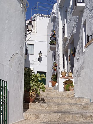
Axarquía is a comarca of Andalusia in southern Spain. It is the wedge-shaped area east of Málaga. Its name is traced back to Arabic الشرقية. It extends along the coast and inland. Its coastal towns make up the Costa del Sol Oriental - one of the sunniest places in mainland Spain with the average of 320 sunny days a year. The natives of the region are called axárquicos.

Antequera is a city and municipality in the Comarca de Antequera, province of Málaga, part of the Spanish autonomous community of Andalusia. It is known as "the heart of Andalusia" because of its central location among Málaga, Granada, Córdoba, and Seville. The Antequera Dolmens Site is a UNESCO World Heritage site.

The Guadalhorce is the principal river of the Province of Málaga in southern Spain.

The Bay of Cádiz is a comarca in the province of Cádiz, Andalusia, southern Spain.

Campiña de Jerez is a comarca in the province of Cádiz, southern Spain.
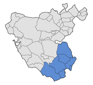
Campo de Gibraltar is a comarca (county) in the province of Cádiz, Spain, in the southwestern part of the autonomous community of Andalusia, the southernmost part of mainland Europe. It comprises the municipalities of Algeciras, La Línea de la Concepción, San Roque, Los Barrios, Castellar de la Frontera, Jimena de la Frontera, San Martín del Tesorillo and Tarifa.

Sierra de Cádiz is a comarca province of Cádiz.
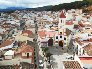
Alameda is a town and municipality in the province of Málaga, part of the autonomous community of Andalusia in southern Spain. The municipality is situated approximately 85 km from the city of Málaga. It has a population of approximately 5,000 and the natives are called Alamedanos or Lametanos. It takes its name from the stream Álamos, which crosses the municipality. The Bandito "El Tempranillo" is buried here.

Campillos is a municipality and town in the province of Málaga, part of the autonomous community of Andalusia in southern Spain. It is located northwest of the province in the comarca of Guadalteba and within the judicial district of Antequera. The municipality is approximately 30 kilometers from Antequera and 70 from the provincial capital. It covers an area of 188 km2 extending from grain fields and olive groves and includes several lakes inhabited by flamingos and storks.

Cuevas Bajas is a town and municipality in the province of Málaga, part of the autonomous community of Andalusia in southern Spain. It belongs to the comarca of Nororma. It is part of the judicial district of Archidona. The municipality is situated 75 kilometers from Málaga and 495 km from Madrid In 2011 it had a population of 1,482 inhabitants. Its surface area is 16.53 km2. Cuevas Bajas has a density of 89.66 inhabitants/km2. The natives are called Cueveños.

Cuevas de San Marcos is a town and municipality in the province of Málaga, part of the autonomous community of Andalusia in southern Spain. The municipality is situated in the northern part of the Antequera region, on the border of the province of Córdoba from the river valley of Genil to the Sierra Malnombre and Camorro de Cuevas Altas. It is also located within the comarca of Nororma. It borders the provinces of Granada and Cordoba to the north, the comarcas of La Axarquía to the south and Antequera to the west. The town is situated at an altitude of 420 meters above sea level.

Sierra de Yeguas is a town and municipality in the province of Málaga, part of the autonomous community of Andalusia in southern Spain. It belongs to the comarca of Antequera. The municipality is situated approximately 95 kilometres from the provincial capital of Málaga. It had a population of 3,356 residents in 2018.
Villanueva de Algaidas is a town and municipality in the North-Eastern Malaga comarca (Nororma), province of Málaga, part of the autonomous community of Andalusia in southern Spain. The municipality is situated approximately 11 kilometres from Archidona, 30 from Antequera and 70 from the provincial capital of Málaga. It has a population of approximately 4,200 residents. The natives are called Algaideños.
Villanueva de Tapia is a town and municipality in the Province of Málaga, part of the autonomous community of Andalusia in southern Spain. It is located in the comarca of Antequera. The municipality is situated approximately 67 kilometres from Málaga. It has a population of approximately 1,700 residents. The natives are called Tapienses or Entricheros.
Villanueva del Trabuco is a town and municipality in the province of Málaga, part of the autonomous community of Andalusia in southern Spain. It is situated in the northeast of the province. Villanueva del Trabuco is located in the comarca of Nororma. The municipality is situated approximately 45 kilometres from the provincial capital of Málaga and 34 from Antequera. It has a population of approximately 5,000 residents. The natives are called Trabuqueños. Local legend has it that the town is named after a type of early gun called a Trabuco, which was in common usage in the area many years ago.
La Algaba is a Spanish municipality in the province of Seville, Andalusia, with a population of around 16,000. It is part of the region of La Vega and is located 11 km from the province's capital, Seville. The town dates back to the Byzantine Empire and has many historical artifacts and significant churches.
Las Villas is a natural region and comarca in Andalusia, southern Spain. It is located in the mountainous area at the eastern end of Jaén Province. The main town is Villacarrillo.

The Serranía de Ronda is a comarca in the western part of the province of Málaga, Andalusia, Spain. As is currently the norm in Andalusia, it has no formal status. The 2007 Statute of Autonomy of Andalusia, unlike its 1981 predecessor, mentions comarcas in Article 97 of Title III, which defines the significance of comarcas and establishes a basis for formal recognition in future legislation, but no such legislation has yet been enacted.

In Andalusia, comarcas have no defined administrative powers; many municipalities have gathered together to form mancomunidades in order to provide basic services, but those do not always coincide with the traditional comarcas. The current (2007) Statute of Autonomy of Andalusia, unlike its 1981 predecessor, allows for the establishment and regulation of official comarcas under its Title III, Article 97, which defines the significance of comarcas and sets the basis for future legislation in this area.

El Andévalo or El Campo de Andévalo is a comarca in Huelva Province, Andalusia, southern Spain. It is located between the Sierra de Huelva, Costa Occidental, Cuenca Minera, Huelva and Condado de Huelva comarcas and the border of Portugal.


