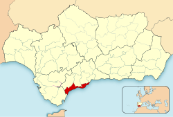
The province of Málaga is located in Andalusia, Spain. It is bordered by the Mediterranean Sea to the south and by the provinces of Cádiz to the west, Seville to the northwest, Córdoba to the north, and Granada to the east.

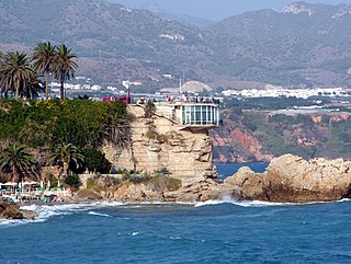
The Costa del Sol is a region in the south of Spain in the autonomous community of Andalusia, comprising the coastal towns and communities along the coastline of the Province of Málaga and the eastern part of Campo de Gibraltar in Cádiz. Formerly made up only of a series of small fishing settlements, today the region is a world-renowned tourist destination. The Costa del Sol is situated between two lesser known coastal regions, the Costa de la Luz and the Costa Tropical.

Fuengirola is a city on the Costa del Sol in the province of Málaga in the autonomous community of Andalusia in southern Spain. It is located on the central coast of the province and integrated into the region of the Costa del Sol and the Commonwealth of Municipalities of the Costa del Sol Occidental.

Mijas is a municipality in the Province of Málaga, in the autonomous community of Andalusia. Located on the southeastern coast of Spain, Mijas belongs to the region of Costa del Sol Occidental. Its center is a typical Andalusian white-washed village, Mijas Pueblo, located on a mountainside about 430 metres or 1,476 feet above sea level, in the heart of the Costa del Sol region.
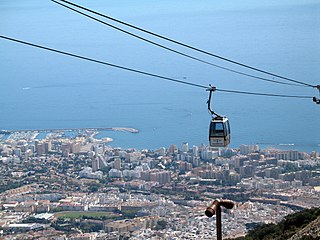
Benalmádena is a town in Andalusia in southern Spain, 12 km west of Málaga, on the Costa del Sol between Torremolinos and Fuengirola.
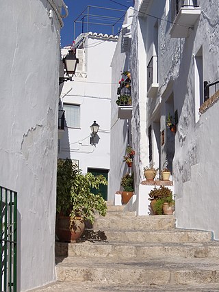
Axarquía is a comarca of Andalusia in southern Spain. It is the wedge-shaped area east of Málaga. Its name is traced back to Arabic الشرقية. It extends along the coast and inland. Its coastal towns make up the Costa del Sol Oriental - one of the sunniest places in mainland Spain with the average of 320 sunny days a year. The natives of the region are called axárquicos.

Sierra de las Nieves is a mountain range of the Penibaetic System in Málaga Province, Andalusia, Spain with its highest point being La Torrecilla.

Alhaurín el Grande is a town located in the province of Málaga in the autonomous community of Andalusia in southern Spain.

The Guadalhorce is the principal river of the Province of Málaga in southern Spain.
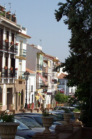
Alhaurín de la Torre is a town in the province of Málaga, Andalusia, in southern Spain. The town is part of Málaga Metropolitan Area and of the comarca of Valle del Guadalhorce. It sits at the entrance to the Guadalhorce valley on the slopes of the Sierra de Mijas mountains, some 17 km from Málaga.
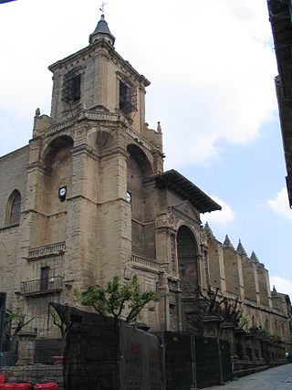
Viana is a town and municipality located in the province and autonomous community of Navarre, northern Spain. Cesare Borgia is buried there.

Istán is a town and municipality in the province of Málaga in Andalusia in southern Spain with an estimated population in 2005 of 1400 people. It lies beneath the Sierra Blanca in the valley of the Rio Verde about 15 km to the northwest from Marbella and the Mediterranean coast. It is situated on the southern slope of the Sierra de las Nieves. It is also near the large reservoir created by the Presa de la Concepción dam, built in 1972 to provide drinking water to towns all along the Costa del Sol.

The Penibaetic System is the southernmost of the three systems of mountain ranges of the Baetic System in the southern Iberian Peninsula. It includes the highest point in the peninsula, 3,478 m high Mulhacén in the Sierra Nevada.

Canillas de Albaida is a town and municipality in the province of Málaga, part of the autonomous community of Andalusia in southern Spain. It has a population of approximately 800 residents. The natives are called Canilleros. The village is one of several typical Andalucian pueblos blancos which ring the edge of the national parks.

Cómpeta is a town and municipality in the comarca of Axarquía, and province of Málaga, part of the autonomous community of Andalusia in southern Spain. The municipality is situated approximately 18 kilometres from the coast, and 52 kilometres from Málaga, the provincial capital. It is situated at 638 metres above sea level in the foothills of La Maroma. The population is spread over the southern slopes of the Sierra de Almijara.

Sitio De Calahonda is a small town in Andalusia, southern Spain. It lies on the coast about halfway between Fuengirola and Marbella, and is part of the municipality of Mijas.

The Costa de Almería is a coastal region of Spain consisting of the coastal municipalities of the province of Almería, in the autonomous community of Andalusia, Spain. The region extends 217 kilometres (135 mi) and includes 13 municipalities, from Pulpí on the border with the province of Murcia to Adra on the border with the province of Granada.

The Valle del Guadalhorce is a comarca in the province of Málaga, Andalusia, southern Spain. It includes 8 municipalities and is part of the natural region of the Guadalhorce river.
La Mairena is a hill top residential resort on the Costa del Sol, just 5 km (3 mi) from the coastal ruralisation of Elviria, on the eastern outskirts of Marbella, Spain. At 400 m (1300 ft) above sea level, the village has views towards the Sierra Nevada Mountains, the Mediterranean Sea, the Rock of Gibraltar and the African coast.
Sierra Blanca is a mountain range of the Penibaetic System in Málaga Province, Andalusia, Spain. Its highest point is the 1,275 m high Pico del Lastonar. It is the closest mountain to Marbella.

