Altenbrak

Last updated
Altenbrak
Altenbrak Kirche (4).JPG
Church in Altenbrak
DE-ST 15-0-85-330 Altenbrak COA.png
Location of Altenbrak
Altenbrak
Germany adm location map.svg
Red pog.svg
Altenbrak
Saxony-Anhalt location map.svg
Red pog.svg
Altenbrak
Coordinates: 51°44′N10°56′E / 51.733°N 10.933°E / 51.733; 10.933 Coordinates: 51°44′N10°56′E / 51.733°N 10.933°E / 51.733; 10.933
Country Germany
State Saxony-Anhalt
District Harz
Town Thale
Area
  Total19.43 km2 (7.50 sq mi)
Elevation
340 m (1,120 ft)
Population
 (2017)
  Total332
  Density17/km2 (44/sq mi)
Time zone UTC+01:00 (CET)
  Summer (DST) UTC+02:00 (CEST)
Postal codes
06502
Dialling codes 039456
Vehicle registration HZ

Altenbrak is a village and a former municipality in the district of Harz, in Saxony-Anhalt, Germany.

Contents

1912 map of Altenbrak Altenbrak Karte 1912.JPG
1912 map of Altenbrak
View of Altenbrak from the Boser Kleef vantage point Blick auf Altenbrak.jpg
View of Altenbrak from the Böser Kleef vantage point

Geography

The village is strung out for about 1.6 kilometres along the River Bode in an east–west valley. It is 3 kilometres from the Wendefurth Reservoir, which is part of the Rappbode Reservoir. From its shape and nature, Altenbrak is very much a Straßendorf or ribbon development.

In front of the dam is the hamlet of Wendefurth that used to belong to this parish. Altenbrak's neighbouring communities are Allrode, Blankenburg (Harz), Cattenstedt, Friedrichsbrunn, Hasselfelde, Treseburg, Wendefurth and Wienrode. Within the local area are the forest inn of Todtenrode (Gasthaus Todtenrode) and the Jagdschloss Windenhütte which are also checkpoints 65 and 59 in the Harzer Wandernadel hiking network.

There is viewing point, Aussichtspunkt Schöneburg, above the village at an elevation of 441 metres above sea level. It is checkpoint 63 on the Harzer Wandernadel hiking network. [1]

History

Altenbrak was first mentioned in 1448 as a smelting site. The establishment of the village probably goes back further to 1227. After the last ironworks was closed in 1867 the population became poverty-stricken. Later, tourism developed, encouraged by the sheltered situation of the village.

There has been a private post office (Postagentur) in Altenbrak since 1891. Its post agents were Heinrich Fessel (1891–1902); Adolf Schomburg (1907); Fritz Steffen (1908–09); and Georg Hoffmann (1910–16).

In 1884 Theodor Fontane spent some time in Altenbrak. The Gasthaus zum Rodenstein and other places he visited during his excursion into the Bode Gorge are mentioned in his novel, Cécile. Since 1949 Altenbrak has been a climatic spa (Luftkurort).

Since 1 July 2009, it has been part of the borough of Thale.

Politics

Coat of arms of Altenbrak DE-ST 15-0-85-330 Altenbrak COA.png
Coat of arms of Altenbrak

Mayor

The last mayor (Bürgermeister) of the parish of Altenbrak was Ralf Trute.

Coat of arms

The coat of arms was approved by the county on 10 July 2008.

Blazon: "Divided vertically gold and green, left a green spruce, right a silver half-waterwheel, in the blue wavy base a silver trout" (Gespalten von Gold und Grün, vorn eine ausgerissene grüne Fichte, hinten ein halbes silbernes Wassermühlrad am Spalt, im blauen Wellenschildfuß eine silberne Forelle.") [2]

The colours of the old parish are the colours green and gold (based on the tincture of the coat of arms).

The coat of arms was created by the Magdeburg herald, Jörg Mantzsch.

Flag

The flag has two stripes: the left-hand stripe is green and the right is yellow. On horizontal flags the upper striper is green and the lower one yellow. The coat of arms is placed in the centre.

Culture and places of interest

The Harzer Hexenstieg , a hiking trail just under 100 km long, running from Osterode to Thale passes through Altenbrak. Every year on the first weekend in September the Harz Yodelling Competition takes place in Altenbrak. Plays and concerts take place on the forest stage in Altenbrak in the summer. It has seating for 1300.

Personalities

Born in the village

Related Research Articles

Thale Town in Saxony-Anhalt, Germany

Thale is a town in the Harz district in Saxony-Anhalt in central Germany. Located at the steep northeastern rim of the Harz mountain range, it is known for the scenic Bode Gorge stretching above the town centre.

Sankt Andreasberg Stadtteil of Braunlage in Lower Saxony, Germany

Sankt Andreasberg is a former town in the district of Goslar, in Lower Saxony, Germany. Since 1 November 2011, it is part of the town Braunlage. It is situated in the Harz, approximately 7 km west of Braunlage proper, and 20 km east of Osterode am Harz.

Schierke Stadtteil of Wernigerode in Saxony-Anhalt, Germany

Schierke is a village and a former municipality in the Harz district, in the German state of Saxony-Anhalt. Since 1 July 2009, it is part of the town Wernigerode. Situated within the Harz mountain range in the valley of the river Bode, at the rim of the Harz National Park, it is mainly a tourist resort, especially for hiking and all kinds of winter sports.

Rappbode Dam Dam in Harz

The Rappbode Dam is the largest dam in the Harz region as well as the highest dam in Germany. Together with several other dams and retention basins, it forms the flood protection system for the eastern Harz.

Elend, Saxony-Anhalt Stadtteil of Oberharz am Brocken in Saxony-Anhalt, Germany

Elend is a district of the town of Oberharz am Brocken in the Harz District, in Saxony-Anhalt, Germany. It lies in the Bode valley in the High Harz in central Germany, at a height of 505 m above NN. This part of the valley is known locally as Elendstal. Elend is located near the former Inner German Border between West and East Germany.

Stecklenberg Stadtteil of Thale in Saxony-Anhalt, Germany

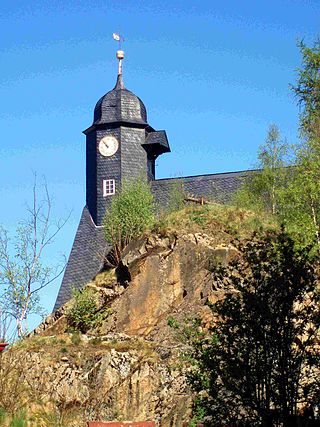
Stecklenberg is a village and a former municipality in the district of Harz, in Saxony-Anhalt, Germany. Since 23 November 2009, it is part of the town Thale.

Treseburg Stadtteil of Thale in Saxony-Anhalt, Germany

Treseburg is a village and a former municipality in the district of Harz, in Saxony-Anhalt, Germany. Since 1 July 2009, it is part of the town Thale.

Harzer Wandernadel

The Harzer Wandernadel is a system of hiking awards in the Harz mountains in central Germany. The hiker can earn awards at different levels of challenge by walking to the various checkpoints in the network and stamping his or her passbook to record the visit. With 222 checkpoints in three federal states and across five districts in the Harz and with membership in five figures, the system has gained a following Germany-wide.

Harzer Hexenstieg

The Harz Witches' Trail is a footpath, just under 100 km long, in Germany that runs from Osterode through the Harz mountains and over its highest peak, the Brocken, to Thale. It is a project by the Harz Transport Association and Harz Club and is part of the system of trails known as the Harzer Wandernadel.

Rübeland Village in Saxony-Anhalt, Germany

Rübeland is a village in the district of Harz in the German state of Saxony-Anhalt. Since 2004, it has been given the additional description of Höhlenort. The sub-districts of Rübeland are Susenburg, Kaltes Tal, Kreuztal and Neuwerk. Since 1 January 2010, it is part of the town Oberharz am Brocken and has 959 inhabitants.

Romkerhall

Romkerhall is a popular tourist destination on the River Oker in the Harz Mountains of Germany. There is a public car park here as well as a hotel and restaurant opposite the Romkerhall Waterfall. Romkerhall lies within the unincorporated area of Harz in the Lower Saxon county of Goslar in the Harz Mountains. The hotel and waterfall form a small tourist attraction which is marketed as the "Kingdom of Romkerhall - the smallest kingdom in the world!"

Hexentanzplatz (Harz) Plateau above the Bode Gorge in the Harz Mountains in Saxony-Anhalt, Germany

The Hexentanzplatz in the Harz mountains is a plateau that lies high above the Bode Gorge, opposite the Rosstrappe in Saxony-Anhalt, Germany.

Hoher Kleef Rock formation in Rübeland, Germany

The Hoher Kleef is a rock formation in Rübeland in the district of Harz within the Harz mountains of Germany. It is mainly composed of granite.

Plessenburg

Plessenburg is a village in the town of Ilsenburg in the Harz National Park, in the district of Harz in the German state of Saxony-Anhalt.

Trautenstein Ortsteil of Oberharz am Brocken in Saxony-Anhalt, Germany

Trautenstein is a village in the borough of Oberharz am Brocken in the district of Harz in the German state of Saxony-Anhalt. Trautenstein has 493 inhabitants as of 1 January 2010. Formerly an independent municipality, it was merged into the town Hasselfelde in 2002, which was merged into Oberharz am Brocken in 2010.

Bremer Teich Dam in Landkreis Harz

The Bremer Teich is an historic reservoir that lies south of the two villages of Bad Suderode and Gernrode in the Harz Mountains of Germany, and is used as a recreation area. It impounds the Bremer Graben, an artificial channel fed by water from the Bode and the Saale. The water reservoir was built in the 18th century in the Lower Harz (Saxony-Anhalt). It has an area of ca. 4 ha. The pond is located on the Romanesque Road and the North Harz Cycleway.

Ilse valley

The Ilse valley is the ravine of the Ilse stream in the northern boundary of the Harz mountain range in Germany. Part of the Harz National Park, it runs from the town of Ilsenburg at the foot of the mountain range up to the source region near the summit of the Brocken massif, the highest mountain of the range. The scenic valley is a popular hiking area.

Barenberg (Schierke)

The Barenberg, also called the Bärenberg or Bärenkopf, is a mountain, 695.5 m above sea level (NN), in the Harz Mountains of Germany near the village of Schierke, Harz county, in the state of Saxony-Anhalt.

The Wilhelmsblick in the Harz Mountains of central Germany is a viewing point near the village of Treseburg in the Bode Gorge in the county of Harz, Saxony-Anhalt. From this single point, four different stretches of the River Bode may be seen as it swings in great loops around the spur on which the viewing point is located.

Bergrat Müller Pond Dam in Harz county, Saxony-Anhalt

The Bergrat Müller Pond, named after a former mining director, Müller, in the Harz mountains of central Germany is a storage pond laid out from 1737 to 1738. It has an area of about 1.3 ha and lies in the forested southern part of the borough of Quedlinburg in the county of Harz in Saxony-Anhalt.

References