
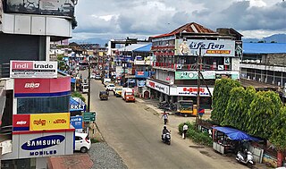
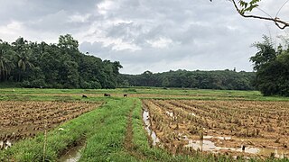
Palakkad is one of the 14 districts in the Indian state of Kerala. It was carved out from the southeastern region of the former Malabar District on 1 January 1957. It is located at the centre of Kerala. It is the largest district in the state since 2006. The city of Palakkad is the district headquarters. Palakkad is bordered on the northwest by the Malappuram district, on the southwest by the Thrissur district, on the northeast by Nilgiris district, and on the east by Coimbatore district of Tamil Nadu. The district is nicknamed "The granary of Kerala". Palakkad is the gateway to Kerala due to the presence of the Palakkad Gap, in the Western Ghats. The 2,383 m high Anginda peak, which is situated in the border of Palakkad district, Nilgiris district, and Malappuram district, in Silent Valley National Park, is the highest point of elevation in Palakkad district. Palakkad city is located just 50 km away from Coimbatore, a major city in Tamil Nadu state.
Erimayur is a gram panchayat in the Palakkad district, state of Kerala, India. It is a local government organization that serves the villages of Erimayur-I and Erimayur-II.
Kavassery is a gram panchayat in the Palakkad district, state of Kerala, India. It is a very local government organisation that serves the villages of Kavasseri-I and Kavasseri-II.
Kizhakkancherry is a gram panchayat in the Palakkad district, state of Kerala, India. It is a local government organisation that serves the villages of Kizhakkencheri-I and Kizhakkencheri-II. It was formed in the year of 1951 and is the fourth largest grama panchayath in Kerala. It covers an area of 112.56 km2 and comprises 22 wards. The boundaries are Vadakkencherry (north), Pananjeri (south), Vandazhy (east) and Kannambra (west). The village is located 37.4 km from the city of Palakkad and 34.9 km from Thrissur.
Vadakkencherry is a town and gram panchayat in the Palakkad district, state of Kerala, India. It is located about 35 km from Palakkad along National Highway 544.
Mannur is a village and gram panchayat in the Palakkad district, state of Kerala, India.
Ongallur-II is a census town in the Palakkad district, state of Kerala, India. It forms a part of Ongallur gram panchayat. According to Census 2011 Ongallur II has a population of 26,273 of which 12,924 are males while 13,349 are females.
Parli-I is a village in Palakkad district in the state of Kerala, India. Parli-I and Parli-II come under the administration of the Parli gram panchayat.
Parli-II is a village in Palakkad district in the state of Kerala, India. Parli-I and Parli-II come under the administration of the Parli gram panchayat.
Pirayiri is a residential and commercial area in Palakkad city.It is located about 8 km (5.0 mi) from the city centre.It belongs to Pirayiri gram panchayat in the Palakkad district, state of Kerala, India.
Puthuppariyaram is a suburb of Palakkad city in Palakkad District of Kerala,India. Puthuppariyaram lies on National Highway 966 and is located about 5 km from district headquarters and 124 km from Kozhikode. Puthuppariyaram Panchayat is one among the Panchayat which is supposed to be part of proposed Palakkad Municipal Corporation.

Vaniyamkulam-I is a town in the Palakkad district, state of Kerala, India. Together with Vaniyamkulam-II, it forms a part of the Vaniamkulam gram panchayat.
Kadampazhipuram is a gram panchayat in Palakkad district, state of Kerala, India. It is a local government organisation that serves the villages of Kadampazhipuram-I and Kadampazhipuram-II. The place is on the Palakkad - Cherpulassery Road.

Karimba is a gram panchayat in the Palakkad district, state of Kerala, India, near the National Highway 213. The largest town in Karimba panchayath is Kalladikode. It borders with Thachampara, Kongad, Katampazhipuram and Mundur. Recently, it was awarded the Nirmal Gram Title (sanitation). It is the local government organisation that serves the villages of Karimba-I and Karimba-II.
Karimpuzha is a gram panchayat in the Palakkad district, state of Kerala, India. It is a local government organisation that serves the villages of Karimpuzha-I and Karimpuzha-II.
Ongallur is a small town, gram panchayat in the Palakkad district, state of Kerala, India. It is a local government organisation serving the villages of Ongallur-I and Ongallur-II ongallur gramapanchayath have 2 village one is Vadanamkurussi P.O and two is Maruthur P.O Vadanamkurussi Pin code is 679121, maruthur Pincode is 679306.
Mundur is a town and gram panchayat in the Palakkad district, state of Kerala, India. Mundur is an important junction which connects National Highway 966 and State Highway 53. It is located about 11 km from Palakkad city and is one of the growing suburbs.
Kongad is a town and gram panchayat in Palakkad taluk, Kerala, India.It is a local government organisation that serves the villages of Kongad-I and Kongad-II.Kongad is located about 18 km from the district headquarters Palakkad.
Kuruvattoor is a village in Palakkad district in the state of Kerala, India. The village shares its borders with Kailiyad, Mundakottukurussi, Vallappuzha and Kanayam. The village comes under Vallapuzha Panchayat, Pattambi block and Pattambi Taluk. The village is encouraging arts and sports, especially football. Many clubs and local bodies create events for boosting cultural aspects.
Kallekkad is a suburb of the Palakkad city, Kerala, India. It is located about 9 km (5.6 mi) from the city centre along Palakkad Ponnani road. The Armed Reserve Police Camp of Palakkad district is located in Kallekkad.
