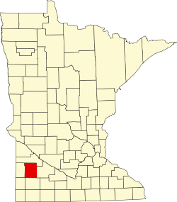
Amiret, Minnesota

Last updated
Amiret, Minnesota
USA Minnesota location map.svg
Red pog.svg
Amiret
Usa edcp location map.svg
Red pog.svg
Amiret
Coordinates: 44°19′00″N95°41′49″W / 44.31667°N 95.69694°W / 44.31667; -95.69694 Coordinates: 44°19′00″N95°41′49″W / 44.31667°N 95.69694°W / 44.31667; -95.69694
Country United States
State Minnesota
County Lyon
Township Amiret
Elevation
1,273 ft (388 m)
Time zone UTC-6 (Central (CST))
  Summer (DST) UTC-5 (CDT)
Area code(s) 507
GNIS feature ID639330 [1]

Amiret is an unincorporated community in Lyon County, in the U.S. state of Minnesota. [1]

History

Amiret was originally called Saratoga, after Saratoga, New York, [2] and under the latter name was platted in 1874. [3] The present name, adopted in 1879, is for Amiretta Sykes, the wife of a railroad official. [3]

The town's post office first opened under the name Coburg [3] in 1873. The name of the post office was changed to Amiret in 1878, and remained in operation until 1992. [4]

Historical population
CensusPop.
1880 46
U.S. Decennial Census [5]

Related Research Articles

Ghent, Minnesota City in Minnesota, United States

Ghent is a city in Lyon County, Minnesota, United States. The population was 370 at the 2010 census.

Tracy, Minnesota City in Minnesota, United States

Tracy is a city in Lyon County, Minnesota, United States. The population was 2,163 at the 2010 census.

Garden City, Minnesota Unincorporated community in Minnesota, US

Garden City is an unincorporated community and census-designated place (CDP) in Garden City Township, Blue Earth County, Minnesota, United States. Its population was 255 as of the 2010 census.

Miloma, Minnesota Unincorporated community in Minnesota, United States

Miloma is an unincorporated community located in Jackson County, Minnesota, United States at latitude 43.763 and longitude -95.368. The elevation is 1,427 feet. Miloma appears on the Heron Lake U.S. Geological Survey Map.

Imogene, Minnesota Unincorporated community in Minnesota, United States

Imogene is an unincorporated community located in Martin County in the U.S. state of Minnesota. The elevation is 1,129 feet. Imogene appears on the Granada U.S. Geological Survey Map.

Lake Tomahawk (CDP), Wisconsin Census-designated place in Wisconsin, United States

Lake Tomahawk is an unincorporated census-designated place located in the town of Lake Tomahawk, Oneida County, Wisconsin, United States. Lake Tomahawk is located on Wisconsin Highway 47 15 miles (24 km) northwest of Rhinelander. Lake Tomahawk has a post office with ZIP code 54539. As of the 2010 census, its population was 228.

Barronett, Barron County, Wisconsin Census-designated place in Wisconsin, United States

Barronett is an unincorporated census-designated place located in the town of Lakeland, Barron County, Wisconsin, United States. Barronett is located on U.S. Route 63 7.5 miles (12.1 km) north-northeast of Cumberland. Barronett has a post office with ZIP code 54813. As of the 2010 census, its population is 111.

Springbrook (community), Wisconsin Census-designated place in Wisconsin, United States

Springbrook is an unincorporated community and census-designated place located in the town of Springbrook, Washburn County, Wisconsin, United States. Springbrook is located on U.S. Route 63 13 miles (21 km) northeast of Spooner. Springbrook has a post office with ZIP code 54875. Its population was 76 in 2017.

Lawrence, Minnesota Ghost town in St. Lawrence Township, Minnesota, US

Lawrence is an extinct village in section 16 of St. Lawrence Township, Scott County, in the U.S. state of Minnesota. The GNIS classifies it as a populated place.

Blakeley, Minnesota Unincorporated community in Minnesota, United States

Blakeley is an unincorporated community in Blakeley Township, Scott County, Minnesota, United States, along the Minnesota River. The community is located west-southwest of Belle Plaine near the junction of Scott County Roads 1, 6, and 60.

Burchard, Minnesota Unincorporated community in Minnesota, United States

Burchard is an unincorporated community in Lyon County, in the U.S. state of Minnesota.

Burr, Minnesota Unincorporated community in Minnesota, United States

Burr is an unincorporated community in Florida Township, Yellow Medicine County, in the U.S. state of Minnesota.

Cambria, Minnesota Unincorporated community in Minnesota, US

Cambria is an unincorporated community in Blue Earth County, in the U.S. state of Minnesota.

Dudley, Minnesota Unincorporated community in Minnesota, United States

Dudley is an unincorporated community in Lyon County, in the U.S. state of Minnesota.

Guckeen, Minnesota Unincorporated community in Minnesota, United States

Guckeen is an unincorporated community in Faribault County, in the U.S. state of Minnesota.

Judson, Minnesota Unincorporated community in Minnesota, US

Judson is an unincorporated community in Blue Earth County, in the U.S. state of Minnesota.

Marna, Minnesota Unincorporated community in Minnesota, United States

Marna is an unincorporated community in Faribault County, in the U.S. state of Minnesota.

Grogan, Minnesota Unincorporated community in Minnesota, United States

Grogan is an unincorporated community in Watonwan County, in the U.S. state of Minnesota.

Merriam, Minnesota Ghost town in Minnesota, United States

Merriam was a town in Scott County, in the U.S. state of Minnesota. The town has since been closed altogether.

Perth, Minnesota Unincorporated community in Minnesota, US

Perth is an unincorporated community in Blue Earth County, in the U.S. state of Minnesota.

References

  1. 1 2 U.S. Geological Survey Geographic Names Information System: Amiret, Minnesota
  2. Chicago and North Western Railway Company (1908). A History of the Origin of the Place Names Connected with the Chicago & North Western and Chicago, St. Paul, Minneapolis & Omaha Railways. p. 37.
  3. 1 2 3 Upham, Warren (1920). Minnesota Geographic Names: Their Origin and Historic Significance. Minnesota Historical Society. p. 311.
  4. "Lyon County". Jim Forte Postal History. Retrieved 17 February 2015.
  5. United States Census Bureau. "Census of Population and Housing".