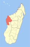
Andabotoka is a town and commune (Malagasy: kaominina) in western Madagascar. It belongs to the district of Maintirano, which is a part of Melaky Region. The population of the commune was estimated to be approximately 5,000 in 2001 commune census.[2]
Only primary schooling is available. The majority 85% of the population of the commune are farmers, while an additional 13% receives their livelihood from raising livestock. The most important crop is rice, while other important products are wheat, maize and cassava. Services provide employment for 2% of the population.[2]
Bemanevika is a town and commune in northern Madagascar. It belongs to the district of Sambava, which is a part of Sava Region. The population of the commune was estimated to be approximately 13,000 in 2001 commune census.
Antindra is a municipality in northern Madagascar. It belongs to the district of Sambava, which is a part of Sava Region. The population of the commune was estimated to be approximately 16,000 in 2001 commune census.
Tsinjomitondraka is a town and commune in Madagascar. It belongs to the district of Boriziny, which is a part of Sofia Region. The population of the commune was estimated to be approximately 11,000 in 2001 commune census.
Bebakony Sud is a town and commune in western Madagascar. It belongs to the district of Maintirano, which is a part of Melaky Region. The population of the commune was estimated to be approximately 7,000 in 2001 commune census.
Ampasimazava is a town and commune in Madagascar. It belongs to the district of Vavatenina, which is a part of Analanjirofo Region. The population of the commune was estimated to be approximately 10,000 in 2001 commune census.
Beroy Sud is a town and commune in southwestern Madagascar. It belongs to the district of Ampanihy, which is a part of Atsimo-Andrefana Region. The population of the commune was estimated to be approximately 15,000 in 2001 commune census.
Vohitany is a town and commune in southwestern Madagascar. It belongs to the district of Ampanihy, which is a part of Atsimo-Andrefana Region. The population of the commune was estimated to be approximately 10,000 in 2001 commune census.
Beantake is a town and commune in southwest Madagascar. It belongs to the district of Betioky Sud, which is a part of Atsimo-Andrefana Region. The population of the commune was estimated to be approximately 18,000 in 2001 commune census.
Vatolatsaka is a town and commune in southwest Madagascar. It belongs to the district of Betioky Sud, which is a part of Atsimo-Andrefana Region. The population of the commune was estimated to be approximately 14,000 in 2001 commune census.
Andranovory is a town and commune in Madagascar. It belongs to the district of Toliara II, which is a part of Atsimo-Andrefana Region. The population of the commune was estimated to be approximately 31,000 in 2001 commune census.
Antanimena is a municipality in Madagascar. It belongs to the district of Toliara II, which is a part of Atsimo-Andrefana Region. The population of the commune was estimated to be approximately 4,000 in 2001 commune census.
Mihavatsy is a town and commune in Madagascar. It belongs to the district of Sakaraha, which is a part of Atsimo-Andrefana Region. The population of the commune was estimated to be approximately 3,000 in 2001 commune census.
Miary Taheza is a town and commune in Madagascar. It belongs to the district of Sakaraha, which is a part of Atsimo-Andrefana Region. The population of the commune was estimated to be approximately 10,000 in 2001 commune census.
Manandroy is a rural municipality in Madagascar. It belongs to the district of Ambohimahasoa, which is a part of Haute Matsiatra Region. The population of the commune was estimated to be approximately 11,000 in 2001 commune census.
Marovato Befeno is a town and commune in Madagascar. It belongs to the district of Ambovombe, which is a part of Androy Region. The population of the commune was estimated to be approximately 60,000 in 2001 commune census.
Marolinta is a town and commune in Madagascar. It belongs to the district of Beloha, which is a part of Androy Region.
Ambalaroka is a town and commune in Madagascar. It belongs to the district of Manakara, which is a part of Vatovavy-Fitovinany Region. The population of the commune was estimated to be approximately 22,000 in 2001 commune census.
Vohimasina Nord is a town and commune in Madagascar. It belongs to the district of the district of Manakara Atsimo., which is a part of the region of Fitovinany. The population of the commune was estimated to be approximately 22,000 in 2001 commune census.
Merikanjaka is a town and commune in Madagascar. It belongs to the district of Manjakandriana, which is a part of Analamanga Region. The population of the commune was estimated to be approximately 8,000 in 2001 commune census.
Antsahalalina is a rural municipality in Madagascar. It belongs to the district of Manjakandriana, which is a part of Analamanga Region. The population of the commune was estimated to be approximately 4,000 in 2001 commune census.
This page is based on this Wikipedia article Text is available under the CC BY-SA 4.0 license; additional terms may apply. Images, videos and audio are available under their respective licenses.