Bebakony Sud is a town and commune (Malagasy: kaominina) in western Madagascar. It belongs to the district of Maintirano, which is a part of Melaky Region. The population of the commune was estimated to be approximately 7,000 in 2001 commune census.[2]
Bebakony Sud has a maritime harbour. Only primary schooling is available. The majority 65% of the population of the commune are farmers, while an additional 30% receives their livelihood from raising livestock. The most important crop is rice, while other important products are wheat, seeds of catechu, barley and raffia palm. Additionally fishing employs 5% of the population.[2]
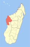
Ambolodia Sud or Ambolodia Atsimo is a town and commune in western Madagascar. It belongs to the district of Besalampy, which is a part of Melaky Region. The population of the commune was estimated to be approximately 2,000 in 2001 commune census.
Antsahidoha Bebao or Antsaidoha-Bebao is a town and commune in western Madagascar. It belongs to the district of Maintirano, which is a part of Melaky Region. The population of the commune was estimated to be approximately 9,000 in 2001 commune census.
Anontsibe Centre or Anontsibe Sakalava is a town and commune in Madagascar. It belongs to the district of Manja, which is a part of Menabe Region. The population of the commune was estimated to be approximately 10,000 in 2001 commune census.
Beroy Sud is a town and commune in southwestern Madagascar. It belongs to the district of Ampanihy, which is a part of Atsimo-Andrefana Region. The population of the commune was estimated to be approximately 15,000 in 2001 commune census.
Montifeno or Montofeno is a town and commune in southwest Madagascar. It belongs to the district of Betioky Sud, which is a part of Atsimo-Andrefana Region. The population of the commune was estimated to be approximately 1,000 in 2001 commune census.
Andranomangatsiaka is a town and commune in southwest Madagascar. It belongs to the district of Betioky Sud, which is a part of Atsimo-Andrefana Region. The population of the commune was estimated to be approximately 10,000 in 2001 commune census.
Antohabato is a town and commune in southwest Madagascar. It belongs to the district of Betioky Sud, which is a part of Atsimo-Andrefana Region. The population of the commune was estimated to be approximately 7,000 in 2001 commune census.
Beantake is a town and commune in southwest Madagascar. It belongs to the district of Betioky Sud, which is a part of Atsimo-Andrefana Region. The population of the commune was estimated to be approximately 18,000 in 2001 commune census.
Belamoty is a town and commune in southwest Madagascar. It belongs to the district of Betioky Sud, which is a part of Atsimo-Andrefana Region. The population of the commune was estimated to be approximately 19,000 in 2001 commune census.
Fenoandala is a town and commune in southwest Madagascar. It belongs to the district of Betioky Sud, which is a part of Atsimo-Andrefana Region. The population of the commune was estimated to be approximately 4,000 in 2001 commune census.
Lazarivo is a town and commune in southwest Madagascar. It belongs to the district of Betioky Sud, which is a part of Atsimo-Andrefana Region. The population of the commune was estimated to be approximately 17,000 in 2001 commune census.
Manalobe is a town and commune in southwest Madagascar. It belongs to the district of Betioky Sud, which is a part of Atsimo-Andrefana Region. The population of the commune was estimated to be approximately 4,000 in 2001 commune census.
Masiaboay is a town and commune in southwest Madagascar. It belongs to the district of Betioky Sud, which is a part of Atsimo-Andrefana Region. The population of the commune was estimated to be approximately 10,000 in 2001 commune census.
Salobe is a town and commune in southwest Madagascar. It belongs to the district of Betioky Sud, which is a part of Atsimo-Andrefana Region. The population of the commune was estimated to be approximately 9,000 in 2001 commune census.
Soaserana is a town and commune in southwest Madagascar. It belongs to the district of Betioky Sud, which is a part of Atsimo-Andrefana Region. The population of the commune was estimated to be approximately 8,000 in 2001 commune census.
Tameantsoa is a rural municipality in southwest Madagascar. It belongs to the district of Betioky Atsimo, which is a part of Atsimo-Andrefana Region and is crossed by the Onilahy River and the Route nationale 10.
Vatolatsaka is a town and commune in southwest Madagascar. It belongs to the district of Betioky Sud, which is a part of Atsimo-Andrefana Region. The population of the commune was estimated to be approximately 14,000 in 2001 commune census.
Marerano is a town and commune in Madagascar. It belongs to the district of Beroroha, which is a part of Atsimo-Andrefana Region. The population of the commune was estimated to be approximately 4,000 in 2001 commune census.
Marolinta is a town and commune in Madagascar. It belongs to the district of Beloha, which is a part of Androy Region.
Tranovaho is a town and commune in Madagascar. It belongs to the district of Beloha, which is a part of Androy Region. The population of the commune was estimated to be approximately 13,000 in 2001 commune census.
This page is based on this Wikipedia article Text is available under the CC BY-SA 4.0 license; additional terms may apply. Images, videos and audio are available under their respective licenses.