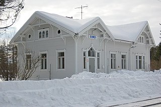
Simo is a municipality located in the province of Lapland, Finland, about 50 kilometres (30 mi) from the Swedish border.

Alajärvi is a town and municipality of Finland. It is located in the South Ostrobothnia region. The town has a population of 9,321 and covers an area of 1,056.74 square kilometres (408.01 sq mi) of which 47.99 km2 (18.53 sq mi) is water. The population density is 9.24 inhabitants per square kilometre (23.9/sq mi). The town is unilingually Finnish; there are few immigrants.

Alavus is a town and municipality of Finland. It is located in the province of Western Finland and is part of the Southern Ostrobothnia region, 52 kilometres (32 mi) southeast of Seinäjoki, 138 kilometres (86 mi) north of Tampere and 319 kilometres (198 mi) north of Helsinki. The town has a population of 11,198 and covers an area of 1,151.46 square kilometres (444.58 sq mi) of which 52.31 km2 (20.20 sq mi) is water. The population density is 14.17 inhabitants per square kilometre (36.7/sq mi). Neighbouring municipalities are Alajärvi, Kuortane, Seinäjoki, Virrat and Ähtäri.
Askola is a municipality of Finland. It is located in the Uusimaa region. The municipality has a population of 4,847 and covers an area of 218.03 square kilometres (84.18 sq mi) of which 5.61 km2 (2.17 sq mi) is water. The population density is 22.82 inhabitants per square kilometre (59.1/sq mi). Monninkylä is the largest village of municipality in terms of population. Neighbouring municipalities are Myrskylä, Mäntsälä, Pornainen, Porvoo and Pukkila.

Kankaanpää is a town and municipality of Finland. Kankaanpää was founded in 1865, became a township in 1967 and finally a town in 1972. It is located in the crossroads of Hämeenkangas and Pohjankangas ridges. It belongs to the region of Satakunta. Kankaanpää has a population of about 12,700 inhabitants, which make it the third largest municipality in the Satakunta region in terms of population, after the city of Pori and the town of Rauma. Pori is located 53 kilometres (33 mi) southwest of Kankaanpää.

Hailuoto is a Finnish island in the northern Baltic Sea and a municipality in Northern Ostrobothnia region. The population of Hailuoto is 949, which make it the smallest municipality in Northern Ostrobothnia and the former Oulu Province in terms of population. The municipality covers an area of 200.53 km2 (77.43 sq mi) of which 1.70 km2 (0.66 sq mi) is inland water. The population density is 4.73/km2 (12.3/sq mi). Of all the Finnish sea islands, Hailuoto is the third largest after Fasta Åland and Kimitoön.

Halikko is a former municipality of Finland that existed until December 31, 2008. On January 1, 2009, the municipality was merged with the larger neighboring Salo. Before the merge Halikko had become a rapidly urbanizing rural area.

Ilomantsi is municipality and a village of Finland. It is located in the North Karelia region. The municipality has a population of 4,646 and covers an area of 3,172.69 square kilometres (1,224.98 sq mi) of which 409.01 km2 (157.92 sq mi) is water. The population density is 1.68 inhabitants per square kilometre (4.4/sq mi). The most eastern point of Finland and of the continental part of the European Union is located in Ilomantsi near the village of Hattuvaara.

Kannonkoski is a municipality of Finland.
Kaskinen is a town, municipality and island of Finland. It is located in the province of Western Finland and is part of the Ostrobothnia region. The population of Kaskinen is 1,288 and the municipality covers an area of 10.49 km2 (4.05 sq mi) of which 0.16 km2 (0.062 sq mi) is inland water. The population density is 122.78/km2 (318.0/sq mi). The population is bilingual with a majority speaking Finnish (68%) and the minority Swedish (28%).

Kimito is a former municipality of Finland. On January 1, 2009, it was consolidated with Dragsfjärd and Västanfjärd to form the new municipality of Kimitoön. Prior to the consolidation, it was one of the four municipalities located on Kimito island, the other three being Västanfjärd, Dragsfjärd and Halikko.

Lemi is a municipality of Finland. It is located in the South Karelia region. The municipality has a population of 2,917, which make it the smallest municipality in South Karelia in terms of population. It covers an area of 262.48 square kilometres (101.34 sq mi) of which 44.71 km2 (17.26 sq mi) is water. The population density is 13.39 inhabitants per square kilometre (34.7/sq mi).

Loppi is a municipality in Finland. It is located in the province of Southern Finland and is part of the Tavastia Proper region, located about 50 kilometers south of the city of Hämeenlinna. Loppi was founded in 1632. The municipality has a population of 7,790 and covers an area of 655.97 square kilometres (253.27 sq mi) of which 58.36 km2 (22.53 sq mi) is water. The population density is 13.04 inhabitants per square kilometre (33.8/sq mi). The municipality is unilingually Finnish.
Luumäki is a municipality of Finland. Its seat is in the Taavetti village. It is located in the province of Southern Finland and is part of the South Karelia region. The municipality has a population of 4,476 (31 December 2021) and covers an area of 859.83 square kilometres (331.98 sq mi) of which 109.77 km2 (42.38 sq mi) is water. The population density is 5.97 inhabitants per square kilometre (15.5/sq mi). The municipality is unilingually Finnish.

Raisio is a town and municipality in south-western Finland and an important junction of major roads. The town has a population of 24,818 and is located in the region of Southwest Finland, neighbouring the region's capital, Turku. The town's land area is 48.76 km2 (18.83 sq mi), and has about 5 kilometres (3 mi) of coastline to the Bay of Raisio on its southern tip.
Siuntio is a municipality of Finland. It is located in the province of Southern Finland, 46 kilometres (29 mi) west of Helsinki, and is part of the Uusimaa region. The municipality has a population of 6,198 and covers an area of 266.12 square kilometres (102.75 sq mi) of which 24.96 km2 (9.64 sq mi) is water. The population density is 25.7 inhabitants per square kilometre (67/sq mi).

Uurainen is a municipality of Finland.

Pargas is a town and municipality of Finland, in the Archipelago Sea, the biggest archipelago in the world by the number of islands, 50,000. The big limestone mine in Pargas is the base of the main industry and except for the central parts, the municipality is still mostly rural.

Kimitoön is a municipality and island of Finland. It was created on 1 January 2009, when the municipalities of Dragsfjärd, Kimito and Västanfjärd were consolidated into a single municipality.

Pihlajavesi is a town and a former municipality of Finland, which in 1969 was merged into the municipality of Keuruu, located in the Central Finland region.