{{lang|sv|Velkua kommun}}"},"native_name":{"wt":""},"native_name_lang":{"wt":""},"settlement_type":{"wt":"[[Municipalities of Finland|Former municipality]]"},"image_skyline":{"wt":""},"image_alt":{"wt":""},"image_caption":{"wt":""},"image_flag":{"wt":""},"flag_alt":{"wt":""},"image_seal":{"wt":""},"seal_alt":{"wt":""},"image_shield":{"wt":"Velkua.vaakuna.svg"},"shield_alt":{"wt":""},"nickname":{"wt":""},"motto":{"wt":""},"image_map":{"wt":"Velkua.sijainti.suomi.2008.svg"},"map_alt":{"wt":""},"map_caption":{"wt":""},"pushpin_map":{"wt":""},"pushpin_label_position":{"wt":"right"},"pushpin_map_alt":{"wt":""},"pushpin_map_caption":{"wt":"Location within Finland"},"coordinates":{"wt":""},"coor_pinpoint":{"wt":""},"coordinates_footnotes":{"wt":""},"subdivision_type":{"wt":"[[List of sovereign states|Country]]"},"subdivision_name":{"wt":"[[Finland]]"},"subdivision_type1":{"wt":"[[Provinces of Finland|Province]]"},"subdivision_name1":{"wt":"[[Western Finland]]"},"subdivision_type2":{"wt":"[[Regions of Finland|Region]]"},"subdivision_name2":{"wt":"[[Southwest Finland]]"},"subdivision_type3":{"wt":"[[Sub-regions of Finland|Sub-region]]"},"subdivision_name3":{"wt":"[[Turku sub-region|Turku]]"},"established_title":{"wt":""},"established_date":{"wt":""},"extinct_title":{"wt":"Merged with [[Naantali]]"},"extinct_date":{"wt":"January 1, 2009"},"founder":{"wt":""},"named_for":{"wt":""},"seat_type":{"wt":""},"seat":{"wt":""},"government_footnotes":{"wt":""},"leader_party":{"wt":""},"leader_title":{"wt":"[[City manager]]"},"leader_name":{"wt":"Tiina Rinne-Kylänpää"},"unit_pref":{"wt":"Metric"},"area_footnotes":{"wt":""},"area_total_km2":{"wt":"31.21"},"area_land_km2":{"wt":"31.08"},"area_water_km2":{"wt":"0.13"},"area_rank":{"wt":"[[List of Finnish municipalities by area|427th]]"},"area_note":{"wt":""},"elevation_footnotes":{"wt":""},"elevation_m":{"wt":""},"population_footnotes":{"wt":""},"population_total":{"wt":"233"},"population_as_of":{"wt":"2003"},"population_rank":{"wt":"[[List of Finnish municipalities by population|431st]]"},"population_density_km2":{"wt":"auto"},"population_demonym":{"wt":""},"population_note":{"wt":"−2.9 % change"},"blank_name":{"wt":"Official [[language]]s"},"blank_info":{"wt":"[[Finnish language|Finnish]]"},"blank1_name":{"wt":"[[Urbanisation]]"},"blank1_info":{"wt":"0.0%"},"blank2_name":{"wt":"[[Unemployment]] rate"},"blank2_info":{"wt":"10.3%"},"timezone":{"wt":"[[Eastern European Time|EET]]"},"utc_offset":{"wt":"+2"},"timezone_DST":{"wt":"[[Eastern European Summer Time|EEST]]"},"utc_offset_DST":{"wt":"+3"},"postal_code_type":{"wt":""},"postal_code":{"wt":""},"area_code_type":{"wt":""},"area_code":{"wt":""},"website":{"wt":"http://www.velkua.fi/"},"footnotes":{"wt":""}},"i":0}}]}" id="mwAg">Former municipality in Western Finland, Finland
Velkua | |
---|---|
Velkuan kunta Velkua kommun | |
![]() | |
Country | Finland |
Province | Western Finland |
Region | Southwest Finland |
Sub-region | Turku |
Merged with Naantali | January 1, 2009 |
Government | |
• City manager | Tiina Rinne-Kylänpää |
Area | |
• Total | 31.21 km2 (12.05 sq mi) |
• Land | 31.08 km2 (12.00 sq mi) |
• Water | 0.13 km2 (0.05 sq mi) |
• Rank | 427th |
Population (2003) | |
• Total | 233 |
• Rank | 431st |
• Density | 7.5/km2 (19/sq mi) |
−2.9 % change | |
Time zone | UTC+2 (EET) |
• Summer (DST) | UTC+3 (EEST) |
Official languages | Finnish |
Urbanisation | 0.0% |
Unemployment rate | 10.3% |
Website | http://www.velkua.fi/ |
Velkua (Finnish pronunciation: [ˈʋelkuɑ] ) is a former municipality of Finland. It was, together with Merimasku and Rymättylä, consolidated with the town of Naantali on January 1, 2009.
It is part of the Southwest Finland region. The municipality had a population of 245 (2005-12-31) and covered an area of 30.07 km² (excluding sea) of which 0.13 km² is inland water. The population density was 8,1 inhabitants per km².
The municipality was unilingually Finnish.
The village of Palva, located on the homonymous island, was mentioned already in 1469. Its name may refer to a place where meat and fish were cured by hunters or to a site of worship. Palva was the original center of the area, becoming a separate chapel community in 1793, when it was a part of the Taivassalo parish. In the 19th century, the name Velkua began appearing for the chapel community after the largest island in it: Velkua or Velkuanmaa. A densely populated village on the island of Velkua, Velkuankaupunki, was established in the 19th century.
The municipality was established in the 1860s and Velkua had become the predominant name. Velkua became a separate parish in 1917. [1]
Velkua was consolidated with Naantali in 2009.
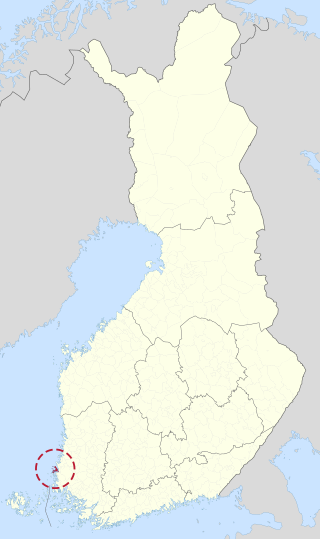
Askainen is a former municipality of Finland. Together with Lemu, it was consolidated with Masku on January 1, 2009.
Töysä is a former municipality in Western Finland. It was consolidated to Alavus on 1 January 2013. It is part of the Southern Ostrobothnia region. The municipality had a population of 3,122 and covered an area of 309.66 square kilometres (119.56 sq mi) of which 11.91 km2 (4.60 sq mi) was water. The population density is 10.4853/km2 (27.157/sq mi). Most inhabitants speak Finnish, with hardly any other languages being spoken.
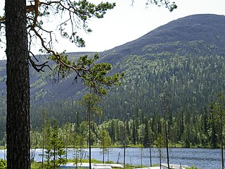
Kolari is a municipality of Finland at the Swedish border, which follows the Torne River, the longest free-flowing river in Europe.
Jyväskylän maalaiskunta, 'The Rural Municipality of Jyväskylä' is a former municipality of Finland. Together with Korpilahti, Jyväskylän maalaiskunta was consolidated with Jyväskylä on 1 January 2009. It was the last municipality to carry the name maalaiskunta.
Kisko is a former municipality of Finland. It was consolidated with Salo on 1 January 2009.
Hämeenkoski is a former municipality of Finland. It was merged to the municipality of Hollola on 1 January 2016.
Masku is a municipality of Finland. It is located in the province of Western Finland and is part of the Southwest Finland region. The municipality, which is located about 17 kilometres (11 mi) just north of Turku, has a population of 9,624 (28 February 2023) and covers an area of 204.01 square kilometres (78.77 sq mi) of which 29.21 km2 (11.28 sq mi) is water. The population density is 55.03 inhabitants per square kilometre (142.5/sq mi).
Merimasku is a former municipality of Finland. It was, together with Rymättylä and Velkua, consolidated with the town of Naantali on January 1, 2009.
Naantali is a town in Southwest Finland, and, as a resort town during the summer, an important centre of tourism in the country. The municipality has a population of 19,882 (28 February 2023), and is located 14 kilometres (8.7 mi) west of Turku.
Piippola is a village and a former municipality of Finland.
Suomusjärvi is a former municipality of Finland. It was consolidated with Salo on January 1, 2009.
Taivassalo is a municipality of Finland, about 50 kilometres (31 mi) from the city of Turku. It is located in the Southwest Finland region. The municipality has a population of 1,691 and covers an area of 217.68 square kilometres (84.05 sq mi) of which 77.23 km2 (29.82 sq mi) is water. The population density is 12.04 inhabitants per square kilometre (31.2/sq mi).
Koskenpää is a village and former municipality of Finland in the Central Finland region. It was consolidated with Jämsänkoski in 1969, which in turn was consolidated with Jämsä in 2009.
Karhula is a former market town (kauppala) and a former municipality of Finland in the former Kymi Province, now in the Kymenlaakso region. It was consolidated with the town of Kotka in 1977. Its seat was in Helilä, however the municipality was named after the industrial area of Karhula.
Angelniemi is a former municipality of Finland. It became part of Halikko in 1967. It was located on partly on the continent by the Halikonlahti Bay and partly on Kimito Island and is still nowadays the only part of the island where Finnish is the primary language. Today the population of the area is 398, but it rises during the summer because of the summer cottages.
Ahlainen is a former municipality in the province of Satakunta, Finland. It was annexed with the city of Pori in 1972. Population of Ahlainen was 2,445 in 1971.
Konginkangas is a settlement and former municipality of Finland in the Central Finland region. It was consolidated with Äänekoski in 1993.
Simpele is a built-up area and a former municipality of Finland in the South Karelia region, originally in the Viipuri Province and after the Second World War, the Kymi Province. It was consolidated with Rautjärvi in 1973, becoming its new administrative center.
Pyhämaa is a village and a former municipality of Finland in the former Turku and Pori Province, now in the Finland Proper region. It was consolidated with the town of Uusikaupunki in 1974.
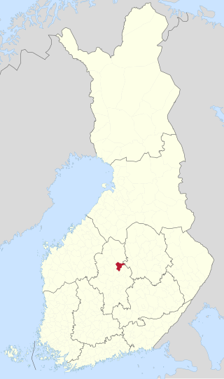
Oravasaari is a district of Jyväskylä and a village in Central Finland. Before 2009, it was a part of Jyväskylän maalaiskunta. It is located in the southeastern part of Jyväskylä near Toivakka and between the major lakes Päijänne and Leppävesi. The direct distance to central Jyväskylä is about 12 km, while the distance to Vaajakoski is about 10 km.
Media related to Velkua at Wikimedia Commons
60°28′N021°40′E / 60.467°N 21.667°E