Ankaraobato, Marovoay

Last updated
Ankaraobato
Madagascar location map.svg
Red pog.svg
Ankaraobato
Location in Madagascar
Coordinates: 16°21′S46°11′E / 16.350°S 46.183°E / -16.350; 46.183
CountryFlag of Madagascar.svg  Madagascar
Region Boeny
District Marovoay
Elevation [1] 135 m (443 ft)
Population (2001) [2]
  Total 7,000
Time zone EAT (UTC3)

Ankaraobato is a town and commune (Malagasy : kaominina) in Madagascar. It belongs to the district of Marovoay, which is a part of Boeny Region. The population of the commune was estimated to be approximately 7,000 in 2001 commune census. [2]

Malagasy is an Austronesian language and the national language of Madagascar. Most people in Madagascar speak it as a first language as do some people of Malagasy descent elsewhere.

Madagascar island nation off the coast of Southeast Africa, in the Indian Ocean

Madagascar, officially the Republic of Madagascar, and previously known as the Malagasy Republic, is an island country in the Indian Ocean, approximately 400 kilometres off the coast of East Africa. The nation comprises the island of Madagascar and numerous smaller peripheral islands. Following the prehistoric breakup of the supercontinent Gondwana, Madagascar split from the Indian subcontinent around 88 million years ago, allowing native plants and animals to evolve in relative isolation. Consequently, Madagascar is a biodiversity hotspot; over 90% of its wildlife is found nowhere else on Earth. The island's diverse ecosystems and unique wildlife are threatened by the encroachment of the rapidly growing human population and other environmental threats.

Districts of Madagascar

Districts are second-level administrative divisions of Madagascar below the regions. There are 114 districts in Madagascar. Districts are in their turn divided into communes; while some of the districts in urban areas and offshore islands each consist of only one commune, most of the districts are divided typically into 5–20 communes.

Only primary schooling is available. The majority 60% of the population of the commune are farmers, while an additional 29% receives their livelihood from raising livestock. The most important crop is rice, while other important products are bananas and maize. Services provide employment for 1% of the population. Additionally fishing employs 10% of the population. [2]

Rice cereal grain and seed of Oryza sativa

Rice is the seed of the grass species Oryza sativa or Oryza glaberrima. As a cereal grain, it is the most widely consumed staple food for a large part of the world's human population, especially in Asia. It is the agricultural commodity with the third-highest worldwide production, after sugarcane and maize.

Banana edible fruit

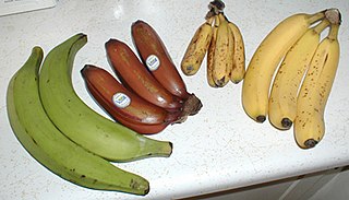
A banana is an edible fruit – botanically a berry – produced by several kinds of large herbaceous flowering plants in the genus Musa. In some countries, bananas used for cooking may be called "plantains", distinguishing them from dessert bananas. The fruit is variable in size, color, and firmness, but is usually elongated and curved, with soft flesh rich in starch covered with a rind, which may be green, yellow, red, purple, or brown when ripe. The fruits grow in clusters hanging from the top of the plant. Almost all modern edible seedless (parthenocarp) bananas come from two wild species – Musa acuminata and Musa balbisiana. The scientific names of most cultivated bananas are Musa acuminata, Musa balbisiana, and Musa × paradisiaca for the hybrid Musa acuminata × M. balbisiana, depending on their genomic constitution. The old scientific name Musa sapientum is no longer used.

Maize Cereal grain

Maize, also known as corn, is a cereal grain first domesticated by indigenous peoples in southern Mexico about 10,000 years ago. The leafy stalk of the plant produces pollen inflorescences and separate ovuliferous inflorescences called ears that yield kernels or seeds, which are fruits.

References and notes

  1. Estimated based on DEM data from Shuttle Radar Topography Mission
  2. 1 2 3 "ILO census data". Cornell University. 2002. Retrieved 2008-03-02.

Coordinates: 16°21′S46°11′E / 16.350°S 46.183°E / -16.350; 46.183

Geographic coordinate system Coordinate system

A geographic coordinate system is a coordinate system that enables every location on Earth to be specified by a set of numbers, letters or symbols. The coordinates are often chosen such that one of the numbers represents a vertical position and two or three of the numbers represent a horizontal position; alternatively, a geographic position may be expressed in a combined three-dimensional Cartesian vector. A common choice of coordinates is latitude, longitude and elevation. To specify a location on a plane requires a map projection.


Related Research Articles

Marosakoa Place in Boeny, Madagascar

Marosakoa is a town and commune in western Madagascar over the Mozambique Channel. It is approximately 35 kilometres south of Mahajanga. It belongs to the district of Marovoay, which is a part of Boeny Region. The population of the commune was estimated to be approximately 10,000 in 2001 commune census.

Zazafotsy Place in Ihorombe, Madagascar

Zazafotsy is a town and commune in Madagascar. It belongs to the district of Ihosy, which is a part of Ihorombe Region. The population of the commune was estimated to be approximately 10,000 in 2001 commune census.

Andreba Place in Sofia, Madagascar

Andreba is a town and commune in Madagascar. It belongs to the district of Antsohihy, which is a part of Sofia Region. The population of the commune was estimated to be approximately 13,000 in 2001 commune census. It on the shore of Lake Alaotra.

Ankazomborona Place in Boeny, Madagascar

Ankazomborona is a town and commune in Madagascar. It belongs to the district of Marovoay, which is a part of Boeny Region. The population of the commune was estimated to be approximately 25,000 in 2001 commune census.

Anosinalainolona Place in Boeny, Madagascar

Anosinalainolona is a town and commune in Madagascar. It belongs to the district of Marovoay, which is a part of Boeny Region. The population of the commune was estimated to be approximately 4,000 in 2001 commune census.

Bemaharivo Place in Boeny, Madagascar

Bemaharivo is a town and commune in Madagascar. It belongs to the district of Marovoay, which is a part of Boeny Region in Mahajanga Province. The population of the commune was estimated to be approximately 9,000 in 2001 commune census.

Manaratsandry Place in Boeny, Madagascar

Manaratsandry is a town and commune in Madagascar. It belongs to the district of Marovoay, which is a part of Boeny Region. The population of the commune was estimated to be approximately 20,000 in 2001 commune census.

Ambato Ambarimay Place in Boeny, Madagascar

Ambato Ambarimay is a town and commune in Madagascar. It belongs to the district of Ambato-Boeni, which is a part of Boeny Region. The population of the commune was estimated to be approximately 35,000 in 2001 commune census.

Andranofasika Place in Boeny, Madagascar

Andranofasika is a town and commune in Madagascar. It belongs to the district of Ambato-Boeni, which is a part of Boeny Region. The population of the commune was estimated to be approximately 8,000 in 2001 commune census.

Anjiajia Place in Boeny, Madagascar

Anjiajia is a town and commune in Madagascar. It belongs to the district of Ambato-Boeni, which is a part of Boeny Region. The population of the commune was estimated to be approximately 13,000 in 2001 commune census.

Ankijabe Place in Boeny, Madagascar

Ankijabe is a town and commune in Madagascar. It belongs to the district of Ambato-Boeni, which is a part of Boeny Region. The population of the commune was estimated to be approximately 19,000 in 2001 commune census.

Antanimbary Place in Betsiboka, Madagascar

Antanimbary is a town and commune in Madagascar. It belongs to the district of Maevatanana, which is a part of Betsiboka Region. The population of the commune was estimated to be approximately 3,000 in 2001 commune census.

Tsararano, Maevatanana Place in Betsiboka, Madagascar

Tsararano is a town and commune in Madagascar. It belongs to the district of Maevatanana, which is a part of Betsiboka Region. The population of the commune was estimated to be approximately 10,000 in 2001 commune census.

Maintsokely Place in Alaotra-Mangoro, Madagascar

Maintsokely is a town and commune in Madagascar. It belongs to the district of Andilamena, which is a part of Alaotra-Mangoro Region. The population of the commune was estimated to be approximately 4,000 in 2001 commune census.

Ampary Place in Itasy, Madagascar

Ampary is a town and commune in Madagascar. It belongs to the district of Soavinandriana, which is a part of Itasy Region. The population of the commune was estimated to be approximately 9,000 in 2001 commune census.

Ambia, Ihosy Place in Ihorombe, Madagascar

Ambia is a town and commune in Madagascar. It belongs to the district of Ihosy, which is a part of Ihorombe Region. The population of the commune was estimated to be approximately 5,000 in 2001 commune census.

Fanjakana, Fianarantsoa II Place in Haute Matsiatra, Madagascar

Fanjakana is a town and commune in Madagascar. It belongs to the district of Fianarantsoa II, which is a part of Haute Matsiatra Region. The population of the commune was estimated to be approximately 10,000 in 2001 commune census.

Sihanamaro Place in Androy, Madagascar

Sihanamaro is a town and commune in Madagascar. It belongs to the district of Ambovombe, which is a part of Androy Region. The population of the commune was estimated to be approximately 10,000 in 2001 commune census.

Mahaly Place in Anosy, Madagascar

Mahaly is a town and commune in Madagascar. It belongs to the district of Amboasary Sud, which is a part of Anosy Region. The population of the commune was estimated to be approximately 11,000 in 2001 commune census.

Maromby Place in Anosy, Madagascar

Maromby is a town and commune in Madagascar. It belongs to the district of Amboasary Sud, which is a part of Anosy Region. The population of the commune was estimated to be approximately 12,000 in 2001 commune census.