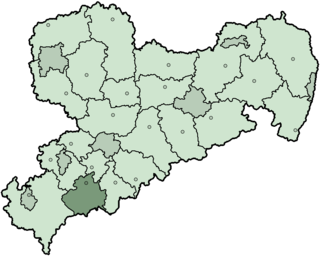
Aue-Schwarzenberg is a former district in the Free State of Saxony, Germany. It was bounded by the Czech Republic and the districts of Vogtlandkreis, Zwickauer Land, Stollberg and Annaberg.
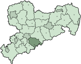
The Mittlerer Erzgebirgskreis is a former district in the Free State of Saxony, Germany. It was bounded by the districts of Annaberg, Stollberg, the district-free city Chemnitz, and the district Freiberg. To the south it borders the Czech Republic.

Stollberg is a former district in the Free State of Saxony, Germany. It was bounded by the district-free city Chemnitz, and the districts Mittlerer Erzgebirgskreis, Annaberg, Aue-Schwarzenberg, Zwickauer Land and Chemnitzer Land.

Annaberg-Buchholz is a town in the Free State of Saxony, Germany. Lying in the Ore Mountains, it is the capital of the district of Erzgebirgskreis.

Marienberg is a town in Germany. It was the district capital of the Mittlerer Erzgebirgskreis in the southern part of Saxony, and since August 2008 it has been part of the new district of Erzgebirgskreis. As of 2007, the town had 14,181 inhabitants.

Schwarzenberg is a town in the district of Erzgebirgskreis in Saxony’s Ore Mountains, near the German–Czech border. The town lies roughly 15 km southeast of Aue, and 35 km southwest of Chemnitz.

Jöhstadt is a town in the district of Erzgebirgskreis, in the Free State of Saxony, Germany. It is situated in the Ore Mountains, on the border with the Czech Republic, 10 km southeast of Annaberg-Buchholz, and 35 km northeast of Karlovy Vary.
Oberwiesenthal is a town and a ski resort in the district of Erzgebirgskreis in Saxony in Germany. It is situated in the Ore Mountains, on the border with the Czech Republic, 19 km south of Annaberg-Buchholz, and 23 km northeast of Karlovy Vary. At 914 metres (2,999 ft), it is the highest town in Germany. The Olympic and World Championships goldmedalist in ski jumping Jens Weißflog competed for SC Tractor Oberwiesenthal and Oberwiesenthaler SV.

Scheibenberg is a town in the district of Erzgebirgskreis in Saxony in Germany. It is situated in the Ore Mountains, 8 km southwest of Annaberg-Buchholz, and 9 km east of Schwarzenberg.

Schlettau is a town in the district of Erzgebirgskreis, in Saxony in Germany. It is situated in the Ore Mountains, 5 km southwest of Annaberg-Buchholz, and 12 km east of Schwarzenberg.

The 140-kilometre-long road, the Silver Road is the first and longest holiday route in the German Free State of Saxony. Against the background of the importance of mining in the history of Saxony, the road links those sights and tourist attractions of the Ore Mountains and its foreland that relate to the centuries-old mining and smelting industries of the region.
Erzgebirgskreis is a district (Kreis) in the Free State of Saxony, Germany. It is named after the Erzgebirge, a mountain range in the southern part of the district which forms part of the Germany–Czech Republic border. It borders the districts of Vogtlandkreis and Zwickau, the urban district Chemnitz, the district Mittelsachsen and the Czech Republic.

Günter Helmut Baumann is a German politician and member of the CDU. An engineer by profession, Baumann has been a member of the Christian Democratic Union since 1972 until that party merged with its West German counterpart in 1990. From 1990 to 1998 he served as the mayor of Jöhstadt. Since 1998, he has been a directly elected member of the Bundestag, representing the constituencies of Annaberg – Stollberg – Zschopau (1998-2002), Annaberg – Aue-Schwarzenberg and Erzgebirgskreis I since 2009.

The Bezirk Karl-Marx-Stadt, also known as Bezirk Chemnitz, was a district (Bezirk) of East Germany. The administrative seat and the main town was Karl-Marx-Stadt, renamed back to Chemnitz after the reunification of Germany.

The Erzgebirgsbahn is a German railway company and a RegioNetz subsidiary of Deutsche Bahn. It operates in the Ore Mountains region of southern Saxony, near the towns of Chemnitz and Zwickau.

The Miners' Parade is a parade traditionally held in places in Germany where ore was and is smelted. It was and is a public event held by a community or corporation whose employment is linked to mining and smelting. It is usually known in German as a Bergparade, but also as a Berg- und Hüttenparade. It takes place as one of the highlights of a festival. The Miner's Parade is a special form of procession which is organised to march past important dignitaries or which is organized for such high-ranking individuals.

The Kleiner Kranichsee is one of the most important raised bogs in the Ore Mountains of Central Europe. The bog straddles the German/Czech border; the part lying in the German state of Saxony has been protected since 1930, whilst the Czech part was declared a nature reserve in 1962.

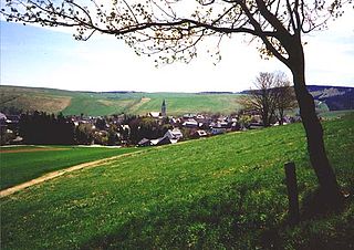
Satzung is a village in the Saxon municipality of Marienberg, which is in the district of Erzgebirgskreis in the German Ore Mountains.

Reitzenhain is a village in the Ore Mountains which is now a subdivision of Marienberg in the district Erzgebirgskreis.
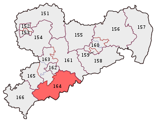
Erzgebirgskreis I is an electoral constituency represented in the Bundestag. It elects one member via first-past-the-post voting. Under the current constituency numbering system, it is designated as constituency 164. It is located in southwestern Saxony, comprising most of the Erzgebirgskreis district.