Geyer

Last updated
Geyer
Geyer Altmarkt.jpg
Wappen Geyer.png
Location of Geyer within Erzgebirgskreis district
Geyer in ERZ.pngAuerbachBreitenbrunnNeukirchenNiederdorfOelsnitzSchneebergSchwarzenbergTannenbergThalheim
Germany adm location map.svg
Red pog.svg
Geyer
Saxony location map.svg
Red pog.svg
Geyer
Coordinates: 50°37′25″N12°55′24″E / 50.62361°N 12.92333°E / 50.62361; 12.92333
Country Germany
State Saxony
District Erzgebirgskreis
Municipal assoc. Geyer
Government
   Mayor (201825) Harald Wendler [1] (Left)
Area
  Total18.76 km2 (7.24 sq mi)
Highest elevation
741 m (2,431 ft)
Lowest elevation
550 m (1,800 ft)
Population
 (2021-12-31) [2]
  Total3,350
  Density180/km2 (460/sq mi)
Time zone UTC+01:00 (CET)
  Summer (DST) UTC+02:00 (CEST)
Postal codes
09468
Dialling codes 037346
Vehicle registration ERZ, ANA, ASZ, AU, MAB, MEK, STL, SZB, ZP
Website www.stadt-geyer.de

Geyer is a town in the district of Erzgebirgskreis, in Saxony, Germany. It has a population of about 4,000.

Contents

Geography

Geyer is situated 8 km (4.97 mi) northwest of Annaberg-Buchholz, and 23 km (14.29 mi) south of Chemnitz, in the valley of the Geyersbach creek. The town is largely surrounded by forest, with the Geyersche Wald forest to the west being owned by the town.

Geyer borders to Ehrenfriedersdorf in the north east, Tannenberg in the south east, Elterlein in the south. The town of Zwönitz is in the west, Hormersdorf to the north west and the Greifensteine area to the north.

History

Geyer was first mentioned in official documents in 1381, although mining in the Ore Mountains had already existed a few decades before. In 1407 Geyer was granted town privileges (Marktrecht), and 60 years later it already became a town. In 1537 the town was introduced to the Protestant Reformation. Famous Renaissance builder Hieronymus Lotter settled in Geyer in 1566.

In the 16th century mining became harder to sustain, since most of the mines started to become depleted, which produced more and more waste rock. This resulted in larger and larger cavities, which led in 1704 and in 1803 to large cave-ins in Geyer. The resulting Geyersche Binge cave-in can still be visited today.

With the decline in ore-mining in the area, Geyer (as in many other towns and villages in the Ore Mountains) turned to wooden toy manufacture - such as Schwibbogen, nutcrackers and Christmas pyramids – as well as bobbin lace as a matter of economic survival. In the 18th and 19th centuries, the textile industry was the main source of income for Geyer. In 1888, Geyer was connected to a narrow gauge railway that was to become part of the Thumer Netz, and in 1897, the town was connected to the electrical grid.

From 1952 to 1990, Geyer was part of the Bezirk Karl-Marx-Stadt of East Germany.

Watch tower Geyer Wachtturm.jpg
Watch tower

Sights

Tower museum

The 42 m (137.8 ft) high watch tower was built in 1395 as a wall tower, serving as refuge for citizens in times of war. Between 1561 and 1564 the tower was raised with the characteristic octagonal shape. This was done to create room for the Türmerfamilie, a fire guard (and his family), in order to provide warning from the devastating and frequent conflagrations in those days. In 1952 this tower was converted into a museum, which shows on seven levels historic items related to mining and the town's life through the centuries.

Saxon IV K 99 534 at the former railroad station in Geyer 99 534 Geyer 28.09.05.JPG
Saxon IV K 99 534 at the former railroad station in Geyer

Old railway station

Geyersche Binge Pinge geyer.jpg
Geyersche Binge

At the former station site, there is a historic Saxon IV K narrow gauge steam locomotive together with railroad cars on display, a reminder of the time when Geyer was part of the Thumer Netz within the narrow gauge railways in Saxony.

Geyersche Binge

Geyer Geyer Altmarkt.jpg
Geyer
Laurentius church Geyer Laurentiuskirche Geyer.jpg
Laurentius church Geyer

The Geyersche Binge is a collapsed ore mine caused by fire-setting (a Binge is a mining sink-hole). The first cave-in was caused in 1704, and was followed by several others over the years. The last collapse was on 11 May 1803 and led to the cessation of mining in Geyer. The area of the Binge is about 60 m (197 ft) deep, 200 m (656 ft) wide and 250 m (820 ft) long. In 1935 it became a nature reserve.

Notable people

Personalities who have worked on the ground

Related Research Articles

<span class="mw-page-title-main">Annaberg-Buchholz</span> Town in Saxony, Germany

Annaberg-Buchholz is a town in Saxony, Germany. Lying in the Ore Mountains, it is the capital of the district of Erzgebirgskreis.

<span class="mw-page-title-main">Hohenstein-Ernstthal</span> Town in Saxony, Germany

Hohenstein-Ernstthal is a town in the Zwickau rural district, Saxony, Germany. The towns of Hohenstein and Ernstthal were united in 1898, and the town is either known by its hyphenated form, or simply called Hohenstein.

<span class="mw-page-title-main">Pegau</span> Town in Saxony, Germany

Pegau is a town in the Leipzig district in Saxony, Germany, situated in a fertile plain, on the White Elster, 18 m. S.W. from Leipzig by the railway to Zeitz.

<span class="mw-page-title-main">Eibenstock</span> Town in Saxony, Germany

Eibenstock is a town in the Erzgebirgskreis, Saxony, Germany. It is situated in the western Ore Mountains, near the river Mulde.

<span class="mw-page-title-main">Marienberg</span> Town in Saxony, Germany

Marienberg is a town in Germany. It was the district capital of the Mittlerer Erzgebirgskreis in the southern part of Saxony, and since August 2008 it has been part of the new district of Erzgebirgskreis. As of 2020, the town had 16,716 inhabitants.

<span class="mw-page-title-main">Narrow-gauge railways in Saxony</span> Railway network in Saxony

The narrow-gauge railways in Saxony were once the largest single-operator narrow-gauge railway network in Germany. In Saxony, the network peaked shortly after World War I with over 500 km (311 mi) of tracks. At first, it was primarily created to connect the small towns and villages in Saxony – which had formed a viable industry in the 19th century – to already established standard-gauge railways. But even shortly after 1900, some of the railways would become important for tourism in the area.

<span class="mw-page-title-main">Freital</span> City in Saxony, Germany

Freital is a town in the district of Sächsische Schweiz-Osterzgebirge in Saxony, Germany. The town is situated on a small river, the Weißeritz, and is eight kilometres (5 mi) southwest of Dresden.

<span class="mw-page-title-main">Altenberg, Saxony</span> Place in Saxony, Germany

Altenberg is a town in the Sächsische Schweiz-Osterzgebirge district, in Saxony, Germany.

<span class="mw-page-title-main">Grünhain-Beierfeld</span> Town in Saxony, Germany

Grünhain-Beierfeld is a town in the district of Erzgebirgskreis in Saxony, Germany lying 8 km east of Aue. It came into being on 1 January 2005 through the merger of the town of Grünhain and the community of Beierfeld.

<span class="mw-page-title-main">Oberwiesenthal</span> Town in Saxony, Germany

Oberwiesenthal is a town and a ski resort in the district of Erzgebirgskreis in Saxony in Germany. It is situated in the Ore Mountains, on the border with the Czech Republic, 19 km south of Annaberg-Buchholz, and 23 km northeast of Karlovy Vary. At 914 metres (2,999 ft), it is the highest town in Germany. The Olympic and World Championships goldmedalist in ski jumping Jens Weißflog competed for SC Tractor Oberwiesenthal and Oberwiesenthaler SV.

<span class="mw-page-title-main">Thum</span> Town in Saxony, Germany

Thum is a small town in the district of Erzgebirgskreis in Saxony, Germany. It has a population of about 5,000.

<span class="mw-page-title-main">Wolkenstein</span> Town in Saxony, Germany

Wolkenstein is a town in the district Erzgebirgskreis, in Saxony, Germany. It is situated in the Ore Mountains, on the river Zschopau, 22 km southeast of Chemnitz.

<span class="mw-page-title-main">Seiffen</span> Municipality in Saxony, Germany

The town of Seiffen is located in the district of Erzgebirgskreis, which is in the central south of the Free State of Saxony in Germany. The earliest record of the town dates to 1324 when it was referred to as "Cynsifen".

<span class="mw-page-title-main">Schönheide</span> Municipality in Saxony, Germany

Schönheide is a municipality in Saxony's district of Erzgebirgskreis. It lies in the western Ore Mountains, and was founded as an industrial village.

<span class="mw-page-title-main">Sosa, Germany</span> Ortsteil of Eibenstock in Saxony, Germany

Sosa is a former municipality in the western Ore Mountains, in the Erzgebirgskreis, Saxony, Germany. It is a state-recognized health resort, that has belonged to the town Eibenstock since 1 January 2011.

<span class="mw-page-title-main">Stützengrün</span> Municipality in Saxony, Germany

Stützengrün is a community in the district of Erzgebirgskreis, Saxony, Germany.

<span class="mw-page-title-main">Oybin</span> Municipality in Saxony, Germany

Oybin is a municipality in the Görlitz district, in Saxony, Germany, located very close to the border of the Czech Republic. Following the defeat of the Protestant armies by the Habsburgs in the Battle of the White Mountain in 1620, many Protestant Czechs found refuge across the border in the hills of Upper Lusatia. It is a "Kurort", a resort or spa certified by the state, where people go for rest and recuperation. It is most famous for its mountain of the same name, an exposed natural sandstone dome that towers above the town. The ruins of a medieval monastery lend a wild romantic beauty to it and it was a favorite subject of 19th-century Romantic painters like Caspar David Friedrich. Many bizarrely shaped geological rock formations can be found in the surroundings. The scenic narrow gauge Zittau–Kurort Oybin/Kurort Jonsdorf railway runs from Oybin to Bertsdorf, from there to the neighboring municipality of Jonsdorf and the town of Zittau. Oybin municipality has 3 districts: Oybin, Hain and Lückendorf.

<span class="mw-page-title-main">DRG Class 99.73–76</span>

The German Class 99.73-76 engines were standard locomotives (Einheitslokomotiven) in service with the Deutsche Reichsbahn for Saxony's narrow gauge railways. Together with their follow-on class, the DR Class 99.77-79, they were the most powerful narrow gauge locomotives in Germany for the 750 mm track gauge.

<span class="mw-page-title-main">Thumer Netz</span>

The Thumer Netz was a narrow gauge railway network in the area around Thum in Saxony, Germany that operated from 1886 until 1975. It had a 750 mm gauge. Total length was about 44 km (27.34 mi).

<span class="mw-page-title-main">Pinge</span>

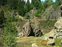
A Pinge or Binge ("binger") is the name given in German-speaking Europe to a wedge-, ditch- or funnel-shaped depression in the terrain caused by mining activity. This depression or sink-hole is frequently caused by the collapse of old underground mine workings that are close to the Earth's surface. Unlike natural landforms, a Pinge is a direct result of human activity. The term has no direct equivalent in English, but may be translated as "mining sink-hole", "mine slump" or, in some cases, as "glory hole".

References

  1. Bürgermeisterwahlen 2018, Freistaat Sachsen, accessed 10 July 2021.
  2. "Bevölkerung des Freistaates Sachsen nach Gemeinden am 31. Dezember 2021" (XLS) (in German). Statistisches Landesamt des Freistaates Sachsen. 2022.