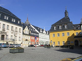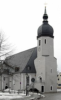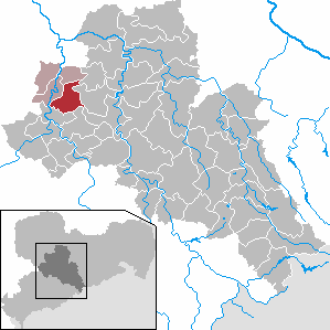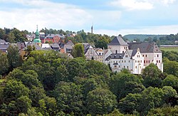
Zschopau, is a town in the Erzgebirgskreis district of Saxony, Germany.

Böhlen is a town in the Free State of Saxony, Germany, south of Leipzig. Its main features are a small airport and a power-plant. It is located in the newly built Neuseenland, the lakes created in the former open-pit mining areas.

Bad Gottleuba-Berggießhübel is a spa town in the district Sächsische Schweiz-Osterzgebirge in the Free State of Saxony, Germany. The municipality borders the Czech Republic in the south. The municipality was formed on 1 January 1999 by the merger of the former municipalities Bad Gottleuba, Berggießhübel, Langenhennersdorf and Bahratal. Surrounded by forests and near a water dam Bad Gottleuba-Berggießhübel has several facilities, including a spa health park, a plant garden and a heated open air pool.

Mittweida is a town in the Free State of Saxony, Germany, in the Mittelsachsen district.

Marienberg is a town in Germany. It was the district capital of the Mittlerer Erzgebirgskreis in the southern part of Saxony, and since August 2008 it has been part of the new district of Erzgebirgskreis. As of 2020, the town had 16,716 inhabitants.

Olbernhau is a town in the district Erzgebirgskreis, in the Free State of Saxony, Germany. It is situated in the Ore Mountains, 35 km southeast of Chemnitz, and 23 km north of Chomutov, Czech Republic.

Königswalde is a municipality in the district of Erzgebirgskreis, in Saxony, Germany.

Gelenau is a municipality in the district of Erzgebirgskreis, in Saxony, Germany.

Großschönau is a municipality in the district Görlitz, in Saxony, Germany located in the cross-border region with the Czech Republic. It used to be a famous Upper Lusatian center of Damask fabric production until the end of the 1980s. Since then it has turned into an area of tourism.

Deutschneudorf is a municipality in the district Erzgebirgskreis, in Saxony, Germany.

Seelitz is a municipality in the district of Mittelsachsen, in Saxony, Germany. It is part of the administrative partnership Verwaltungsgemeinschaft Rochlitz based in the eponymous town.

Striegistal is a municipality in the district of Mittelsachsen, in Saxony, Germany. In 1994, the unification of the former municipalities of Berbersdorf, Goßberg, Mobendorf and Pappendorf as part of the regional administrative reform, created the municipality of Striegistal. In 2008 it absorbed the former municipality Tiefenbach. It received its name from the two rivers that flow through the community, the Little Striegis and the Big Striegis.

Borsdorf is a municipality in the Leipzig district in Saxony, Germany.

Pulsnitz is a town in the district of Bautzen, in the Free State of Saxony, Germany. It is situated on the small river Pulsnitz, 11 km southwest of Kamenz, and 24 km northeast of the centre of Dresden.

The Preßnitz is a right-hand tributary of the River Zschopau in the state of Saxony in eastern Germany and in the Czech Republic. It rises in the Bohemian Ore Mountains near Horní Halže, northwest of the mining town of Měděnec.
Frohnau is a village in the Saxon town of Annaberg-Buchholz in the district of Erzgebirgskreis in southeast Germany. The discovery of silver on the Schreckenberg led in 1496 to the foundation of the neighbouring mining town of Annaberg. The village of Frohnau is best known for its museum of technology, the Frohnauer Hammer, and the visitor mine of Markus Röhling Stolln. The mining area around Frohnau has been selected as a candidate for a UNESCO World Heritage Site: the Ore Mountain Mining Region.

Wildenthal is a village in the town of Eibenstock in the district of Erzgebirgskreis in the Saxon Ore Mountains of Central Germany.
Gehringswalde, a so-called Waldhufendorf, is situated about 1.5 km east of Wolkenstein in the Ore Mountains. It extends for about 1.5 km along the valley of a stream which joins the Zschopau river ca. 1.5 km west of Warmbad. The nearby Hüttengrundmühle is also part of the village. The mountain Dreibrüderhöhe lies ca. 3 km east of Gehringswalde.
Niederlauterstein is a village in Saxony which has been incorporated into the town of Marienberg in the district Erzgebirgskreis since 1996.

Siebenlehn is a district of the town Großschirma in Landkreis Mittelsachsen. Until 2003 it was a separate town. Upon fusion with the neighbouring rural municipality Großschirma on 1 September 2003, the town privileges were transferred to the joint municipality.


