Perungudi is a neighbourhood of Chennai in the state of Tamil Nadu, India. It is situated about 10 kilometres (6.2 mi) south of Adyar. It is bordered on two sides by the Old Mahabalipuram Road and the Perungudi lake. It is situated on the Old Mahabalipuram IT Expressway right in middle of an Information Technology (IT) Estate. It is between Taramani and Thoraipakkam and parallel to Kottivakkam and Palavakkam in the East Coast Road.
Kemri is a town and nagar panchayat in Rampur district in the Indian state of Uttar Pradesh.
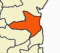
Akodia is a town and a Nagar Panchayat in Shajapur District in the state of Madhya Pradesh, India.
Bharatganj is a Nagar Panchayat city in district of Prayagraj, Uttar Pradesh.
Diken is a town and a nagar panchayat in Neemuch district in the state of Madhya Pradesh, India.
Dostpur is a town and a nagar panchayat in Sultanpur district in the state of Uttar Pradesh, India. The town borders Sultanpur and Ambedkarnagar. Purvanchal Expressway passes near the town.
Harpalpur is a town and a nagar panchayat in Chhatarpur District in the Indian state of Madhya Pradesh.
Jhalu is a town and a nagar panchayat in Bijnor district in the Indian state of Uttar Pradesh.
Kachhwa is a town and a nagar panchayat in Mirzapur district in the Indian state of Uttar Pradesh.

Makhu is a town and a nagar panchayat in Ferozepur district in Indian state of Punjab.
Narasimhanaickenpalayam is a part of Coimbatore city. It is about 14 km from Coimbatore city junction in the northern direction. Narasimhanaickenpalayam is on the stretch of National Highway NH 67 Extn (NH-181) Mettupalayam Road, one of the arterial roads of Coimbatore city. Neighbouring places are Thudiyalur, NGGO Colony, and Periyanaickenpalayam
Nasrullaganj, also known as Bherunda, is a nagar panchayat in Sehore district in the Indian state of Madhya Pradesh. The nearest airport is in Bhopal.
Patharia is a town and a nagar panchayat in Damoh district in the Indian state of Madhya Pradesh. During World War II, the town served as the training camp for what would become Wingate's Chindits.
Pinahat is a town and a nagar panchayat in Agra district in the Indian state of Uttar Pradesh and situated on the Bank of Chambal River. It is about 55 km from Agra. The distance between Pinahat and Chambal is only 2 km.
Sewalkhas is a town and a Nagar Panchayat in Meerut district in the Indian state of Uttar Pradesh.
Suthaliya is a town and a nagar panchayat in Rajgarh district in the Indian state of Madhya Pradesh.
Jalalabad (Jalālābād) is a town and a nagar panchayat in Bijnor district in the Indian state of Uttar Pradesh. Habib khan was 1st pradhan of jalalabad after independence of India for many years. On his name NGO habibia gram vikas sansthan jalalabad running a school named Habib memorial school and Madarsa Habibia lilbanat.
Tarana is a town and a nagar parishad in Ujjain district in the Indian state of Madhya Pradesh. Tarana is a tehsil in Ujjain and the distance to Ujjain is 34 km. Tarana was part of Holkar estate. The current M.L.A of Tarana constituency is Mahesh Parmar (INC).

Dewa Sharif or Dewa is a town and a nagar panchayat in Barabanki district in the state of Uttar Pradesh, India. It is famous for the shrine of Haji Waris Ali Shah. This town is also known by the name of Dewa Sharif in respect for the shrine. It is about 26 km north-east of the capital Lucknow.
Gola Bazar is a town and a nagar panchayat in Gorakhpur district in the Indian state of Uttar Pradesh. It is also known for its gold market. It is located near the Saryu (Ghaghra) river. This river itself is a border between Gorakhpur and Azamgarh. Distance from Gorakhpur City is around 54 km via kauriram. It is one of the tehsils of Gorakhpur. It is very famous for its ghats which are on the bank of river Saryu. Gola market is very famous among the villages and other towns around it.